Lay-Saint-Christophe (Lay-Saint-Christophe)

- commune in Meurthe-et-Moselle, France
- Country:

- Postal Code: 54690
- Coordinates: 48° 44' 53" N, 6° 12' 2" E


- GPS tracks (wikiloc): [Link]
- Area: 11.59 sq km
- Population: 2482
- Web site: http://www.lay-saint-christophe.fr/
- Wikipedia en: wiki(en)
- Wikipedia: wiki(fr)
- Wikidata storage: Wikidata: Q785359
- Wikipedia Commons Category: [Link]
- Freebase ID: [/m/03qdk_d]
- Freebase ID: [/m/03qdk_d]
- GeoNames ID: Alt: [6436700]
- GeoNames ID: Alt: [6436700]
- SIREN number: [215403056]
- SIREN number: [215403056]
- BnF ID: [15264374s]
- BnF ID: [15264374s]
- INSEE municipality code: 54305
- INSEE municipality code: 54305
Shares border with regions:

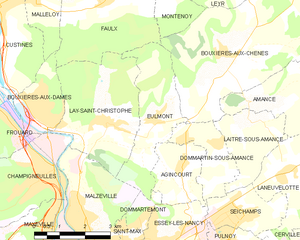
Eulmont
- commune in Meurthe-et-Moselle, France
- Country:
- Postal Code: 54690
- Coordinates: 48° 45' 2" N, 6° 13' 27" E
- GPS tracks (wikiloc): [Link]
- Area: 7.97 sq km
- Population: 1007
- Web site: [Link]


Champigneulles
- commune in Meurthe-et-Moselle, France
- Country:
- Postal Code: 54250
- Coordinates: 48° 44' 1" N, 6° 9' 52" E
- GPS tracks (wikiloc): [Link]
- Area: 23.99 sq km
- Population: 6808
- Web site: [Link]


Bouxières-aux-Dames
- commune in Meurthe-et-Moselle, France
- Country:
- Postal Code: 54136
- Coordinates: 48° 45' 7" N, 6° 9' 47" E
- GPS tracks (wikiloc): [Link]
- Area: 4.11 sq km
- Population: 4189
- Web site: [Link]
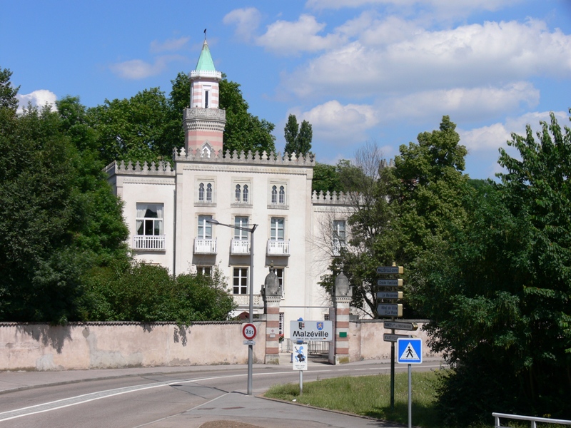

Malzéville
- commune in Meurthe-et-Moselle, France
- Country:
- Postal Code: 54220
- Coordinates: 48° 42' 37" N, 6° 11' 11" E
- GPS tracks (wikiloc): [Link]
- Area: 7.53 sq km
- Population: 7976


Faulx
- commune in Meurthe-et-Moselle, France
- Country:
- Postal Code: 54760
- Coordinates: 48° 47' 35" N, 6° 11' 53" E
- GPS tracks (wikiloc): [Link]
- Area: 17.2 sq km
- Population: 1325