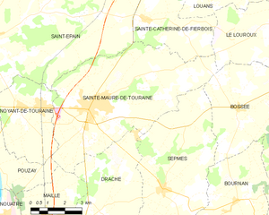
Le Louroux (Le Louroux)
- commune in Indre-et-Loire, France
- Country:

- Postal Code: 37240
- Coordinates: 47° 9' 38" N, 0° 47' 11" E


- GPS tracks (wikiloc): [Link]
- Area: 28.87 sq km
- Population: 520
- Web site: http://www.lelouroux.com
- Wikipedia en: wiki(en)
- Wikipedia: wiki(fr)
- Wikidata storage: Wikidata: Q1158059
- Wikipedia Commons Category: [Link]
- Freebase ID: [/m/03nvfrg]
- GeoNames ID: Alt: [6455922]
- SIREN number: [213701360]
- BnF ID: [15257687g]
- PACTOLS thesaurus ID: [pcrtl0HBIzSgdA]
- INSEE municipality code: 37136
Shares border with regions:


Sainte-Catherine-de-Fierbois
- commune in Indre-et-Loire, France
- Country:

- Postal Code: 37800
- Coordinates: 47° 9' 27" N, 0° 39' 13" E


- GPS tracks (wikiloc): [Link]
- Area: 15.49 sq km
- Population: 747
- Web site: [Link]


Bossée
- commune in Indre-et-Loire, France
- Country:

- Postal Code: 37240
- Coordinates: 47° 6' 43" N, 0° 43' 44" E


- GPS tracks (wikiloc): [Link]
- Area: 19.01 sq km
- Population: 334


Tauxigny
- former commune in Indre-et-Loire, France
- Country:

- Postal Code: 37310
- Coordinates: 47° 12' 50" N, 0° 50' 4" E


- GPS tracks (wikiloc): [Link]
- Area: 36.83 sq km
- Population: 1403
- Web site: [Link]


Saint-Bauld
- former commune in Indre-et-Loire, France
- Country:

- Postal Code: 37310
- Coordinates: 47° 10' 48" N, 0° 50' 14" E


- GPS tracks (wikiloc): [Link]
- Area: 4.11 sq km
- Population: 196


Louans
- commune in Indre-et-Loire, France
- Country:

- Postal Code: 37320
- Coordinates: 47° 11' 3" N, 0° 44' 47" E


- GPS tracks (wikiloc): [Link]
- Area: 18.02 sq km
- Population: 634
- Web site: [Link]


Sainte-Maure-de-Touraine
- commune in Indre-et-Loire, France
- Country:

- Postal Code: 37800
- Coordinates: 47° 6' 44" N, 0° 37' 16" E


- GPS tracks (wikiloc): [Link]
- Area: 40.41 sq km
- Population: 4351
- Web site: [Link]


Manthelan
- commune in Indre-et-Loire, France
- Country:

- Postal Code: 37240
- Coordinates: 47° 8' 8" N, 0° 47' 35" E


- GPS tracks (wikiloc): [Link]
- Area: 39.58 sq km
- Population: 1385
- Web site: [Link]
