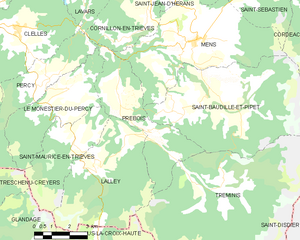
Le Monestier-du-Percy (Le Monestier-du-Percy)

- commune in Isère, France
 Hiking in Le Monestier-du-Percy
Le Monestier-du-Percy is a picturesque commune located in the Isère department of the Auvergne-Rhône-Alpes region in southeastern France. It's a fantastic destination for hiking enthusiasts, offering a mix of serene landscapes, lush forests, and stunning mountain vistas.
Hiking Highlights:
-
Scenic Trails: The area is surrounded by various marked trails suitable for different skill levels, from easy walks to more challenging hikes. The trails often take you through beautiful natural settings, including alpine meadows and rugged mountain terrain.
-
Vercors Regional Natural Park: Le Monestier-du-Percy lies on the fringes of the Vercors Regional Natural Park, which is known for its dramatic cliffs, deep gorges, and abundant wildlife. This park features numerous hiking routes, including the famous GR91 long-distance trail, which runs through the Vercors.
-
Flora and Fauna: Hikers can enjoy a rich diversity of flora and fauna. Depending on the season, you might spot alpine flowers, wild herbs, and various bird species, as well as the possibility of encountering larger wildlife like chamois or deer.
-
Local Culture and History: As you hike, take the opportunity to explore the local culture. The area is steeped in history, with remnants of ancient architecture and traditional mountain villages. Be sure to check out local points of interest like chapels and historical sites.
-
Seasonal Hiking: The best time for hiking in Le Monestier-du-Percy typically spans from late spring to early autumn (May to October). However, winter activities, such as snowshoeing, are also popular given the area's snowfall.
Practical Tips:
- Maps and Guides: It’s a good idea to have a detailed hiking map or trail guide, as some paths might not be well-marked.
- Essentials: Always pack essentials such as water, snacks, and weather-appropriate clothing, as conditions can change rapidly in mountainous areas.
- Safety: Inform someone about your hiking plans, especially if you plan to trek on less-traveled routes.
Hiking in Le Monestier-du-Percy not only provides excellent physical activity but also offers an opportunity to immerse yourself in the beauty of the French Alps. Enjoy your adventure!
- Country:

- Postal Code: 38930
- Coordinates: 44° 47' 39" N, 5° 39' 32" E


- GPS tracks (wikiloc): [Link]
- Area: 14.99 sq km
- Population: 249
- Web site: http://monestierdupercy.over-blog.com
- Wikipedia en: wiki(en)
- Wikipedia: wiki(fr)
- Wikidata storage: Wikidata: Q1106901
- Wikipedia Commons Category: [Link]
- Freebase ID: [/m/03nvk7w]
- GeoNames ID: Alt: [6455939]
- SIREN number: [213802432]
- BnF ID: [15258055f]
- INSEE municipality code: 38243
Shares border with regions:


Percy
- commune in Isère, France
Hiking in Percy
Hiking in Percy, Isère, is a wonderful experience for outdoor enthusiasts, as it offers access to breathtaking landscapes and a variety of trails suitable for different skill levels. Located in the Auvergne-Rhône-Alpes region of France, Percy is surrounded by the stunning natural beauty of the Vercors massif and the Chartreuse mountains....
- Country:
- Postal Code: 38930
- Coordinates: 44° 48' 5" N, 5° 38' 59" E
- GPS tracks (wikiloc): [Link]
- Area: 15.93 sq km
- Population: 165
- Web site: [Link]


Saint-Maurice-en-Trièves
- commune in Isère, France
Hiking in Saint-Maurice-en-Trièves
Saint-Maurice-en-Trièves is a charming village nestled in the Trièves region of the French Alps, known for its stunning natural landscapes, diverse wildlife, and a variety of hiking opportunities. Here are some key points to consider if you're planning a hiking trip in this area:...
- Country:
- Postal Code: 38930
- Coordinates: 44° 45' 52" N, 5° 39' 50" E
- GPS tracks (wikiloc): [Link]
- Area: 12.94 sq km
- Population: 156

Prébois
- commune in Isère, France
Hiking in Prébois
Prébois is a scenic area located in the French Alps, known for its stunning landscapes, diverse flora and fauna, and hiking opportunities. Here are some key points to consider if you're planning a hike in Prébois:...
- Country:
- Postal Code: 38710
- Coordinates: 44° 47' 22" N, 5° 41' 42" E
- GPS tracks (wikiloc): [Link]
- Area: 16.03 sq km
- Population: 165
- Web site: [Link]


Treschenu-Creyers
- commune in Drôme, France
Hiking in Treschenu-Creyers
Treschenu-Creyers is a picturesque village located in the heart of the French Alps, near the beautiful Vercors National Park. The stunning natural landscape surrounding the village offers many opportunities for hiking enthusiasts of all skill levels. Here’s a brief overview of what you can expect when hiking in the area:...
- Country:
- Postal Code: 26410
- Coordinates: 44° 44' 15" N, 5° 33' 14" E
- GPS tracks (wikiloc): [Link]
- Area: 82.04 sq km
- Population: 112