Saint-Maurice-en-Trièves (Saint-Maurice-en-Trièves)

- commune in Isère, France
 Hiking in Saint-Maurice-en-Trièves
Saint-Maurice-en-Trièves is a charming village nestled in the Trièves region of the French Alps, known for its stunning natural landscapes, diverse wildlife, and a variety of hiking opportunities. Here are some key points to consider if you're planning a hiking trip in this area:
1. Scenic Trails
The region offers a range of trails that cater to different ability levels, from leisurely walks to more challenging hikes. Many trails provide breathtaking views of the surrounding mountains and valleys, particularly the Vercors Massif and the Écrins National Park.
2. Nature and Wildlife
Hikers can experience a rich diversity of flora and fauna. The trails wind through lush forests, alpine meadows, and rocky outcrops, making it an ideal location for nature enthusiasts and photographers.
3. Local Highlights
- The Plateau of Gervais: This is a popular hiking destination that offers serene views and a variety of trails. It's perfect for family hikes or those looking for a more relaxed experience.
- Mont Aiguille: Though a more challenging trek, hiking around Mont Aiguille provides spectacular panoramas and a sense of accomplishment.
- Historical Sites: Along some trails, you may encounter remnants of historical structures, such as old stone cottages and chapels, providing a glimpse into the area's cultural heritage.
4. Seasonal Considerations
- Summer: Ideal for hiking, with many trails being accessible, offering wildflowers and clear views.
- Fall: The autumn months transform the landscape with vibrant colors, making it a particularly beautiful time to hike.
- Winter: Snow may cover higher elevations, transforming trails into snowshoeing paths or skiing routes, targeting different outdoor activities.
5. Tips for Hikers
- Preparation: Always check the weather conditions before heading out, and ensure you have suitable clothing, footwear, and supplies (water, snacks, first aid).
- Maps and Guidance: It’s advisable to carry a detailed map or a GPS device, as some trails may not be clearly marked.
- Local Guides: Consider joining guided hikes, especially if you are unfamiliar with the area. Local guides can offer insights into the geography, flora, and history.
Conclusion
Hiking in Saint-Maurice-en-Trièves is a rewarding experience that combines the beauty of nature with outdoor adventure. Whether you're a beginner or an experienced hiker, this region has something to offer everyone. Enjoy your hike and embrace the stunning scenery!
- Country:

- Postal Code: 38930
- Coordinates: 44° 45' 52" N, 5° 39' 50" E


- GPS tracks (wikiloc): [Link]
- Area: 12.94 sq km
- Population: 156
- Wikipedia en: wiki(en)
- Wikipedia: wiki(fr)
- Wikidata storage: Wikidata: Q1150660
- Wikipedia Commons Category: [Link]
- Freebase ID: [/m/03nvh22]
- SIREN number: [213804248]
- BnF ID: [15258233p]
- INSEE municipality code: 38424
Shares border with regions:

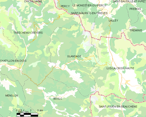
Glandage
- commune in Drôme, France
Hiking in Glandage
It seems like there might be a typo in your request, as "Glandage" does not correspond to a well-known hiking location. If you meant "Glandage" in France, located in the Drôme department, I'd be happy to provide information about hiking in that area....
- Country:
- Postal Code: 26410
- Coordinates: 44° 41' 17" N, 5° 35' 54" E
- GPS tracks (wikiloc): [Link]
- Area: 52.11 sq km
- Population: 115


Le Monestier-du-Percy
- commune in Isère, France
Hiking in Le Monestier-du-Percy
Le Monestier-du-Percy is a picturesque commune located in the Isère department of the Auvergne-Rhône-Alpes region in southeastern France. It's a fantastic destination for hiking enthusiasts, offering a mix of serene landscapes, lush forests, and stunning mountain vistas....
- Country:
- Postal Code: 38930
- Coordinates: 44° 47' 39" N, 5° 39' 32" E
- GPS tracks (wikiloc): [Link]
- Area: 14.99 sq km
- Population: 249
- Web site: [Link]


Lalley
- commune in Isère, France
Hiking in Lalley
Lalley, located in the northern part of the United States, specifically in New Hampshire's White Mountains, offers a variety of hiking opportunities for all skill levels. The area is known for its stunning natural beauty, including dense forests, mountain streams, and panoramic views. Here are some highlights of hiking in Lalley:...
- Country:
- Postal Code: 38930
- Coordinates: 44° 45' 28" N, 5° 40' 34" E
- GPS tracks (wikiloc): [Link]
- Area: 23.65 sq km
- Population: 201
- Web site: [Link]

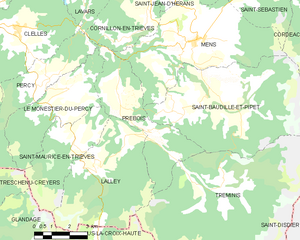
Prébois
- commune in Isère, France
Hiking in Prébois
Prébois is a scenic area located in the French Alps, known for its stunning landscapes, diverse flora and fauna, and hiking opportunities. Here are some key points to consider if you're planning a hike in Prébois:...
- Country:
- Postal Code: 38710
- Coordinates: 44° 47' 22" N, 5° 41' 42" E
- GPS tracks (wikiloc): [Link]
- Area: 16.03 sq km
- Population: 165
- Web site: [Link]


Treschenu-Creyers
- commune in Drôme, France
Hiking in Treschenu-Creyers
Treschenu-Creyers is a picturesque village located in the heart of the French Alps, near the beautiful Vercors National Park. The stunning natural landscape surrounding the village offers many opportunities for hiking enthusiasts of all skill levels. Here’s a brief overview of what you can expect when hiking in the area:...
- Country:
- Postal Code: 26410
- Coordinates: 44° 44' 15" N, 5° 33' 14" E
- GPS tracks (wikiloc): [Link]
- Area: 82.04 sq km
- Population: 112