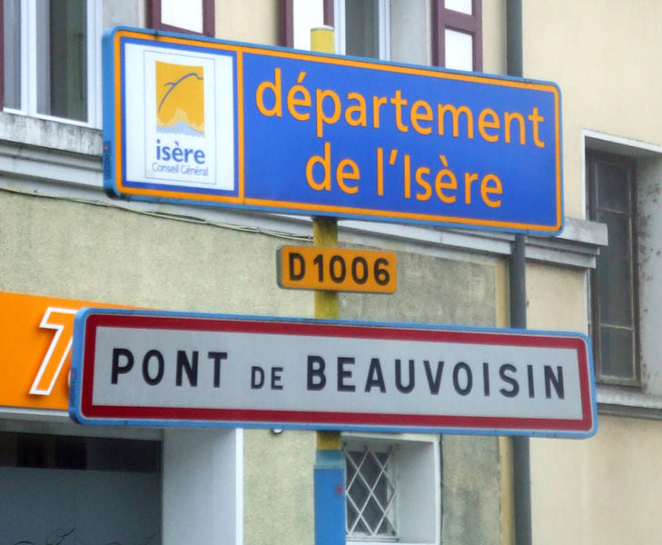
Le Pont-de-Beauvoisin, Savoie (Le Pont-de-Beauvoisin)
- commune in Savoie, France
 Hiking in Le Pont-de-Beauvoisin, Savoie
Le Pont-de-Beauvoisin, located in the Savoie department of the Auvergne-Rhône-Alpes region in France, is a great spot for hiking enthusiasts. Nestled between the picturesque mountains and rolling hills, this area offers a variety of trails and scenic views.
Hiking Trails
-
Sentier de la Cava: This trail is relatively easy and suitable for families. It winds through beautiful woodlands and offers lovely views of the surrounding valleys.
-
Montagne de l'Épine: For those looking for a more challenging hike, this mountain offers several paths leading to the summit. The ascent provides stunning panoramic views of the surrounding region, including the Chartreuse Mountains and the Rhône Valley.
-
Lac d'Aiguebelette: While not directly in Le Pont-de-Beauvoisin, this nearby lake offers a network of trails around its shores. It's a great destination for a gentler hike, with options for swimming and picnicking.
Best Time to Hike
The best time to hike in this region typically runs from late spring (May) to early autumn (October), when the weather is mild and the trails are usually accessible. Summer months can be warm, so make sure to carry plenty of water and wear appropriate sun protection.
Tips for Hiking in Le Pont-de-Beauvoisin
- Prepare for varied terrain: Trails can vary from easy to difficult. Always check the trail difficulty before heading out.
- Clothing: Wear layers, as temperatures can vary significantly between morning and afternoon.
- Stay Hydrated: Bring enough water, especially on longer trails, as there may not always be sources available.
- Navigation: Carry a local map or use a hiking app to stay on track, as some trails might not be well-marked.
- Respect Nature: Follow Leave No Trace principles; take all rubbish with you and respect wildlife.
Le Pont-de-Beauvoisin is a fantastic place for hiking, with a blend of natural beauty and challenge. Whether you're a beginner or an experienced hiker, you're sure to find trails that suit your preferences!
- Country:

- Postal Code: 73330
- Coordinates: 45° 32' 11" N, 5° 40' 21" E


- GPS tracks (wikiloc): [Link]
- Area: 1.83 sq km
- Population: 2071
- Web site: http://www.lepontdebeauvoisin.fr
- Wikipedia en: wiki(en)
- Wikipedia: wiki(fr)
- Wikidata storage: Wikidata: Q658564
- Wikipedia Commons Category: [Link]
- Freebase ID: [/m/03qlmw9]
- Freebase ID: [/m/03qlmw9]
- GeoNames ID: Alt: [6614904]
- GeoNames ID: Alt: [6614904]
- SIREN number: [217302041]
- SIREN number: [217302041]
- BnF ID: [15274135j]
- BnF ID: [15274135j]
- INSEE municipality code: 73204
- INSEE municipality code: 73204
Shares border with regions:


Romagnieu
- commune in Isère, France
Romagnieu is a charming commune located in the Isère department in the Auvergne-Rhône-Alpes region of southeastern France. It’s known for its natural beauty and proximity to hiking opportunities in the surrounding area, particularly due to its location near the Chartreuse Mountains and the Vercors Regional Natural Park....
- Country:

- Postal Code: 38480
- Coordinates: 45° 34' 12" N, 5° 38' 29" E


- GPS tracks (wikiloc): [Link]
- Area: 17.11 sq km
- Population: 1560
- Web site: [Link]


Le Pont-de-Beauvoisin
- commune in Isère, France
 Hiking in Le Pont-de-Beauvoisin
Le Pont-de-Beauvoisin, located in the Isère department of France, is a charming small town that serves as a gateway to the beautiful landscapes of the Alps and the surrounding regions. Here are some highlights and tips for hiking in and around Le Pont-de-Beauvoisin:...
- Country:

- Postal Code: 38480
- Coordinates: 45° 32' 4" N, 5° 39' 59" E


- GPS tracks (wikiloc): [Link]
- Area: 7.36 sq km
- Population: 3574
- Web site: [Link]


Domessin
- commune in Savoie, France
Domessin is a quaint commune located in the Savoie department in the Auvergne-Rhône-Alpes region of southeastern France. Nestled at the foot of the Chartreuse Mountains, this area offers a variety of hiking opportunities that cater to different skill levels....
- Country:

- Postal Code: 73330
- Coordinates: 45° 32' 25" N, 5° 42' 33" E


- GPS tracks (wikiloc): [Link]
- Area: 9.83 sq km
- Population: 1839
- Web site: [Link]
