Domessin (Domessin)

- commune in Savoie, France
 Hiking in Domessin
Domessin is a quaint commune located in the Savoie department in the Auvergne-Rhône-Alpes region of southeastern France. Nestled at the foot of the Chartreuse Mountains, this area offers a variety of hiking opportunities that cater to different skill levels.
Hiking Opportunities in Domessin:
-
Scenic Trails: The region boasts picturesque trails that provide stunning views of the surrounding mountains and valleys. The nearby Chartreuse Mountains are known for their beautiful landscapes, including forests, rivers, and rugged terrains.
-
Nature Walks: Many trails are suitable for families and casual hikers. These walks often lead through lush greenery and offer a chance to experience the local flora and fauna.
-
Mountain Hikes: For more experienced hikers, challenging trails that ascend into the Chartreuse Massif are available. These hikes will reward you with breathtaking panoramas over the region.
-
Accessibility: The area around Domessin is accessible and well-marked for hikers. It’s advisable to bring a detailed map, as well as local guides or apps that can help in navigation.
-
Local Attractions: A hike in this region can also provide opportunities to visit local cultural sites, such as charming villages with traditional architecture and local markets.
-
Seasonal Considerations: The best time for hiking in Domessin is typically from late spring to early autumn. Winter hikes may be possible, but they can require special gear and preparations due to snow and ice.
Tips for Hiking in Domessin:
- Stay Hydrated: Always carry enough water, especially during warmer months.
- Wear Proper Footwear: Good hiking boots can help provide support and traction.
- Check Weather Conditions: Mountain weather can change rapidly; it’s best to be prepared for various conditions.
- Respect Nature: Follow Leave No Trace principles to preserve the natural beauty of the area.
- Know Your Limits: Choose trails that match your fitness level, and don't hesitate to turn back if conditions change or if you feel unwell.
Exploring the hiking trails around Domessin can be a memorable experience filled with natural beauty, tranquility, and a sense of adventure. Enjoy your hike!
- Country:

- Postal Code: 73330
- Coordinates: 45° 32' 25" N, 5° 42' 33" E


- GPS tracks (wikiloc): [Link]
- Area: 9.83 sq km
- Population: 1839
- Web site: http://www.domessin.fr
- Wikipedia en: wiki(en)
- Wikipedia: wiki(fr)
- Wikidata storage: Wikidata: Q1153919
- Wikipedia Commons Category: [Link]
- Freebase ID: [/m/03qlmbg]
- Freebase ID: [/m/03qlmbg]
- GeoNames ID: Alt: [6442785]
- GeoNames ID: Alt: [6442785]
- SIREN number: [217301001]
- SIREN number: [217301001]
- BnF ID: [15274034x]
- BnF ID: [15274034x]
- VIAF ID: Alt: [315523716]
- VIAF ID: Alt: [315523716]
- INSEE municipality code: 73100
- INSEE municipality code: 73100
Shares border with regions:


Romagnieu
- commune in Isère, France
Hiking in Romagnieu
Romagnieu is a charming commune located in the Isère department in the Auvergne-Rhône-Alpes region of southeastern France. It’s known for its natural beauty and proximity to hiking opportunities in the surrounding area, particularly due to its location near the Chartreuse Mountains and the Vercors Regional Natural Park....
- Country:
- Postal Code: 38480
- Coordinates: 45° 34' 12" N, 5° 38' 29" E
- GPS tracks (wikiloc): [Link]
- Area: 17.11 sq km
- Population: 1560
- Web site: [Link]


Saint-Jean-d'Avelanne
- commune in Isère, France
Hiking in Saint-Jean-d'Avelanne
Saint-Jean-d'Avelanne is a charming commune located in the Isère department of the Auvergne-Rhône-Alpes region in southeastern France. Surrounded by beautiful natural landscapes, it offers several opportunities for hiking and outdoor activities....
- Country:
- Postal Code: 38480
- Coordinates: 45° 30' 25" N, 5° 40' 23" E
- GPS tracks (wikiloc): [Link]
- Area: 7.85 sq km
- Population: 946
- Web site: [Link]
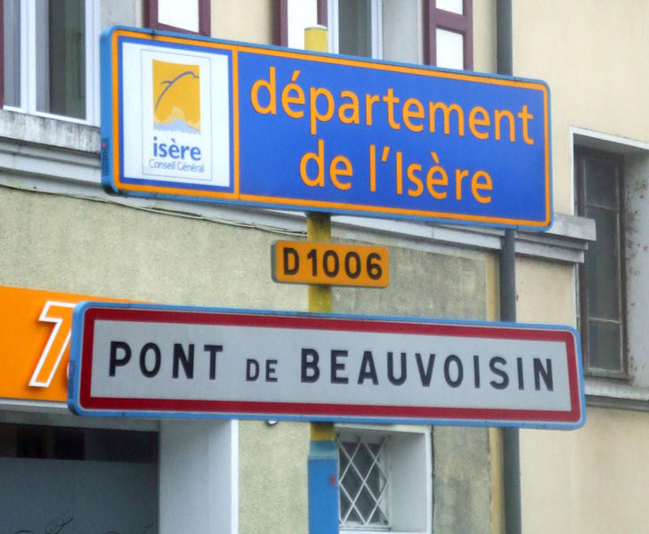

Le Pont-de-Beauvoisin
- commune in Isère, France
Hiking in Le Pont-de-Beauvoisin
Le Pont-de-Beauvoisin, located in the Isère department of France, is a charming small town that serves as a gateway to the beautiful landscapes of the Alps and the surrounding regions. Here are some highlights and tips for hiking in and around Le Pont-de-Beauvoisin:...
- Country:
- Postal Code: 38480
- Coordinates: 45° 32' 4" N, 5° 39' 59" E
- GPS tracks (wikiloc): [Link]
- Area: 7.36 sq km
- Population: 3574
- Web site: [Link]


Saint-Béron
- commune in Savoie, France
Hiking in Saint-Béron
Saint-Béron is a charming commune located in the Savoie department of the Auvergne-Rhône-Alpes region in southeastern France. It's nestled in the foothills of the French Alps, providing some beautiful hiking opportunities for outdoor enthusiasts....
- Country:
- Postal Code: 73520
- Coordinates: 45° 30' 5" N, 5° 43' 45" E
- GPS tracks (wikiloc): [Link]
- Area: 8.66 sq km
- Population: 1656

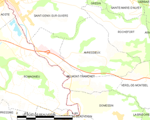
Belmont-Tramonet
- commune in Savoie, France
Hiking in Belmont-Tramonet
Belmont-Tramonet is a picturesque municipality located in the Savoie region of France, nestled in the French Alps. It offers stunning views and a variety of hiking opportunities, making it a great destination for outdoor enthusiasts....
- Country:
- Postal Code: 73330
- Coordinates: 45° 33' 34" N, 5° 40' 46" E
- GPS tracks (wikiloc): [Link]
- Area: 5.46 sq km
- Population: 561


Saint-Albin-de-Vaulserre
- commune in Isère, France
Hiking in Saint-Albin-de-Vaulserre
Saint-Albin-de-Vaulserre is a charming commune located in the Isère department in the Auvergne-Rhône-Alpes region of southeastern France. While it is not as well-known as other hiking destinations, it offers beautiful rural landscapes and access to outdoor activities that can be enjoyed by hikers of all levels....
- Country:
- Postal Code: 38480
- Coordinates: 45° 30' 17" N, 5° 42' 9" E
- GPS tracks (wikiloc): [Link]
- Area: 4.99 sq km
- Population: 400


Verel-de-Montbel
- commune in Savoie, France
Hiking in Verel-de-Montbel
Verel-de-Montbel is a charming commune located in the Auvergne-Rhône-Alpes region of France, nestled at the edge of the Chartreuse Mountains. Hiking in this area offers a wonderful opportunity to explore scenic landscapes, diverse flora, and panoramic views of the surrounding mountains and lakes....
- Country:
- Postal Code: 73330
- Coordinates: 45° 33' 33" N, 5° 43' 49" E
- GPS tracks (wikiloc): [Link]
- Area: 3.74 sq km
- Population: 299


Le Pont-de-Beauvoisin, Savoie
- commune in Savoie, France
Hiking in Le Pont-de-Beauvoisin, Savoie
Le Pont-de-Beauvoisin, located in the Savoie department of the Auvergne-Rhône-Alpes region in France, is a great spot for hiking enthusiasts. Nestled between the picturesque mountains and rolling hills, this area offers a variety of trails and scenic views....
- Country:
- Postal Code: 73330
- Coordinates: 45° 32' 11" N, 5° 40' 21" E
- GPS tracks (wikiloc): [Link]
- Area: 1.83 sq km
- Population: 2071
- Web site: [Link]


La Bridoire
- commune in Savoie, France
Hiking in La Bridoire
La Bridoire is a charming commune located in the Savoie department of the Auvergne-Rhône-Alpes region in southeastern France. It is set in a scenic area that offers a variety of hiking opportunities amidst beautiful landscapes....
- Country:
- Postal Code: 73520
- Coordinates: 45° 31' 34" N, 5° 44' 33" E
- GPS tracks (wikiloc): [Link]
- Area: 6.18 sq km
- Population: 1238