Le Sauze-du-Lac (Le Sauze-du-Lac)
- commune in Hautes-Alpes, France
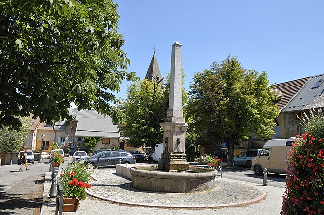
 Hiking in Le Sauze-du-Lac
Le Sauze-du-Lac is a picturesque village located in the French Alps, known for its stunning natural beauty, pristine lakes, and accessibility to various hiking routes. Here’s what you should know about hiking in this delightful area:
Scenic Trails
-
Lac de Serre-Ponçon: The region surrounding Le Sauze-du-Lac features the breathtaking Lac de Serre-Ponçon, one of the largest artificial lakes in Europe. Hiking along its shores offers stunning views and opportunities for swimming or picnicking.
-
Mountain Trails: There are numerous trails that lead into the surrounding mountains, offering varying levels of difficulty. Trails like the ones leading to the Col de la Croix, or up to the peaks of the Écrins National Park, provide stunning panoramas and a chance to encounter local wildlife.
-
Heritage and Culture: Many hiking routes also pass by charming traditional villages and ancient heritage sites, allowing you to experience local culture, architecture, and gastronomy.
Trail Difficulty
- Easy to Moderate: Most trails around Le Sauze-du-Lac are suitable for beginner to intermediate hikers, making this a great destination for families.
- Steep and Challenging: For more experienced hikers, there are steeper trails that lead to higher altitudes with rewarding views.
Best Time to Hike
- Spring and Summer: These seasons typically offer the best hiking conditions, with milder temperatures and blooming landscapes. Late spring to early fall is perfect for enjoying the natural beauty.
- Autumn: Fall can also be stunning, as the foliage changes color, but be prepared for cooler weather.
Practical Tips
- Map and Compass: Always carry a detailed map and a compass, as signposting can vary.
- Gear: Wear good hiking shoes, carry sufficient water, snacks, and sun protection. Weather can change quickly in the mountains, so layers are advisable.
- Local Guides: Consider hiring a local guide for a richer experience, as they can provide insights into the local flora, fauna, and history.
Conclusion
Hiking in Le Sauze-du-Lac offers a wonderful blend of adventure, stunning landscapes, and cultural experiences. Whether you are a casual walker or an experienced hiker, you are sure to find trails that cater to your interests and skill level. Enjoy your hike!
- Country:

- Postal Code: 05160
- Coordinates: 44° 28' 42" N, 6° 18' 50" E


- GPS tracks (wikiloc): [Link]
- AboveSeaLevel: 1052 м m
- Area: 8.49 sq km
- Population: 145
- Web site: http://www.lesauzedulac.fr
- Wikipedia en: wiki(en)
- Wikipedia: wiki(fr)
- Wikidata storage: Wikidata: Q1085543
- Wikipedia Commons Gallery: [Link]
- Wikipedia Commons Category: [Link]
- Freebase ID: [/m/03mfnrn]
- Freebase ID: [/m/03mfnrn]
- GeoNames ID: Alt: [6615736]
- GeoNames ID: Alt: [6615736]
- SIREN number: [210501631]
- SIREN number: [210501631]
- INSEE municipality code: 05163
- INSEE municipality code: 05163
Shares border with regions:


La Bréole
- former commune in Alpes-de-Haute-Provence, France
Hiking in La Bréole
La Bréole is a picturesque village located in the Alpes-de-Haute-Provence region of southeastern France. It sits at an altitude of approximately 1,100 meters and offers a variety of hiking opportunities that cater to different skill levels....
- Country:
- Postal Code: 04340
- Coordinates: 44° 27' 24" N, 6° 17' 40" E
- GPS tracks (wikiloc): [Link]
- Area: 39.66 sq km
- Population: 358
- Web site: [Link]

Pontis
- commune in Alpes-de-Haute-Provence, France
Hiking in Pontis
Pontis, located in the Alpes-de-Haute-Provence region of France, is a hidden gem for hiking enthusiasts. This picturesque village is surrounded by stunning natural landscapes, offering a range of trails for all levels of hikers....
- Country:
- Postal Code: 05160
- Coordinates: 44° 30' 15" N, 6° 21' 28" E
- GPS tracks (wikiloc): [Link]
- Area: 14.11 sq km
- Population: 85
- Web site: [Link]
Chorges
- commune in Hautes-Alpes, France
Hiking in Chorges
Chorges, located in the Hautes-Alpes region of France, is a beautiful destination for hiking enthusiasts. Nestled in the stunning natural environment of the French Alps, it offers a range of trails suitable for all levels of hikers, from beginners to experienced trekkers. Here’s what you need to know about hiking in Chorges:...
- Country:
- Postal Code: 05230
- Coordinates: 44° 32' 44" N, 6° 16' 35" E
- GPS tracks (wikiloc): [Link]
- AboveSeaLevel: 835 м m
- Area: 53.34 sq km
- Population: 2810
- Web site: [Link]

Le Lauzet-Ubaye
- commune in Alpes-de-Haute-Provence, France
Hiking in Le Lauzet-Ubaye
Le Lauzet-Ubaye is a beautiful destination located in the Alpes-de-Haute-Provence region of southeastern France. Situated along the Ubaye River, this picturesque area offers stunning landscapes, rich biodiversity, and a variety of hiking trails suitable for different skill levels. Here are some highlights and tips for hiking in Le Lauzet-Ubaye:...
- Country:
- Postal Code: 04340
- Coordinates: 44° 25' 48" N, 6° 25' 56" E
- GPS tracks (wikiloc): [Link]
- Area: 66.26 sq km
- Population: 211

Rousset
- commune in Hautes-Alpes, France
Hiking in Rousset
Rousset, located in the Hautes-Alpes region of France, is a fantastic destination for hiking enthusiasts. This picturesque village is surrounded by stunning natural landscapes, ranging from mountainous terrain to lush valleys, making it an ideal spot for hikers of all skill levels....
- Country:
- Postal Code: 05190
- Coordinates: 44° 27' 59" N, 6° 14' 3" E
- GPS tracks (wikiloc): [Link]
- AboveSeaLevel: 1040 м m
- Area: 14.38 sq km
- Population: 171
- Web site: [Link]