Pontis (Pontis)
- commune in Alpes-de-Haute-Provence, France
Pontis, located in the Alpes-de-Haute-Provence region of France, is a hidden gem for hiking enthusiasts. This picturesque village is surrounded by stunning natural landscapes, offering a range of trails for all levels of hikers.
Hiking Highlights in Pontis:
-
Scenic Trails: The area is known for its breathtaking scenery, including views of the surrounding mountains, valleys, and the clear waters of local lakes. Trails often provide opportunities to see diverse flora and fauna.
-
Variety of Routes: Whether you’re looking for a leisurely walk or a challenging trek, there are trails tailored to different skill levels. You can find easy paths suitable for families as well as challenging routes that require more experience.
-
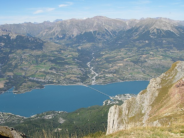
Lac de Serre-Ponçon: Close to Pontis, this large artificial lake offers remarkable views and several hiking paths around its periphery. It’s a great spot for combining hiking with other outdoor activities like swimming or water sports.
-
Wildlife Watching: The region offers good opportunities for birdwatching and spotting local wildlife, making it a rewarding experience for nature lovers.
-
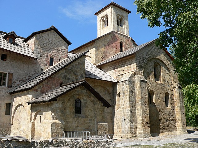
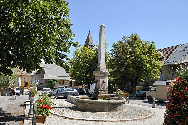
Cultural Experience: Hiking around Pontis not only allows you to immerse yourself in nature, but also to discover the local culture, including traditional villages, historic architecture, and local cuisine.
-
Seasonal Hiking: The best times to hike in this region are late spring through early autumn (May to October), when the weather is mild and trails are accessible. Winter hiking can also be enjoyed, but trails may require proper gear, such as snowshoes.
Practical Tips:
- Maps and Navigation: Ensure you have a map or a GPS device as some trails might not be well-marked.
- Local Guides: Consider hiring a local guide for a more informative experience or to discover hidden trails.
- Safety: Always carry enough water, snacks, and a first-aid kit. Inform someone about your hiking plans, especially if you’re going alone.
- Weather Check: Check the weather forecast before heading out, as conditions can change rapidly in mountainous areas.
Whether you're enjoying a leisurely stroll or embarking on a day hike, Pontis and its surrounding areas provide a beautiful backdrop for outdoor adventures in the heart of the French Alps.
- Country:

- Postal Code: 05160
- Coordinates: 44° 30' 15" N, 6° 21' 28" E


- GPS tracks (wikiloc): [Link]
- Area: 14.11 sq km
- Population: 85
- Web site: http://www.pontis.fr/
- Wikipedia en: wiki(en)
- Wikipedia: wiki(fr)
- Wikidata storage: Wikidata: Q1381822
- Wikipedia Commons Category: [Link]
- Freebase ID: [/m/03m7_nn]
- Freebase ID: [/m/03m7_nn]
- GeoNames ID: Alt: [6612232]
- GeoNames ID: Alt: [6612232]
- SIREN number: [210401543]
- SIREN number: [210401543]
- INSEE municipality code: 04154
- INSEE municipality code: 04154
Shares border with regions:

Crots
- commune in Hautes-Alpes, France
Crots, located in the French Alps within the Hautes-Alpes department, is a beautiful destination for hiking enthusiasts. The area is known for its stunning landscapes, including mountains, valleys, and picturesque villages. If you're planning a hiking trip in Crots, here are some key points to consider:...
- Country:

- Postal Code: 05200
- Coordinates: 44° 32' 1" N, 6° 28' 16" E


- GPS tracks (wikiloc): [Link]
- AboveSeaLevel: 790 м m
- Area: 53.84 sq km
- Population: 1022

Savines-le-Lac
- commune in Hautes-Alpes, France
Savines-le-Lac is a picturesque village located in the French Alps, near the Serre-Ponçon Lake in the Hautes-Alpes region. It's an excellent destination for hiking enthusiasts, offering a variety of trails that cater to different skill levels, with stunning views of the lake and surrounding mountains....
- Country:

- Postal Code: 05160
- Coordinates: 44° 31' 33" N, 6° 24' 18" E


- GPS tracks (wikiloc): [Link]
- AboveSeaLevel: 790 м m
- Area: 25.13 sq km
- Population: 1063
- Web site: [Link]

Le Sauze-du-Lac
- commune in Hautes-Alpes, France
Le Sauze-du-Lac is a picturesque village located in the French Alps, known for its stunning natural beauty, pristine lakes, and accessibility to various hiking routes. Here’s what you should know about hiking in this delightful area:...
- Country:

- Postal Code: 05160
- Coordinates: 44° 28' 42" N, 6° 18' 50" E


- GPS tracks (wikiloc): [Link]
- AboveSeaLevel: 1052 м m
- Area: 8.49 sq km
- Population: 145
- Web site: [Link]

Prunières
- commune in Hautes-Alpes, France
Hiking in Prunières, located in the Hautes-Alpes region of France, offers stunning landscapes and a variety of trails suitable for all levels of hikers. This area is known for its beautiful mountains, alpine meadows, and pristine nature, making it an ideal destination for outdoor enthusiasts....
- Country:

- Postal Code: 05230
- Coordinates: 44° 32' 31" N, 6° 20' 0" E


- GPS tracks (wikiloc): [Link]
- Area: 13.2 sq km
- Population: 298
- Web site: [Link]

Chorges
- commune in Hautes-Alpes, France
Chorges, located in the Hautes-Alpes region of France, is a beautiful destination for hiking enthusiasts. Nestled in the stunning natural environment of the French Alps, it offers a range of trails suitable for all levels of hikers, from beginners to experienced trekkers. Here’s what you need to know about hiking in Chorges:...
- Country:

- Postal Code: 05230
- Coordinates: 44° 32' 44" N, 6° 16' 35" E


- GPS tracks (wikiloc): [Link]
- AboveSeaLevel: 835 м m
- Area: 53.34 sq km
- Population: 2810
- Web site: [Link]

Le Lauzet-Ubaye
- commune in Alpes-de-Haute-Provence, France
Le Lauzet-Ubaye is a beautiful destination located in the Alpes-de-Haute-Provence region of southeastern France. Situated along the Ubaye River, this picturesque area offers stunning landscapes, rich biodiversity, and a variety of hiking trails suitable for different skill levels. Here are some highlights and tips for hiking in Le Lauzet-Ubaye:...
- Country:

- Postal Code: 04340
- Coordinates: 44° 25' 48" N, 6° 25' 56" E


- GPS tracks (wikiloc): [Link]
- Area: 66.26 sq km
- Population: 211
