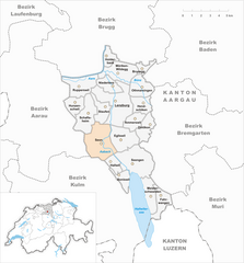
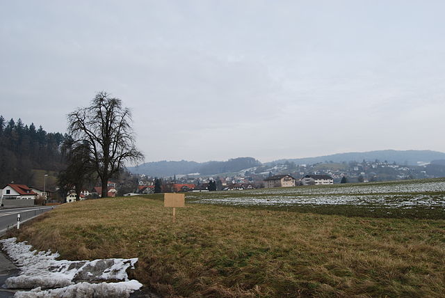
Lenzburg District (Bezirk Lenzburg)

- district in Switzerland
 Hiking in Lenzburg District
Lenzburg District, located in the Aargau canton of Switzerland, boasts a variety of hiking opportunities that cater to all levels of hikers. The region is characterized by its beautiful landscapes, historical sites, and well-maintained trails. Here’s an overview of what you can expect when hiking in Lenzburg District:
Scenic Trails
-
Lake Hallwil: Hike around this picturesque lake which offers stunning views of the water and surrounding hills. The trail is relatively flat, making it accessible for families and less experienced hikers.
-
Bözberg Trail: This trail offers fantastic panoramic views of the Rhine Valley and the Alps on clear days. It's a great choice for those looking for a moderate challenge with rewarding scenery.
-
Historical Trails: The area is rich in history, and several trails are designed to showcase historical sites, including ancient castles and charming villages. One example is the hike to Lenzburg Castle, which also allows for exploration of the castle itself.
Flora and Fauna
The diverse habitats in Lenzburg District provide opportunities to see a wide range of plant and animal life. From lovely wildflowers in the spring to vibrant autumn foliage, the changing seasons provide a beautiful backdrop for hiking.
Accessibility and Infrastructure
The hiking trails are generally well-marked and maintained, making navigation straightforward. Public transportation links are also good, allowing hikers to reach trailheads easily.
Tips for Hiking in Lenzburg District
- Weather Check: Always check the weather conditions before heading out, as they can change rapidly.
- Proper Gear: Wear appropriate footwear and bring necessary gear for the duration of your hike.
- Hydration and Snacks: Carry enough water and snacks, especially on longer trails.
- Respect Nature: Stay on marked paths and take care of the environment.
Conclusion
Hiking in the Lenzburg District offers a wonderful blend of nature, culture, and history. Whether you’re looking for a leisurely stroll by the lake or an adventurous trek with breathtaking views, there’s something for everyone in this charming Swiss region.
- Country:

- Capital: Lenzburg
- Licence Plate Code: AG
- Coordinates: 47° 23' 0" N, 8° 10' 0" E


- GPS tracks (wikiloc): [Link]
- AboveSeaLevel: 457 м m
- Area: 102.71 sq km
- Wikipedia en: wiki(en)
- Wikipedia: wiki(de)
- Wikidata storage: Wikidata: Q659293
- Wikipedia Commons Category: [Link]
- Freebase ID: [/m/03_kds]
- GeoNames ID: Alt: [6458806]
- archINFORM location ID: [5890]
- HDS ID: [8295]
Includes regions:

Boniswil
- municipality in Switzerland
Hiking in Boniswil
Boniswil, a charming village located in the canton of Aargau in Switzerland, offers scenic landscapes and various hiking opportunities. While it is not as widely known as some other Swiss hiking destinations, it provides a more serene experience amidst nature....
- Country:
- Postal Code: 5706
- Local Dialing Code: 062
- Licence Plate Code: AG
- Coordinates: 47° 18' 43" N, 8° 11' 27" E
- GPS tracks (wikiloc): [Link]
- AboveSeaLevel: 467 м m
- Area: 2.78 sq km
- Population: 1398
- Web site: [Link]
Seon
- municipality in Switzerland
Hiking in Seon
Seon, located in the Aargau region of Switzerland, is a charming area that offers a range of hiking opportunities. The region is characterized by its picturesque landscapes, including rolling hills, forests, and scenic rivers. Here are some highlights for those interested in hiking in and around Seon:...
- Country:
- Postal Code: 5703
- Local Dialing Code: 062
- Licence Plate Code: AG
- Coordinates: 47° 20' 45" N, 8° 9' 35" E
- GPS tracks (wikiloc): [Link]
- AboveSeaLevel: 445 м m
- Area: 9.61 sq km
- Population: 5227
- Web site: [Link]


Brunegg
- municipality in Switzerland
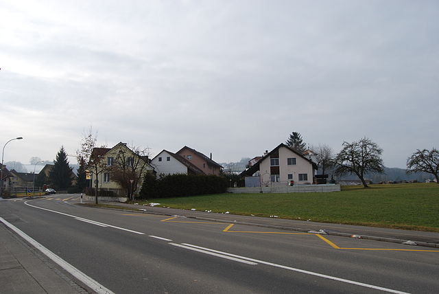
Hiking in Brunegg
Brunegg is a small municipality located in the canton of Aargau, Switzerland. Nestled amidst beautiful landscapes, this area is perfect for hiking enthusiasts, offering a mix of scenic views and nature....
- Country:
- Postal Code: 5505
- Local Dialing Code: 062
- Licence Plate Code: AG
- Coordinates: 47° 25' 15" N, 8° 13' 11" E
- GPS tracks (wikiloc): [Link]
- AboveSeaLevel: 412 м m
- Area: 1.56 sq km
- Population: 809
- Web site: [Link]


Niederlenz
- municipality in Switzerland
Hiking in Niederlenz
Niederlenz is a charming village located in the canton of Aargau, Switzerland. It serves as a great base for hikers as it offers various trails that cater to different skill levels and preferences. Here are some highlights and tips for hiking in Niederlenz:...
- Country:
- Postal Code: 5702
- Local Dialing Code: 062
- Licence Plate Code: AG
- Coordinates: 47° 24' 13" N, 8° 10' 13" E
- GPS tracks (wikiloc): [Link]
- AboveSeaLevel: 387 м m
- Area: 3.26 sq km
- Population: 4747
- Web site: [Link]


Fahrwangen
- municipality in Switzerland
Hiking in Fahrwangen
Fahrwangen is a charming municipality located in the Aargau region of Switzerland, offering a variety of hiking opportunities that allow you to soak in the scenic beauty of the Swiss countryside. Here are some aspects you might consider for your hiking experience in Fahrwangen:...
- Country:
- Postal Code: 5615
- Local Dialing Code: 056
- Licence Plate Code: AG
- Coordinates: 47° 17' 45" N, 8° 14' 35" E
- GPS tracks (wikiloc): [Link]
- AboveSeaLevel: 543 м m
- Area: 5.00 sq km
- Population: 2059
- Web site: [Link]
Seengen
- municipality in Switzerland
Hiking in Seengen
Seengen, located in the canton of Aargau in Switzerland, offers picturesque landscapes and a variety of hiking opportunities suitable for different skill levels. From gentle lakeside walks to more challenging trails in the surrounding hills, there’s something for everyone....
- Country:
- Postal Code: 5707
- Local Dialing Code: 062
- Licence Plate Code: AG
- Coordinates: 47° 19' 45" N, 8° 12' 32" E
- GPS tracks (wikiloc): [Link]
- AboveSeaLevel: 520 м m
- Area: 10.35 sq km
- Population: 3951
- Web site: [Link]


Othmarsingen
- municipality in Switzerland
Hiking in Othmarsingen
Othmarsingen, located in the Swiss Canton of Aargau, offers a range of hiking opportunities amidst beautiful landscapes. Here’s what you can expect when hiking in and around Othmarsingen:...
- Country:
- Postal Code: 5504
- Local Dialing Code: 062
- Licence Plate Code: AG
- Coordinates: 47° 24' 6" N, 8° 12' 53" E
- GPS tracks (wikiloc): [Link]
- AboveSeaLevel: 393 м m
- Area: 4.71 sq km
- Population: 2784
- Web site: [Link]

Dintikon
- municipality in Switzerland
Hiking in Dintikon
Dintikon is a charming village located in the canton of Aargau, Switzerland. It offers picturesque landscapes and various hiking opportunities for outdoor enthusiasts. Here are some key points about hiking in and around Dintikon:...
- Country:
- Postal Code: 5606
- Local Dialing Code: 056
- Licence Plate Code: AG
- Coordinates: 47° 21' 54" N, 8° 13' 45" E
- GPS tracks (wikiloc): [Link]
- AboveSeaLevel: 449 м m
- Area: 3.73 sq km
- Population: 2192
- Web site: [Link]


Staufen
- municipality in the canton Aargau, Switzerland
Hiking in Staufen
Staufen, located in the Aargau region of Switzerland, offers a variety of hiking opportunities that showcase the natural beauty of the area. Nestled in the Wyna Valley, this picturesque region is characterized by rolling hills, lush forests, and scenic views. Here are some key highlights for hiking in Staufen:...
- Country:
- Postal Code: 5603
- Local Dialing Code: 062
- Licence Plate Code: AG
- Coordinates: 47° 23' 0" N, 8° 10' 0" E
- GPS tracks (wikiloc): [Link]
- AboveSeaLevel: 420 м m
- Area: 3.58 sq km
- Population: 3233
- Web site: [Link]
Egliswil
- municipality in Switzerland
Hiking in Egliswil
Egliswil is a picturesque village located in Switzerland, nestled in the scenic Cantonal region of Aargau. It's surrounded by stunning landscapes, making it a wonderful destination for hiking enthusiasts....
- Country:
- Postal Code: 5704
- Local Dialing Code: 062
- Licence Plate Code: AG
- Coordinates: 47° 21' 6" N, 8° 11' 25" E
- GPS tracks (wikiloc): [Link]
- AboveSeaLevel: 483 м m
- Area: 6.29 sq km
- Population: 1407
- Web site: [Link]
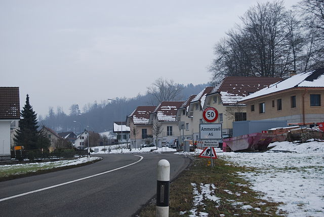

Ammerswil
- municipality in Switzerland
Hiking in Ammerswil
Ammerswil is a small village located in the region of Aargau in Switzerland, known for its beautiful landscapes and access to outdoor activities, including hiking. While it may not be as famous as some of the larger Swiss hiking destinations, there are several opportunities for hiking in and around Ammerswil that you might find enjoyable....
- Country:
- Postal Code: 5600
- Local Dialing Code: 062
- Licence Plate Code: AG
- Coordinates: 47° 22' 5" N, 8° 12' 21" E
- GPS tracks (wikiloc): [Link]
- AboveSeaLevel: 464 м m
- Area: 3.19 sq km
- Population: 679
- Web site: [Link]


Möriken-Wildegg
- municipality in Switzerland
Hiking in Möriken-Wildegg
Möriken-Wildegg is a picturesque municipality located in the Aargau region of Switzerland. It's an excellent destination for hiking enthusiasts, offering a variety of trails that cater to different skill levels....
- Country:
- Postal Code: 5103
- Local Dialing Code: 062
- Licence Plate Code: AG
- Coordinates: 47° 24' 59" N, 8° 10' 59" E
- GPS tracks (wikiloc): [Link]
- AboveSeaLevel: 383 м m
- Area: 6.61 sq km
- Population: 4385
- Web site: [Link]


Hallwil
- municipality in Switzerland
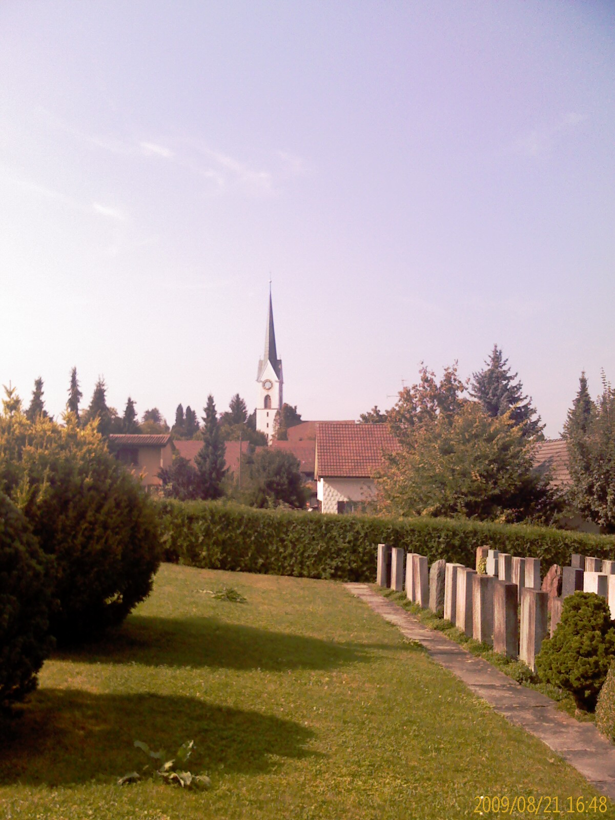
Hiking in Hallwil
Hiking in Hallwil, a picturesque village located on the shores of Lake Hallwil in Switzerland, offers a variety of scenic trails suitable for different skill levels. This area is rich in natural beauty, with rolling hills, lush forests, and stunning views of the lake and surrounding mountains....
- Country:
- Postal Code: 5705
- Local Dialing Code: 062
- Licence Plate Code: AG
- Coordinates: 47° 19' 35" N, 8° 10' 41" E
- GPS tracks (wikiloc): [Link]
- AboveSeaLevel: 479 м m
- Area: 2.18 sq km
- Population: 876


Rupperswil
- municipality in Switzerland
Hiking in Rupperswil
Rupperswil, located in the canton of Aargau, Switzerland, offers several opportunities for hiking enthusiasts. The region is known for its picturesque landscapes, including rolling hills, forests, and views of the Aare River. Here’s an overview of what you can expect when hiking in and around Rupperswil:...
- Country:
- Postal Code: 5102
- Local Dialing Code: 062
- Licence Plate Code: AG
- Coordinates: 47° 24' 14" N, 8° 7' 54" E
- GPS tracks (wikiloc): [Link]
- AboveSeaLevel: 372 м m
- Area: 6.22 sq km
- Population: 5476
- Web site: [Link]

Meisterschwanden
- municipality in Switzerland
Hiking in Meisterschwanden
Meisterschwanden is a charming village located in the Swiss canton of Aargau, near Lake Hallwil. It offers a variety of hiking opportunities that cater to different skill levels and preferences. Here are some highlights of hiking in and around Meisterschwanden:...
- Country:
- Postal Code: 5616
- Local Dialing Code: 056
- Licence Plate Code: AG
- Coordinates: 47° 17' 46" N, 8° 13' 49" E
- GPS tracks (wikiloc): [Link]
- AboveSeaLevel: 497 м m
- Area: 6.86 sq km
- Population: 2938
- Web site: [Link]

Hendschiken
- municipality in Switzerland
Hiking in Hendschiken
Hendschiken is a small municipality in the canton of Aargau, Switzerland, located near the Aare River and surrounded by picturesque landscapes. While it may not be a widely known hiking destination, there are certainly some lovely trails in the surrounding area that you can explore....
- Country:
- Postal Code: 5604
- Local Dialing Code: 062
- Licence Plate Code: AG
- Coordinates: 47° 23' 4" N, 8° 12' 57" E
- GPS tracks (wikiloc): [Link]
- AboveSeaLevel: 410 м m
- Area: 3.52 sq km
- Population: 1227
- Web site: [Link]


Holderbank
- municipality in the canton of Aargau, Switzerland
Hiking in Holderbank
Holderbank, located in the canton of Aargau, Switzerland, is surrounded by stunning landscapes and offers a variety of hiking opportunities for outdoor enthusiasts. Here are some key points about hiking in and around Holderbank:...
- Country:
- Postal Code: 5113
- Local Dialing Code: 062
- Licence Plate Code: AG
- Coordinates: 47° 25' 59" N, 8° 10' 5" E
- GPS tracks (wikiloc): [Link]
- AboveSeaLevel: 365 м m
- Area: 2.32 sq km
- Population: 1216
- Web site: [Link]

Hunzenschwil
- municipality in Switzerland
Hiking in Hunzenschwil
Hunzenschwil is a small municipality located in the canton of Aargau in Switzerland. While it may not be as well-known for hiking as some of the larger mountain regions in Switzerland, it does offer opportunities for outdoor activities, including hiking....
- Country:
- Postal Code: 5502
- Local Dialing Code: 062
- Licence Plate Code: AG
- Coordinates: 47° 23' 3" N, 8° 7' 22" E
- GPS tracks (wikiloc): [Link]
- AboveSeaLevel: 400 м m
- Area: 3.27 sq km
- Population: 4025
- Web site: [Link]


Schafisheim
- municipality in Switzerland
Hiking in Schafisheim
Schafisheim, located in the canton of Aargau, Switzerland, is a charming area that offers various hiking opportunities in a picturesque landscape. While Schafisheim itself is a small village, it serves as a great starting point for exploring the surrounding countryside and nearby trails....
- Country:
- Postal Code: 5503
- Local Dialing Code: 062
- Licence Plate Code: AG
- Coordinates: 47° 22' 25" N, 8° 8' 21" E
- GPS tracks (wikiloc): [Link]
- AboveSeaLevel: 435 м m
- Area: 6.33 sq km
- Population: 3027
- Web site: [Link]


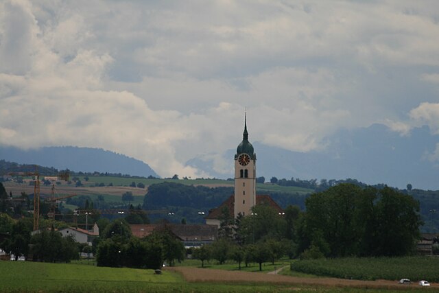
Lenzburg
- municipality in Switzerland
Hiking in Lenzburg
Lenzburg, located in the Aargau region of Switzerland, offers a variety of hiking opportunities that showcase the region's stunning landscapes, rich history, and charming villages. Here are some highlights for hiking in and around Lenzburg:...
- Country:
- Postal Code: 5600
- Local Dialing Code: 062
- Licence Plate Code: AG
- Coordinates: 47° 23' 15" N, 8° 10' 49" E
- GPS tracks (wikiloc): [Link]
- AboveSeaLevel: 413 м m
- Area: 11.33 sq km
- Population: 10173
- Web site: [Link]