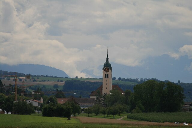
Meisterschwanden (Meisterschwanden)
- municipality in Switzerland
Meisterschwanden is a charming village located in the Swiss canton of Aargau, near Lake Hallwil. It offers a variety of hiking opportunities that cater to different skill levels and preferences. Here are some highlights of hiking in and around Meisterschwanden:
Scenic Trails
-
Lake Hallwil Trail: This is a picturesque trail around Lake Hallwil, offering stunning views of the water and surrounding mountains. It’s relatively flat and suitable for families and beginners.
-
Nearby Forest Trails: The area is surrounded by lush forests that provide numerous hiking paths, perfect for those seeking a more immersive nature experience. These trails may range from easy walks to more challenging hikes.
-
Rigi and Pilatus Excursions: For a more adventurous hike, consider taking a day trip to the nearby Rigi or Pilatus mountains. Both locations offer breathtaking scenery and well-marked trails.
Tips for Hiking
-
Weather Conditions: Always check the local weather forecast before setting out. The Swiss weather can change rapidly, especially in mountainous areas.
-
Proper Gear: Ensure you wear sturdy hiking shoes and dress in layers. The terrain can vary, and it’s important to stay comfortable.
-
Navigation: Familiarize yourself with local maps or use a hiking app for navigation, as trails can sometimes be unmarked or hard to follow.
-
Wildlife Watching: Keep an eye out for local wildlife, especially in forested areas. Observing flora and fauna can be a rewarding part of your hike.
-
Stay Hydrated and Snack Smartly: Bring enough water and some healthy snacks to keep your energy levels up during your hikes.
Accessibility
Most trails around Meisterschwanden are accessible by public transport, making it convenient to start your hikes without the need for a car. The local tourism office can provide additional resources, maps, and advice on current trail conditions.
Conclusion
Hiking in Meisterschwanden can be a delightful experience, combining scenic landscapes with a variety of trails. Whether you’re a beginner or an experienced hiker, the area offers something for everyone. Enjoy your hike and immerse yourself in the beautiful Swiss nature!
- Country:

- Postal Code: 5616
- Local Dialing Code: 056
- Licence Plate Code: AG
- Coordinates: 47° 17' 46" N, 8° 13' 49" E


- GPS tracks (wikiloc): [Link]
- AboveSeaLevel: 497 м m
- Area: 6.86 sq km
- Population: 2938
- Web site: http://www.meisterschwanden.ch
- Wikipedia en: wiki(en)
- Wikipedia: wiki(de)
- Wikidata storage: Wikidata: Q65316
- Wikipedia Commons Category: [Link]
- Freebase ID: [/m/0fzk03]
- GeoNames ID: Alt: [7286476]
- VIAF ID: Alt: [237465638]
- OSM relation ID: [1684359]
- HDS ID: [1767]
- Swiss municipality code: [4202]
Shares border with regions:


Beinwil am See
- municipality in Switzerland
Beinwil am See, located in the Swiss canton of Aargau, is a picturesque village set along the shores of Lake Hallwil. The area is ideal for hiking, offering a mix of scenic views, natural landscapes, and cultural experiences. Here are some highlights and recommendations for hiking in and around Beinwil am See:...
- Country:

- Postal Code: 5712
- Local Dialing Code: 062
- Licence Plate Code: AG
- Coordinates: 47° 16' 4" N, 8° 12' 9" E


- GPS tracks (wikiloc): [Link]
- AboveSeaLevel: 520 м m
- Area: 5.78 sq km
- Population: 3174
- Web site: [Link]


Seengen
- municipality in Switzerland
Seengen, located in the canton of Aargau in Switzerland, offers picturesque landscapes and a variety of hiking opportunities suitable for different skill levels. From gentle lakeside walks to more challenging trails in the surrounding hills, there’s something for everyone....
- Country:

- Postal Code: 5707
- Local Dialing Code: 062
- Licence Plate Code: AG
- Coordinates: 47° 19' 45" N, 8° 12' 32" E


- GPS tracks (wikiloc): [Link]
- AboveSeaLevel: 520 м m
- Area: 10.35 sq km
- Population: 3951
- Web site: [Link]


Sarmenstorf
- municipality in Switzerland
Sarmenstorf is a charming village located in the canton of Aargau in Switzerland. The area surrounding Sarmenstorf offers beautiful landscapes and several hiking opportunities for outdoor enthusiasts. Here's what you can expect when hiking in and around Sarmenstorf:...
- Country:

- Postal Code: 5614
- Local Dialing Code: 056
- Licence Plate Code: AG
- Coordinates: 47° 18' 41" N, 8° 15' 10" E


- GPS tracks (wikiloc): [Link]
- AboveSeaLevel: 551 м m
- Area: 8.30 sq km
- Population: 2864
- Web site: [Link]

