Les Arcs (Les Arcs)
- commune in Var, France
Les Arcs, located in the Var department of the Provence-Alpes-Côte d'Azur region in southeastern France, offers a picturesque setting for hiking with its stunning landscapes, charming villages, and diverse trails. Here are some highlights and tips for hiking in this beautiful area:
Scenic Trails
-
Les Sentiers du Moulin: This trail takes you through lush forests and offers views of the surrounding hills and vineyards. It's a great way to experience the local flora and fauna.
-
The GR 51: Part of the Grande Randonnée network, this long-distance trail offers breathtaking views of the Mediterranean Sea, rugged cliffs, and valleys. Portions of this trail are accessible from Les Arcs.
-
Les Gorges de Châteaudouble: A short drive from Les Arcs, this gorge features striking rock formations and delightful walking paths that follow the river, perfect for a refreshing hike.
Points of Interest
-
The Village of Les Arcs: The historic village itself is worth exploring. It has narrow streets, charming stone buildings, and offers an experience of the local culture and history.
-
Vineyards: The Var region is known for its wines, particularly rosé. Consider incorporating a vineyard visit or wine tasting into your hiking trip.
Hiking Tips
-
Best Time to Hike: Spring (March to June) and fall (September to November) are ideal for hiking in Les Arcs. The weather is mild, and the landscapes are particularly beautiful.
-
What to Wear: Sturdy hiking boots are essential, along with moisture-wicking clothing. Don't forget a hat, sunscreen, and plenty of water.
-
Maps and Guides: It’s wise to carry a detailed map or a hiking app that includes trails in the region. Local tourist offices can provide information and resources.
-
Wildlife and Nature: Be mindful of the wildlife in the region, including birds and possibly deer. Respect their habitats and follow Leave No Trace principles.
-
Local Amenities: After a long day of hiking, you can find local restaurants and cafes in the village to enjoy traditional Provençal cuisine.
Safety Considerations
- Always inform someone of your hiking plans, especially if you are heading out alone.
- Check weather conditions before heading out, as weather can change quickly in the mountains.
- Ensure you have a charged mobile device for navigation and emergencies.
Hiking in Les Arcs offers both adventure and tranquility amidst beautiful scenery, making it an excellent destination for outdoor enthusiasts. Enjoy your hike!
- Country:

- Postal Code: 83460
- Coordinates: 43° 27' 48" N, 6° 28' 44" E


- GPS tracks (wikiloc): [Link]
- Area: 54.26 sq km
- Population: 7143
- Web site: http://www.mairie-les-arcs-sur-argens.fr
- Wikipedia en: wiki(en)
- Wikipedia: wiki(fr)
- Wikidata storage: Wikidata: Q636734
- Wikipedia Commons Category: [Link]
- Freebase ID: [/m/03qhf4b]
- GeoNames ID: Alt: [6457201]
- SIREN number: [218300044]
- BnF ID: [15277831t]
- VIAF ID: Alt: [154754761]
- Library of Congress authority ID: Alt: [n79027070]
- INSEE municipality code: 83004
Shares border with regions:


Vidauban
- commune in Var, France
Vidauban is a charming village located in the Var department of the Provence-Alpes-Côte d'Azur region in southeastern France. Surrounded by beautiful landscapes, it offers a variety of hiking opportunities that cater to different skill levels. Here are some highlights and tips for hiking in Vidauban:...
- Country:

- Postal Code: 83550
- Coordinates: 43° 25' 38" N, 6° 25' 55" E


- GPS tracks (wikiloc): [Link]
- Area: 73.93 sq km
- Population: 11391
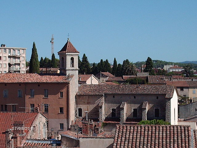
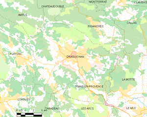
Draguignan
- commune in Var, France
Draguignan, located in the Var region of southern France, is a charming town surrounded by beautiful natural landscapes, making it a fantastic location for hiking enthusiasts. Here are some key points about hiking in and around Draguignan:...
- Country:

- Postal Code: 83300
- Coordinates: 43° 32' 22" N, 6° 27' 58" E


- GPS tracks (wikiloc): [Link]
- Area: 53.75 sq km
- Population: 40278
- Web site: [Link]


La Motte
- commune in Var, France
La Motte, located in the Var department of the Provence-Alpes-Côte d’Azur region in southeastern France, is a charming destination for hiking enthusiasts. Nestled in the picturesque landscape of the Provence countryside, it offers varied trails that cater to different skill levels, all while showcasing the region's natural beauty....
- Country:

- Postal Code: 83920
- Coordinates: 43° 29' 38" N, 6° 32' 7" E


- GPS tracks (wikiloc): [Link]
- Area: 28.12 sq km
- Population: 2931

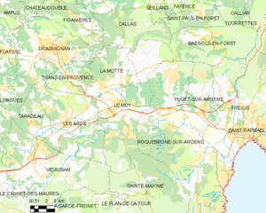
Le Muy
- commune in Var, France
Le Muy, located in the Var department of the Provence-Alpes-Côte d'Azur region in France, is a fantastic spot for hiking enthusiasts. The area is characterized by its stunning natural scenery, including hills, forests, rivers, and vineyards, making it an ideal place for outdoor activities....
- Country:

- Postal Code: 83490
- Coordinates: 43° 28' 21" N, 6° 33' 59" E


- GPS tracks (wikiloc): [Link]
- Area: 66.58 sq km
- Population: 9361

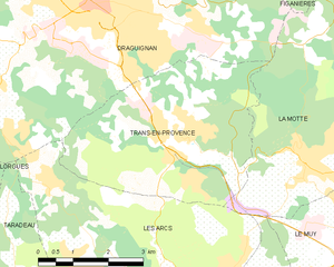
Trans-en-Provence
- commune in Var, France
Trans-en-Provence is a charming village located in the Provence-Alpes-Côte d'Azur region of southeastern France. It's known for its picturesque surroundings, rolling hills, and beautiful landscapes, making it a great base for hiking enthusiasts....
- Country:

- Postal Code: 83720
- Coordinates: 43° 30' 12" N, 6° 29' 10" E


- GPS tracks (wikiloc): [Link]
- Area: 16.99 sq km
- Population: 5694
- Web site: [Link]

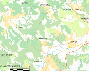
Taradeau
- commune in Var, France
Taradeau is a charming village located in the Var department of the Provence-Alpes-Côte d'Azur region in southeastern France. While it may not be as widely recognized as other hiking destinations, it offers a unique experience for hikers looking to explore the picturesque landscapes of the Provence region....
- Country:

- Postal Code: 83460
- Coordinates: 43° 27' 15" N, 6° 25' 38" E


- GPS tracks (wikiloc): [Link]
- Area: 17.31 sq km
- Population: 1811
- Web site: [Link]

