Le Muy (Le Muy)

- commune in Var, France
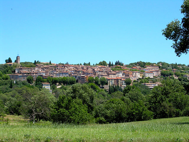
 Hiking in Le Muy
Le Muy, located in the Var department of the Provence-Alpes-Côte d'Azur region in France, is a fantastic spot for hiking enthusiasts. The area is characterized by its stunning natural scenery, including hills, forests, rivers, and vineyards, making it an ideal place for outdoor activities.
Key Highlights for Hiking in Le Muy:
-
Var River Trails: The trails along the Var River provide picturesque views and a diverse landscape. You can enjoy a mix of gentle paths and more challenging routes, depending on your preference.
-
Massif des Maures: Just a short distance from Le Muy, this mountain range offers several hiking trails. The terrain varies from rugged hills to shaded forests, with routes suitable for different skill levels.
-
Vineyards and Olive Groves: Many hikes in the area wind through charming vineyards and olive groves, allowing hikers to admire the local agriculture and perhaps stop for some wine tasting or olive oil sampling along the way.
-
Historical Sites: There are several historical points of interest along various trails, including the remains of old villages and churches, offering a taste of the region's rich history.
-
Guided Hiking Tours: If you're new to the area, consider joining a guided hiking tour. Local guides can provide insights into the flora, fauna, and geology of the region, enhancing your experience.
-
Trail Difficulty: Le Muy offers hikes suitable for all skill levels, from leisurely strolls to more challenging treks. Always check trail difficulty and prepare accordingly.
-
Best Seasons: The best times to hike in Le Muy are during spring (April to June) and fall (September to October), when the weather is usually mild, and the landscape is especially beautiful.
Tips for Hiking in Le Muy:
- Stay Hydrated: Always carry enough water, especially in warmer months.
- Wear Appropriate Footwear: Good hiking boots are essential for comfort and safety.
- Check Weather Conditions: Mountain weather can change quickly, so be prepared.
- Respect Nature: Stay on marked trails and avoid disturbing wildlife, maintaining the area's natural beauty.
Whether you're looking for a relaxing walk or a more strenuous hike, Le Muy's diverse landscapes and scenic beauty make it a perfect destination for hiking enthusiasts.
- Country:

- Postal Code: 83490
- Coordinates: 43° 28' 21" N, 6° 33' 59" E


- GPS tracks (wikiloc): [Link]
- Area: 66.58 sq km
- Population: 9361
- Wikipedia en: wiki(en)
- Wikipedia: wiki(fr)
- Wikidata storage: Wikidata: Q817832
- Wikipedia Commons Category: [Link]
- Freebase ID: [/m/02q6pcj]
- GeoNames ID: Alt: [3003148]
- SIREN number: [218300861]
- BnF ID: [152779135]
- VIAF ID: Alt: [233946979]
- GND ID: Alt: [7707201-7]
- INSEE municipality code: 83086
Shares border with regions:


Vidauban
- commune in Var, France
Hiking in Vidauban
Vidauban is a charming village located in the Var department of the Provence-Alpes-Côte d'Azur region in southeastern France. Surrounded by beautiful landscapes, it offers a variety of hiking opportunities that cater to different skill levels. Here are some highlights and tips for hiking in Vidauban:...
- Country:
- Postal Code: 83550
- Coordinates: 43° 25' 38" N, 6° 25' 55" E
- GPS tracks (wikiloc): [Link]
- Area: 73.93 sq km
- Population: 11391


La Motte
- commune in Var, France
Hiking in La Motte
La Motte, located in the Var department of the Provence-Alpes-Côte d’Azur region in southeastern France, is a charming destination for hiking enthusiasts. Nestled in the picturesque landscape of the Provence countryside, it offers varied trails that cater to different skill levels, all while showcasing the region's natural beauty....
- Country:
- Postal Code: 83920
- Coordinates: 43° 29' 38" N, 6° 32' 7" E
- GPS tracks (wikiloc): [Link]
- Area: 28.12 sq km
- Population: 2931


Roquebrune-sur-Argens
- commune in Var, France
- Country:
- Postal Code: 83520
- Coordinates: 43° 26' 36" N, 6° 38' 16" E
- GPS tracks (wikiloc): [Link]
- Area: 106.1 sq km
- Population: 13195
- Web site: [Link]


Les Arcs
- commune in Var, France
Hiking in Les Arcs
Les Arcs, located in the Var department of the Provence-Alpes-Côte d'Azur region in southeastern France, offers a picturesque setting for hiking with its stunning landscapes, charming villages, and diverse trails. Here are some highlights and tips for hiking in this beautiful area:...
- Country:
- Postal Code: 83460
- Coordinates: 43° 27' 48" N, 6° 28' 44" E
- GPS tracks (wikiloc): [Link]
- Area: 54.26 sq km
- Population: 7143
- Web site: [Link]

Bagnols-en-Forêt
- commune in Var, France
Hiking in Bagnols-en-Forêt
Bagnols-en-Forêt is a charming village located in the Var department of the Provence-Alpes-Côte d'Azur region in France. The area around Bagnols-en-Forêt offers a range of hiking opportunities that cater to different skill levels and preferences. Here are some highlights about hiking in this picturesque location:...
- Country:
- Postal Code: 83600
- Coordinates: 43° 32' 16" N, 6° 41' 54" E
- GPS tracks (wikiloc): [Link]
- Area: 42.9 sq km
- Population: 2700
- Web site: [Link]


Sainte-Maxime
- commune in Var, France
- Country:
- Postal Code: 83120
- Coordinates: 43° 18' 32" N, 6° 38' 16" E
- GPS tracks (wikiloc): [Link]
- Area: 81.61 sq km
- Population: 14289
- Web site: [Link]


Callas
- commune in Var, France
Hiking in Callas
Callas, located in the Var department of the Provence-Alpes-Côte d'Azur region in southeastern France, offers a beautiful setting for hiking enthusiasts. The village is surrounded by picturesque landscapes characterized by rolling hills, vineyards, and forests, making it an excellent destination for outdoor activities....
- Country:
- Postal Code: 83830
- Coordinates: 43° 35' 35" N, 6° 32' 18" E
- GPS tracks (wikiloc): [Link]
- Area: 49.26 sq km
- Population: 1851