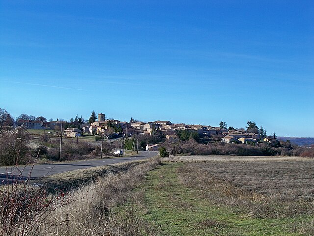
Les Omergues (Les Omergues)
- commune in Alpes-de-Haute-Provence, France
 Hiking in Les Omergues
Les Omergues is a charming village located in the Provence-Alpes-Côte d'Azur region of southeastern France. It's surrounded by scenic landscapes that offer excellent hiking opportunities, making it a great destination for outdoor enthusiasts.
Hiking Opportunities
-
Scenic Trails: The area around Les Omergues features a variety of trails that cater to different skill levels, from leisurely walks suited for families to more challenging hikes for experienced adventurers. The trails often provide stunning views of the surrounding hills, vineyards, and the iconic lavender fields of Provence.
-
Natural Parks: The nearby Region of Luberon Natural Park is particularly notable for its diverse ecosystems, hiking paths, and picturesque villages. You can explore everything from rocky outcrops to serene valleys throughout this protected area.
-
Historical Sites: Many hiking trails in the region also lead to historical sites, such as ancient ruins or traditional stone houses known as "bories". These elements add a cultural dimension to your hiking experience.
-
Wildlife and Flora: The region is rich in biodiversity, providing opportunities for bird watching and discovering unique plant species, especially during the spring and summer months.
-
Local Guides: If you prefer guided hikes, there are local guides available who can enhance your experience with insights into the area's ecology, history, and culture.
Hiking Tips
-
Seasonal Considerations: The best time to hike around Les Omergues is during the spring (April to June) and early fall (September to October) when temperatures are mild, and the scenery is particularly beautiful.
-
Gear: Wear suitable hiking shoes, and bring plenty of water, snacks, and sun protection, especially during the warmer months.
-
Respect Nature: As with any outdoor activity, it’s important to follow Leave No Trace principles to protect the environment and preserve the beauty of the trails.
Whether you're looking for a peaceful stroll or an adventurous trek, hiking in and around Les Omergues can provide a stunning blend of natural beauty and cultural experiences. Enjoy your hike!
- Country:

- Postal Code: 04200
- Coordinates: 44° 10' 18" N, 5° 36' 28" E


- GPS tracks (wikiloc): [Link]
- Area: 34.22 sq km
- Population: 132
- Wikipedia en: wiki(en)
- Wikipedia: wiki(fr)
- Wikidata storage: Wikidata: Q1018605
- Wikipedia Commons Category: [Link]
- Freebase ID: [/m/03m7x1v]
- Freebase ID: [/m/03m7x1v]
- GeoNames ID: Alt: [3000131]
- GeoNames ID: Alt: [3000131]
- SIREN number: [210401402]
- SIREN number: [210401402]
- INSEE municipality code: 04140
- INSEE municipality code: 04140
Shares border with regions:


Ferrassières
- commune in Drôme, France
Hiking in Ferrassières
Ferrassières, a picturesque village located in the Vaucluse department of Provence, France, offers a fantastic hiking experience amidst stunning landscapes, including lavender fields, pine forests, and the rugged beauty of the Mont Ventoux region....
- Country:
- Postal Code: 26570
- Coordinates: 44° 8' 8" N, 5° 28' 42" E
- GPS tracks (wikiloc): [Link]
- Area: 29.27 sq km
- Population: 116


Montfroc
- commune in Drôme, France
Hiking in Montfroc
Montfroc, located in the Provence-Alpes-Côte d'Azur region of France, offers beautiful hiking opportunities amidst stunning natural landscapes. Here are some highlights and tips for hiking in and around Montfroc:...
- Country:
- Postal Code: 26560
- Coordinates: 44° 10' 29" N, 5° 38' 20" E
- GPS tracks (wikiloc): [Link]
- Area: 14.76 sq km
- Population: 77
Revest-du-Bion
- commune in Alpes-de-Haute-Provence, France
Hiking in Revest-du-Bion
Revest-du-Bion, located in the Provence-Alpes-Côte d'Azur region of France, offers a beautiful setting for hiking enthusiasts. Surrounded by natural beauty, this charming village is nestled in the foothills of the Lure Mountains, providing a variety of trails suitable for all skill levels....
- Country:
- Postal Code: 04150
- Coordinates: 44° 4' 58" N, 5° 32' 54" E
- GPS tracks (wikiloc): [Link]
- Area: 43.45 sq km
- Population: 573


Séderon
- commune in Drôme, France
Hiking in Séderon
Séderon is a picturesque village located in the Drôme region of southeastern France, known for its stunning landscapes and hiking opportunities. The surrounding area offers a variety of trails that cater to different skill levels and interests, making it an ideal destination for both casual walkers and experienced hikers....
- Country:
- Postal Code: 26560
- Coordinates: 44° 12' 16" N, 5° 32' 14" E
- GPS tracks (wikiloc): [Link]
- Area: 20.3 sq km
- Population: 272


Barret-de-Lioure
- commune in Drôme, France
Hiking in Barret-de-Lioure
Barret-de-Lioure is a picturesque village located in the Drôme department of southeastern France. It is surrounded by stunning natural landscapes that provide excellent opportunities for hiking and outdoor activities. Here are some key points to consider if you're planning a hiking trip in or around Barret-de-Lioure:...
- Country:
- Postal Code: 26570
- Coordinates: 44° 11' 10" N, 5° 29' 37" E
- GPS tracks (wikiloc): [Link]
- Area: 34.64 sq km
- Population: 86

Redortiers
- commune in Alpes-de-Haute-Provence, France
Hiking in Redortiers
Redortiers is a picturesque village located in the Drôme department of southeastern France, nestled in the beautiful landscape of the Provence region. The area is surrounded by stunning natural scenery, making it an excellent destination for hiking enthusiasts....
- Country:
- Postal Code: 04150
- Coordinates: 44° 6' 17" N, 5° 37' 6" E
- GPS tracks (wikiloc): [Link]
- Area: 45.77 sq km
- Population: 73

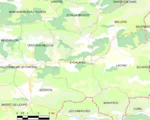
Eygalayes
- commune in Drôme, France
Hiking in Eygalayes
Eygaliers is a picturesque village in the Drôme department of southeastern France, nestled in the beautiful landscape of the Vercors Regional Natural Park. It offers a variety of hiking opportunities that cater to all levels of experience. Here’s a general overview of hiking in the Eygaliers area:...
- Country:
- Postal Code: 26560
- Coordinates: 44° 14' 21" N, 5° 36' 28" E
- GPS tracks (wikiloc): [Link]
- Area: 17.97 sq km
- Population: 76
- Web site: [Link]