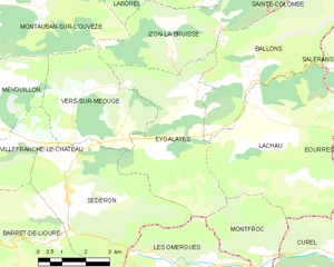
Montfroc (Montfroc)

- commune in Drôme, France
 Hiking in Montfroc
Montfroc, located in the Provence-Alpes-Côte d'Azur region of France, offers beautiful hiking opportunities amidst stunning natural landscapes. Here are some highlights and tips for hiking in and around Montfroc:
Trails and Scenery
-
Variety of Trails: Montfroc has a range of hiking trails suitable for different levels, from easy walks to more challenging treks. The trails often lead through picturesque landscapes of rolling hills, vineyards, and the dramatic backdrop of the nearby mountains.
-
Natural Beauty: As you hike, you'll encounter diverse flora and fauna. The region is known for its scenic views, especially during spring when wildflowers are in bloom.
-
Historical Interest: Some trails may lead you past historical sites, including old stone structures, ruins, and charming rural architecture, giving you a taste of the local culture and heritage.
Tips for Hiking in Montfroc
-
Best Time to Hike: The ideal time for hiking in this region is typically during the spring (April to June) and fall (September to October) when the weather is mild, and the trails are less crowded.
-
Prepare for the Weather: Always check the weather forecast before heading out. The weather can change, and it’s essential to be prepared for various conditions.
-
Sufficient Supplies: Bring enough water, snacks, and a first aid kit. Depending on the length of your hike, you may also want to pack additional layers of clothing.
-
Maps and Navigation: While some trails may be well-marked, carrying a map or a GPS device can be helpful, especially for less traveled paths.
-
Local Wildlife: Be alert for local wildlife and respect their habitats. Avoid feeding animals and maintain a safe distance.
-
Leave No Trace: Follow Leave No Trace principles by carrying out everything you bring in, staying on marked trails, and respecting the environment.
Local Resources
Consider visiting the local tourist office for maps, trail recommendations, and any current conditions or safety advisories.
Whether you're looking for a leisurely hike or an adventurous trek, Montfroc has many options to explore the beauty of southern France. Enjoy your hiking experience!
- Country:

- Postal Code: 26560
- Coordinates: 44° 10' 29" N, 5° 38' 20" E


- GPS tracks (wikiloc): [Link]
- Area: 14.76 sq km
- Population: 77
- Wikipedia en: wiki(en)
- Wikipedia: wiki(fr)
- Wikidata storage: Wikidata: Q1015099
- Wikipedia Commons Category: [Link]
- Freebase ID: [/m/03mgjy5]
- GeoNames ID: Alt: [2992576]
- SIREN number: [212602007]
- BnF ID: [152530615]
- VIAF ID: Alt: [243886567]
- WOEID: [612636]
- INSEE municipality code: 26200
Shares border with regions:

La Rochegiron
- commune in Alpes-de-Haute-Provence, France
Hiking in La Rochegiron
La Rochegiron, located in the Auvergne region of France, is a wonderful destination for hiking enthusiasts. With its picturesque landscapes, scenic views, and a variety of trails, it caters to both novice and experienced hikers. Here’s a bit more information about what you can expect when hiking in the area:...
- Country:
- Postal Code: 04150
- Coordinates: 44° 4' 39" N, 5° 39' 20" E
- GPS tracks (wikiloc): [Link]
- Area: 30.11 sq km
- Population: 93

Les Omergues
- commune in Alpes-de-Haute-Provence, France
Hiking in Les Omergues
Les Omergues is a charming village located in the Provence-Alpes-Côte d'Azur region of southeastern France. It's surrounded by scenic landscapes that offer excellent hiking opportunities, making it a great destination for outdoor enthusiasts....
- Country:
- Postal Code: 04200
- Coordinates: 44° 10' 18" N, 5° 36' 28" E
- GPS tracks (wikiloc): [Link]
- Area: 34.22 sq km
- Population: 132

Curel
- commune in Alpes-de-Haute-Provence, France
Hiking in Curel
Curel, located in the Alpes-de-Haute-Provence region of France, offers a serene and picturesque hiking experience. This area is characterized by its beautiful landscapes, rolling hills, and unique geological features, making it a great destination for hikers of all levels....
- Country:
- Postal Code: 04200
- Coordinates: 44° 10' 37" N, 5° 39' 42" E
- GPS tracks (wikiloc): [Link]
- Area: 10.45 sq km
- Population: 60
- Web site: [Link]

Redortiers
- commune in Alpes-de-Haute-Provence, France
Hiking in Redortiers
Redortiers is a picturesque village located in the Drôme department of southeastern France, nestled in the beautiful landscape of the Provence region. The area is surrounded by stunning natural scenery, making it an excellent destination for hiking enthusiasts....
- Country:
- Postal Code: 04150
- Coordinates: 44° 6' 17" N, 5° 37' 6" E
- GPS tracks (wikiloc): [Link]
- Area: 45.77 sq km
- Population: 73

Eygalayes
- commune in Drôme, France
Hiking in Eygalayes
Eygaliers is a picturesque village in the Drôme department of southeastern France, nestled in the beautiful landscape of the Vercors Regional Natural Park. It offers a variety of hiking opportunities that cater to all levels of experience. Here’s a general overview of hiking in the Eygaliers area:...
- Country:
- Postal Code: 26560
- Coordinates: 44° 14' 21" N, 5° 36' 28" E
- GPS tracks (wikiloc): [Link]
- Area: 17.97 sq km
- Population: 76
- Web site: [Link]

Châteauneuf-Miravail
- commune in Alpes-de-Haute-Provence, France
Hiking in Châteauneuf-Miravail
Châteauneuf-Miravail is a picturesque village located in the Auvergne-Rhône-Alpes region of France, surrounded by beautiful natural landscapes, including hills and forests that offer excellent hiking opportunities. Here’s what you need to know about hiking in and around Châteauneuf-Miravail:...
- Country:
- Postal Code: 04200
- Coordinates: 44° 9' 44" N, 5° 43' 36" E
- GPS tracks (wikiloc): [Link]
- Area: 19.7 sq km
- Population: 72


Lachau
- commune in Drôme, France
Hiking in Lachau
Lachau is a picturesque region located in southeastern France, known for its stunning landscapes, diverse flora and fauna, and well-maintained hiking trails. Here are some key points to consider if you're planning to hike in Lachau:...
- Country:
- Postal Code: 26560
- Coordinates: 44° 13' 56" N, 5° 38' 16" E
- GPS tracks (wikiloc): [Link]
- Area: 25.78 sq km
- Population: 222