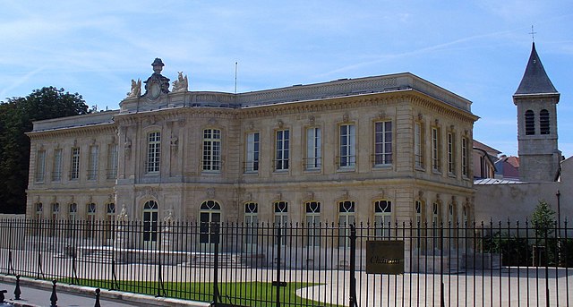
Levallois-Perret (Levallois-Perret)
- commune in Hauts-de-Seine, France
- Country:

- Postal Code: 92300
- Coordinates: 48° 53' 36" N, 2° 17' 16" E


- GPS tracks (wikiloc): [Link]
- AboveSeaLevel: 28 м m
- Area: 2.41 sq km
- Population: 64195
- Web site: http://www.ville-levallois.fr
- Wikipedia en: wiki(en)
- Wikipedia: wiki(fr)
- Wikidata storage: Wikidata: Q166640
- Wikipedia Commons Gallery: [Link]
- Wikipedia Commons Category: [Link]
- Wikipedia Commons Maps Category: [Link]
- Freebase ID: [/m/04mr13]
- Freebase ID: [/m/04mr13]
- Freebase ID: [/m/04mr13]
- GeoNames ID: Alt: [2998975]
- GeoNames ID: Alt: [2998975]
- GeoNames ID: Alt: [2998975]
- SIREN number: [219200441]
- SIREN number: [219200441]
- SIREN number: [219200441]
- BnF ID: [152802639]
- BnF ID: [152802639]
- BnF ID: [152802639]
- VIAF ID: Alt: [145449163]
- VIAF ID: Alt: [145449163]
- VIAF ID: Alt: [145449163]
- GND ID: Alt: [4301145-7]
- GND ID: Alt: [4301145-7]
- GND ID: Alt: [4301145-7]
- Library of Congress authority ID: Alt: [n82257131]
- Library of Congress authority ID: Alt: [n82257131]
- Library of Congress authority ID: Alt: [n82257131]
- MusicBrainz area ID: [6cb275db-cc60-46c0-b2b7-6b401d1245d3]
- MusicBrainz area ID: [6cb275db-cc60-46c0-b2b7-6b401d1245d3]
- MusicBrainz area ID: [6cb275db-cc60-46c0-b2b7-6b401d1245d3]
- SUDOC authorities ID: [026543028]
- SUDOC authorities ID: [026543028]
- SUDOC authorities ID: [026543028]
- Encyclopædia Britannica Online ID: [place/Levallois-Perret]
- Encyclopædia Britannica Online ID: [place/Levallois-Perret]
- Encyclopædia Britannica Online ID: [place/Levallois-Perret]
- Gran Enciclopèdia Catalana ID: [0037061]
- Gran Enciclopèdia Catalana ID: [0037061]
- Gran Enciclopèdia Catalana ID: [0037061]
- data.gouv.fr org ID: [ville-de-levallois]
- data.gouv.fr org ID: [ville-de-levallois]
- data.gouv.fr org ID: [ville-de-levallois]
- INSEE municipality code: 92044
- INSEE municipality code: 92044
- INSEE municipality code: 92044
Shares border with regions:


Courbevoie
- commune in Hauts-de-Seine, France
- Country:

- Postal Code: 92400
- Coordinates: 48° 53' 48" N, 2° 15' 24" E


- GPS tracks (wikiloc): [Link]
- Area: 4.17 sq km
- Population: 83136
- Web site: [Link]


Asnières-sur-Seine
- commune in Hauts-de-Seine, France
- Country:

- Postal Code: 92600
- Coordinates: 48° 54' 40" N, 2° 17' 8" E


- GPS tracks (wikiloc): [Link]
- Area: 4.82 sq km
- Population: 86512
- Web site: [Link]


Clichy
- commune in Hauts-de-Seine, France
- Country:

- Postal Code: 92110
- Coordinates: 48° 54' 13" N, 2° 18' 20" E


- GPS tracks (wikiloc): [Link]
- AboveSeaLevel: 30 м m
- Area: 3.08 sq km
- Population: 60435
- Web site: [Link]


Neuilly-sur-Seine
- commune in Hauts-de-Seine, France
- Country:

- Postal Code: 92200
- Coordinates: 48° 53' 14" N, 2° 16' 3" E


- GPS tracks (wikiloc): [Link]
- AboveSeaLevel: 33 м m
- Area: 3.73 sq km
- Population: 60910
- Web site: [Link]

Paris
- capital and largest city of France
- Country:

- Postal Code: 75020; 75019; 75018; 75017; 75016; 75015; 75014; 75013; 75012; 75011; 75010; 75009; 75008; 75007; 75006; 75005; 75004; 75003; 75002; 75001; 75116
- Local Dialing Code: 1
- Licence Plate Code: 75
- Coordinates: 48° 51' 24" N, 2° 21' 7" E


- GPS tracks (wikiloc): [Link]
- AboveSeaLevel: 28 м m
- Area: 105.4 sq km
- Population: 2206488
- Web site: [Link]
