Lignières-de-Touraine (Lignières-de-Touraine)

- commune in Indre-et-Loire, France
- Country:

- Postal Code: 37130
- Coordinates: 47° 17' 50" N, 0° 25' 1" E


- GPS tracks (wikiloc): [Link]
- Area: 10 sq km
- Population: 1293
- Web site: https://lignieresdetouraine.wordpress.com/
- Wikipedia en: wiki(en)
- Wikipedia: wiki(fr)
- Wikidata storage: Wikidata: Q1171952
- Wikipedia Commons Category: [Link]
- Freebase ID: [/m/03nvdt6]
- GeoNames ID: Alt: [6433035]
- SIREN number: [213701287]
- BnF ID: [15257679v]
- INSEE municipality code: 37128
Shares border with regions:

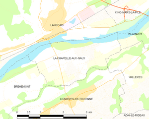
La Chapelle-aux-Naux
- commune in Indre-et-Loire, France
- Country:
- Postal Code: 37130
- Coordinates: 47° 19' 6" N, 0° 25' 39" E
- GPS tracks (wikiloc): [Link]
- Area: 5.25 sq km
- Population: 586
- Web site: [Link]


Bréhémont
- commune in Indre-et-Loire, France
- Country:
- Postal Code: 37130
- Coordinates: 47° 17' 42" N, 0° 21' 20" E
- GPS tracks (wikiloc): [Link]
- Area: 12.71 sq km
- Population: 776

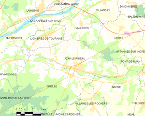
Azay-le-Rideau
- commune in Indre-et-Loire, France
- Country:
- Postal Code: 37190
- Coordinates: 47° 15' 41" N, 0° 27' 58" E
- GPS tracks (wikiloc): [Link]
- Area: 27.34 sq km
- Population: 3434
- Web site: [Link]


Vallères
- commune in Indre-et-Loire, France
- Country:
- Postal Code: 37190
- Coordinates: 47° 18' 42" N, 0° 28' 27" E
- GPS tracks (wikiloc): [Link]
- Area: 14.72 sq km
- Population: 1193
- Web site: [Link]