Bréhémont (Bréhémont)

- commune in Indre-et-Loire, France
- Country:

- Postal Code: 37130
- Coordinates: 47° 17' 42" N, 0° 21' 20" E


- GPS tracks (wikiloc): [Link]
- Area: 12.71 sq km
- Population: 776
- Wikipedia en: wiki(en)
- Wikipedia: wiki(fr)
- Wikidata storage: Wikidata: Q1138781
- Wikipedia Commons Category: [Link]
- Freebase ID: [/m/03nvd80]
- GeoNames ID: Alt: [6448658]
- SIREN number: [213700388]
- VIAF ID: Alt: [243120661]
- INSEE municipality code: 37038
Shares border with regions:

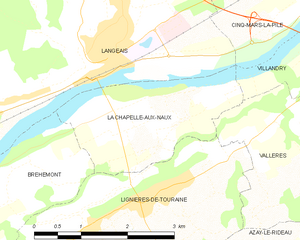
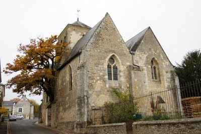
La Chapelle-aux-Naux
- commune in Indre-et-Loire, France
- Country:
- Postal Code: 37130
- Coordinates: 47° 19' 6" N, 0° 25' 39" E
- GPS tracks (wikiloc): [Link]
- Area: 5.25 sq km
- Population: 586
- Web site: [Link]

Cheillé
- commune in Indre-et-Loire, France
- Country:
- Postal Code: 37190
- Coordinates: 47° 15' 16" N, 0° 27' 41" E
- GPS tracks (wikiloc): [Link]
- Area: 46.26 sq km
- Population: 1800
- Web site: [Link]


Rigny-Ussé
- commune in Indre-et-Loire, France
- Country:
- Postal Code: 37420
- Coordinates: 47° 15' 8" N, 0° 17' 57" E
- GPS tracks (wikiloc): [Link]
- Area: 13.97 sq km
- Population: 494
- Web site: [Link]


Lignières-de-Touraine
- commune in Indre-et-Loire, France
- Country:
- Postal Code: 37130
- Coordinates: 47° 17' 50" N, 0° 25' 1" E
- GPS tracks (wikiloc): [Link]
- Area: 10 sq km
- Population: 1293
- Web site: [Link]

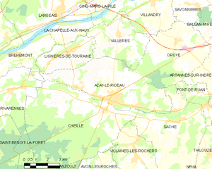
Azay-le-Rideau
- commune in Indre-et-Loire, France
- Country:
- Postal Code: 37190
- Coordinates: 47° 15' 41" N, 0° 27' 58" E
- GPS tracks (wikiloc): [Link]
- Area: 27.34 sq km
- Population: 3434
- Web site: [Link]


Langeais
- former commune in Indre-et-Loire, France
- Country:
- Postal Code: 37130
- Coordinates: 47° 19' 32" N, 0° 24' 22" E
- GPS tracks (wikiloc): [Link]
- Area: 60.38 sq km
- Population: 4248
- Web site: [Link]


Saint-Michel-sur-Loire
- former commune in Indre-et-Loire, France
- Country:
- Postal Code: 37130
- Coordinates: 47° 18' 27" N, 0° 20' 57" E
- GPS tracks (wikiloc): [Link]
- Area: 17.51 sq km
- Population: 688

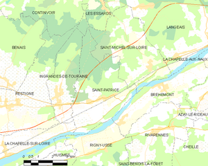
Saint-Patrice
- former commune in Indre-et-Loire, France
- Country:
- Postal Code: 37130
- Coordinates: 47° 17' 11" N, 0° 18' 24" E
- GPS tracks (wikiloc): [Link]
- Area: 17.18 sq km
- Population: 672

Rivarennes
- commune in Indre-et-Loire, France
- Country:
- Postal Code: 37190
- Coordinates: 47° 15' 59" N, 0° 21' 14" E
- GPS tracks (wikiloc): [Link]
- Area: 18.92 sq km
- Population: 1016