La Chapelle-aux-Naux (La Chapelle-aux-Naux)

- commune in Indre-et-Loire, France
- Country:

- Postal Code: 37130
- Coordinates: 47° 19' 6" N, 0° 25' 39" E


- GPS tracks (wikiloc): [Link]
- Area: 5.25 sq km
- Population: 586
- Web site: http://lachapelleauxnaux.com
- Wikipedia en: wiki(en)
- Wikipedia: wiki(fr)
- Wikidata storage: Wikidata: Q1097108
- Wikipedia Commons Category: [Link]
- Freebase ID: [/m/03nvdb2]
- GeoNames ID: Alt: [6456862]
- SIREN number: [213700560]
- BnF ID: [152576070]
- INSEE municipality code: 37056
Shares border with regions:
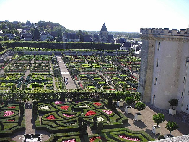

Villandry
- commune in Indre-et-Loire, France
- Country:
- Postal Code: 37510
- Coordinates: 47° 20' 22" N, 0° 30' 40" E
- GPS tracks (wikiloc): [Link]
- Area: 17.8 sq km
- Population: 1099
- Web site: [Link]


Bréhémont
- commune in Indre-et-Loire, France
- Country:
- Postal Code: 37130
- Coordinates: 47° 17' 42" N, 0° 21' 20" E
- GPS tracks (wikiloc): [Link]
- Area: 12.71 sq km
- Population: 776


Lignières-de-Touraine
- commune in Indre-et-Loire, France
- Country:
- Postal Code: 37130
- Coordinates: 47° 17' 50" N, 0° 25' 1" E
- GPS tracks (wikiloc): [Link]
- Area: 10 sq km
- Population: 1293
- Web site: [Link]


Langeais
- former commune in Indre-et-Loire, France
- Country:
- Postal Code: 37130
- Coordinates: 47° 19' 32" N, 0° 24' 22" E
- GPS tracks (wikiloc): [Link]
- Area: 60.38 sq km
- Population: 4248
- Web site: [Link]


Vallères
- commune in Indre-et-Loire, France
- Country:
- Postal Code: 37190
- Coordinates: 47° 18' 42" N, 0° 28' 27" E
- GPS tracks (wikiloc): [Link]
- Area: 14.72 sq km
- Population: 1193
- Web site: [Link]