Livigno (Livigno)
- Italian comune
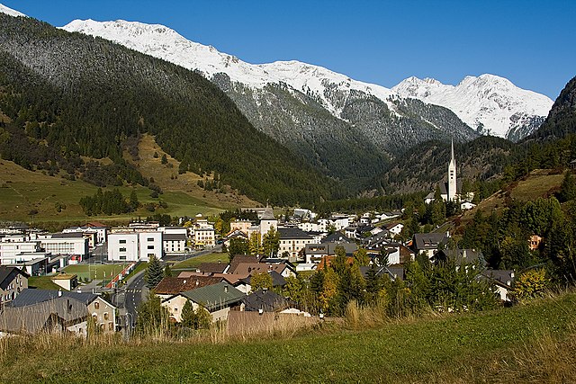
Livigno, located in the Italian Alps near the Swiss border, is a fantastic destination for hiking enthusiasts. This charming alpine resort is surrounded by stunning scenery, with lush valleys, high peaks, and pristine landscapes.
Hiking Trails
Livigno offers a variety of hiking trails suitable for different skill levels. Here are a few notable options:
-
Piz Mottolino: A popular trail that provides breathtaking views of Livigno and the surrounding mountains. The ascent can be challenging, but the panoramic views make it worthwhile.
-
Val Federia: This trail leads through picturesque meadows and offers a relatively easy hike. It's ideal for families and provides an opportunity to learn about local flora and fauna.
-
Miniere di Generoso: A historical hike that takes you to the historical mine areas, combined with beautiful views. This trail offers insight into the region's mining history.
-
Lago di Livigno: A scenic route around the lake which is perfect for a leisurely hike, often frequented by families and dogs.
-
Forcola Pass: A more challenging hike that rewards you with stunning alpine views and takes you towards the Swiss border.
Best Time to Hike
-
Summer (June to September): The best time for hiking in Livigno is during the summer months when weather conditions are generally stable, and the trails are fully accessible.
-
Autumn (Late September to October): For those who appreciate fewer crowds and stunning fall foliage, autumn can be a lovely time to hike.
Preparation Tips
- Gear: Wear proper hiking shoes and dress in layers to accommodate changing weather conditions. A waterproof jacket is also a good idea.
- Hydrate: Always carry enough water and snacks, as some trails may not have facilities.
- Maps and Guides: While many trails are well-marked, having a reliable map or GPS can enhance your hiking experience.
- Wildlife Awareness: Keep an eye out for local wildlife and always remember to respect their habitat.
Local Amenities
Livigno is not just about hiking; it offers various amenities including restaurants that serve local cuisine, shops for gear rental or purchase, and wellness facilities for post-hike relaxation.
Overall, Livigno is an excellent choice for hikers of all levels, providing breathtaking scenery, diverse trails, and a charming atmosphere to enjoy the grace of the Italian Alps.
- Country:

- Postal Code: 23030
- Local Dialing Code: 0342
- Licence Plate Code: SO
- Coordinates: 46° 32' 0" N, 10° 8' 0" E


- GPS tracks (wikiloc): [Link]
- AboveSeaLevel: 1816 м m
- Area: 227.3 sq km
- Population: 6550
- Web site: http://www.comune.livigno.so.it
- Wikipedia en: wiki(en)
- Wikipedia: wiki(it)
- Wikidata storage: Wikidata: Q40871
- Wikipedia Commons Gallery: [Link]
- Wikipedia Commons Category: [Link]
Shares border with regions:


Valdidentro
- Italian comune
Valdidentro is a beautiful valley located in the Lombardy region of northern Italy, within the larger Valtellina area. It's an excellent spot for hiking enthusiasts, offering a variety of trails that cater to different experience levels, stunning scenery, and opportunities to explore the rich natural and cultural heritage of the region....
- Country:

- Postal Code: 23038
- Local Dialing Code: 0342
- Licence Plate Code: SO
- Coordinates: 46° 29' 0" N, 10° 18' 0" E


- GPS tracks (wikiloc): [Link]
- AboveSeaLevel: 1345 м m
- Area: 226.73 sq km
- Population: 4131
- Web site: [Link]


Zernez
- municipality in Switzerland
Zernez is a beautiful village located in the Swiss National Park in the Engadin Valley, known for its stunning natural landscapes, diverse ecosystems, and a variety of hiking trails that cater to different skill levels. Here are some highlights and tips for hiking in Zernez:...
- Country:

- Postal Code: 7530
- Local Dialing Code: 081
- Licence Plate Code: GR
- Coordinates: 46° 41' 59" N, 10° 5' 59" E


- GPS tracks (wikiloc): [Link]
- AboveSeaLevel: 2216 м m
- Area: 344.04 sq km
- Population: 1532
- Web site: [Link]


S-chanf
- municipality in Switzerland
S-chanf, a picturesque village located in the Engadin Valley of Switzerland, offers a variety of hiking opportunities for outdoor enthusiasts of all skill levels. Here are some aspects to consider when hiking in this beautiful area:...
- Country:

- Postal Code: 7525
- Local Dialing Code: 081
- Licence Plate Code: GR
- Coordinates: 46° 36' 59" N, 9° 59' 0" E


- GPS tracks (wikiloc): [Link]
- AboveSeaLevel: 1878 м m
- Area: 138.03 sq km
- Population: 685
- Web site: [Link]


Zuoz
- municipality in Switzerland
Zuoz, a charming village in the Engadin Valley of Switzerland, offers stunning landscapes and a variety of hiking options for all skill levels. The area is renowned for its natural beauty, with majestic mountains, lush forests, and scenic meadows....
- Country:

- Postal Code: 7524
- Local Dialing Code: 081
- Licence Plate Code: GR
- Coordinates: 46° 36' 7" N, 9° 57' 35" E


- GPS tracks (wikiloc): [Link]
- AboveSeaLevel: 1718 м m
- Area: 65.79 sq km
- Population: 1207
- Web site: [Link]


Pontresina
- village in the Engadine valley, Graubünden, Switzerland
Pontresina is a picturesque mountain village located in the Engadin valley of Switzerland, known for its stunning landscapes, diverse hiking trails, and proximity to the Bernina Range. Here are some key points about hiking in Pontresina:...
- Country:

- Postal Code: 7504
- Local Dialing Code: 081
- Licence Plate Code: GR
- Coordinates: 46° 26' 28" N, 9° 57' 27" E


- GPS tracks (wikiloc): [Link]
- AboveSeaLevel: 2446 м m
- Area: 118.19 sq km
- Population: 2195
- Web site: [Link]


Poschiavo
- municipality in Switzerland
Poschiavo is a picturesque valley located in the eastern part of Switzerland, with stunning landscapes that make it an excellent destination for hiking enthusiasts. The valley is part of the canton of Graubünden and is known for its blend of Swiss and Italian cultures, reflected in its charming villages and local cuisine....
- Country:

- Postal Code: 7742; 7746; 7741; 7710; 7745
- Local Dialing Code: 081
- Licence Plate Code: GR
- Coordinates: 46° 20' 0" N, 10° 2' 59" E


- GPS tracks (wikiloc): [Link]
- AboveSeaLevel: 1014 м m
- Area: 191.01 sq km
- Population: 3516
- Web site: [Link]

