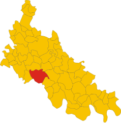
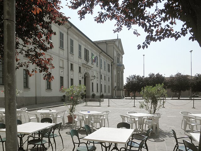
Livraga (Livraga)
- Italian comune
Livraga is a small town located in the Lombardy region of northern Italy. While it may not be well-known for extensive hiking trails, it can serve as a great starting point for exploring the surrounding countryside and nearby natural areas.
Hiking Opportunities Near Livraga:
-
Nearby Natural Parks:
- Parco Naturale Regionale dell'Adda Sud: A short drive from Livraga, this regional park features various trails along the Adda River. You can enjoy a mix of wooded areas, river views, and wildlife observation.
- Parco Agricolo Sud Milano: Located to the west of Livraga, this agricultural park offers scenic trails that wind through fields and small woodlands.
-
Local Trails:
- The area around Livraga may have local paths or trails that are suitable for leisurely walks or more challenging hikes. It’s a good idea to ask locals or check local hiking maps for lesser-known routes.
-
Cycling and Walking Paths:
- In addition to hiking, there are paths designed for cycling and walking, allowing you to explore the surroundings at a leisurely pace.
Tips for Hiking in Livraga Area:
- Check the Weather: The weather can change rapidly, so check forecasts before heading out.
- Bring Sufficient Supplies: Carry water, snacks, a first aid kit, and a map, especially if you’re venturing off marked paths.
- Dress Appropriately: Wear suitable hiking boots and clothing layered for comfort.
- Follow Local Guidelines: Be mindful of the environment and wildlife regulations in natural parks.
Conclusion:
While Livraga itself may not offer extensive hiking options, its proximity to beautiful natural parks makes it a great base for outdoor enthusiasts. Whether you prefer rigorous hikes or gentle walks, you should be able to find a suitable trail nearby. Always research trails in advance and consider visiting local tourist information centers for the most accurate and detailed guidance.
- Country:

- Postal Code: 26814
- Local Dialing Code: 0377
- Licence Plate Code: LO
- Coordinates: 45° 11' 36" N, 9° 32' 51" E


- GPS tracks (wikiloc): [Link]
- AboveSeaLevel: 67 м m
- Area: 12.37 sq km
- Population: 2538
- Web site: http://www.comune.livraga.lo.it
- Wikipedia en: wiki(en)
- Wikipedia: wiki(it)
- Wikidata storage: Wikidata: Q42366
- Wikipedia Commons Category: [Link]
- Freebase ID: [/m/0gr5pz]
- GeoNames ID: Alt: [6543686]
- OSM relation ID: [44388]
- UN/LOCODE: [ITLVV]
- ISTAT ID: 098030
- Italian cadastre code: E627
Shares border with regions:


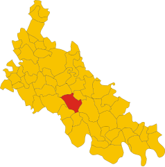
Ospedaletto Lodigiano
- Italian comune
 Hiking in Ospedaletto Lodigiano
Ospedaletto Lodigiano, located in the Lombardy region of Italy, offers a mix of scenic countryside and historical charm, making it a pleasant destination for hiking enthusiasts. While this area may not be as widely recognized for hiking as some of Italy’s mountainous regions, it can still offer enjoyable walking routes and beautiful landscapes....
- Country:

- Postal Code: 26864
- Local Dialing Code: 0377
- Licence Plate Code: LO
- Coordinates: 45° 10' 11" N, 9° 34' 47" E


- GPS tracks (wikiloc): [Link]
- AboveSeaLevel: 64 м m
- Area: 8.5 sq km
- Population: 1989
- Web site: [Link]


Borghetto Lodigiano
- Italian comune
Borghetto Lodigiano, located in the Lombardy region of Italy, is a charming small town that offers a unique blend of rural landscapes and historical sights, making it a pleasant destination for hiking enthusiasts....
- Country:

- Postal Code: 26812
- Local Dialing Code: 0371
- Licence Plate Code: LO
- Coordinates: 45° 12' 57" N, 9° 30' 1" E


- GPS tracks (wikiloc): [Link]
- AboveSeaLevel: 68 м m
- Area: 23.64 sq km
- Population: 4302
- Web site: [Link]


Brembio
- Italian comune
Brembio is a small town located in the Lombardy region of Italy, not far from the larger cities of Lodi and Milan. While it may not be as renowned for hiking as some of the more mountainous areas in Italy, there are still opportunities for enjoying outdoor activities and exploring the surrounding countryside....
- Country:

- Postal Code: 26822
- Local Dialing Code: 0377
- Licence Plate Code: LO
- Coordinates: 45° 12' 56" N, 9° 34' 21" E


- GPS tracks (wikiloc): [Link]
- AboveSeaLevel: 67 м m
- Area: 17.08 sq km
- Population: 2696
- Web site: [Link]


San Colombano al Lambro
- Italian comune
 Hiking in San Colombano al Lambro
San Colombano al Lambro is a charming town located in the Lombardy region of northern Italy, surrounded by beautiful natural landscapes, rolling hills, and vineyards. While it may not be as well-known as some larger national parks or famous hiking areas, it offers a variety of trails that are great for hiking enthusiasts looking to explore the Italian countryside....
- Country:

- Postal Code: 20078
- Local Dialing Code: 0371
- Licence Plate Code: MI
- Coordinates: 45° 11' 0" N, 9° 29' 0" E


- GPS tracks (wikiloc): [Link]
- AboveSeaLevel: 80 м m
- Area: 16.55 sq km
- Population: 7336
- Web site: [Link]


Orio Litta
- Italian comune
Orio Litta is a charming town located in the Lombardy region of Italy, nestled in the Province of Lodi. While it may not be as widely known for hiking compared to other areas in Italy, it offers several opportunities for outdoor exploration, particularly for those who enjoy peaceful rural landscapes....
- Country:

- Postal Code: 26863
- Local Dialing Code: 0377
- Licence Plate Code: LO
- Coordinates: 45° 9' 39" N, 9° 33' 20" E


- GPS tracks (wikiloc): [Link]
- AboveSeaLevel: 63 м m
- Area: 9.78 sq km
- Population: 2056
- Web site: [Link]
