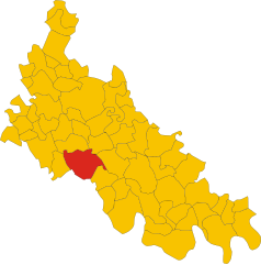
San Colombano al Lambro (San Colombano al Lambro)
.svg)
- Italian comune
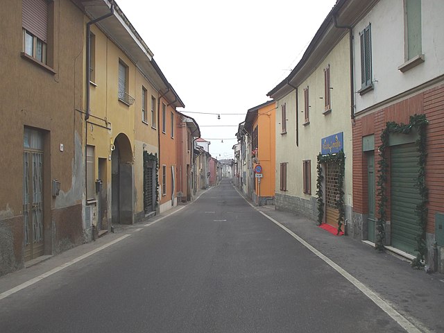
 Hiking in San Colombano al Lambro
San Colombano al Lambro is a charming town located in the Lombardy region of northern Italy, surrounded by beautiful natural landscapes, rolling hills, and vineyards. While it may not be as well-known as some larger national parks or famous hiking areas, it offers a variety of trails that are great for hiking enthusiasts looking to explore the Italian countryside.
Hiking Opportunities:
-
Scenic Trails: The area around San Colombano al Lambro has several scenic paths that wind through vineyards, orchards, and wooded areas. These trails often provide stunning views of the surrounding landscape, particularly during the autumn when the foliage changes color.
-
Local Parks and Reserves: There are nature reserves and parks nearby where you can enjoy hiking. Look for trails in the Parco Agricolo Sud Milano or the surrounding natural areas, which offer diverse ecosystems and wildlife spotting opportunities.
-
Historical Routes: Some trails may lead to historical landmarks or old churches, giving you a taste of the local culture and history while you hike. Exploring these paths can be a memorable experience that combines physical activity with cultural enrichment.
-
Municipality Organized Events: Keep an eye out for any organized hiking events or guided tours that the local municipality might offer. These can provide insight into local flora and fauna or the history of the area.
Tips for Hiking in San Colombano al Lambro:
- Gear Up: Wear comfortable hiking shoes, dress in layers suitable for the weather, and bring plenty of water and snacks.
- Trail Maps: It’s wise to have a map or a reliable hiking app with you to ensure you stay on the right path.
- Local Knowledge: Knowing a bit about the flora and fauna can enrich your hiking experience. Look for resources or locals who can share information about the area.
- Respect Nature: Always follow the principles of Leave No Trace to protect the beautiful landscapes you encounter.
Conclusion:
San Colombano al Lambro offers a peaceful and picturesque hiking experience in a less touristy part of Italy. Whether you're looking for a leisurely stroll among the vineyards or a more challenging hike through varied terrain, you'll find that the natural beauty and tranquility of the area make it a lovely destination for hikers.
- Country:

- Postal Code: 20078
- Local Dialing Code: 0371
- Licence Plate Code: MI
- Coordinates: 45° 11' 0" N, 9° 29' 0" E


- GPS tracks (wikiloc): [Link]
- AboveSeaLevel: 80 м m
- Area: 16.55 sq km
- Population: 7336
- Web site: http://www.comune.sancolombanoallambro.mi.it
- Wikipedia en: wiki(en)
- Wikipedia: wiki(it)
- Wikidata storage: Wikidata: Q42404
- Wikipedia Commons Category: [Link]
- Freebase ID: [/m/0gj7cf]
- GeoNames ID: Alt: [6537130]
- VIAF ID: Alt: [235248667]
- OSM relation ID: [44363]
- MusicBrainz area ID: [197f36a4-6129-479e-8d36-240ad067369c]
- WOEID: [12681597]
- UN/LOCODE: [ITQLM]
- ISTAT ID: 015191
- Italian cadastre code: H803
Shares border with regions:

Miradolo Terme
- Italian comune
Hiking in Miradolo Terme
Miradolo Terme is a charming village located in the Lombardy region of Italy, known for its scenic landscapes and outdoor activities, including hiking. The area around Miradolo Terme offers a variety of trails that cater to different skill levels, making it suitable for both beginners and experienced hikers....
- Country:
- Postal Code: 27010
- Local Dialing Code: 0382
- Licence Plate Code: PV
- Coordinates: 45° 9' 0" N, 9° 29' 0" E
- GPS tracks (wikiloc): [Link]
- AboveSeaLevel: 72 м m
- Area: 9.56 sq km
- Population: 3714
- Web site: [Link]


Chignolo Po
- Italian comune
Hiking in Chignolo Po
Chignolo Po is a small town located in the Lombardy region of Italy, known more for its agricultural landscape than for traditional hiking trails. However, its proximity to larger regions with hiking opportunities makes it a good starting point for exploring the beautiful Italian countryside....
- Country:
- Postal Code: 27013
- Local Dialing Code: 0382
- Licence Plate Code: PV
- Coordinates: 45° 9' 0" N, 9° 29' 0" E
- GPS tracks (wikiloc): [Link]
- AboveSeaLevel: 88 м m
- Area: 23.39 sq km
- Population: 3982
- Web site: [Link]


Livraga
- Italian comune
Hiking in Livraga
Livraga is a small town located in the Lombardy region of northern Italy. While it may not be well-known for extensive hiking trails, it can serve as a great starting point for exploring the surrounding countryside and nearby natural areas....
- Country:
- Postal Code: 26814
- Local Dialing Code: 0377
- Licence Plate Code: LO
- Coordinates: 45° 11' 36" N, 9° 32' 51" E
- GPS tracks (wikiloc): [Link]
- AboveSeaLevel: 67 м m
- Area: 12.37 sq km
- Population: 2538
- Web site: [Link]

Borghetto Lodigiano
- Italian comune
Hiking in Borghetto Lodigiano
Borghetto Lodigiano, located in the Lombardy region of Italy, is a charming small town that offers a unique blend of rural landscapes and historical sights, making it a pleasant destination for hiking enthusiasts....
- Country:
- Postal Code: 26812
- Local Dialing Code: 0371
- Licence Plate Code: LO
- Coordinates: 45° 12' 57" N, 9° 30' 1" E
- GPS tracks (wikiloc): [Link]
- AboveSeaLevel: 68 м m
- Area: 23.64 sq km
- Population: 4302
- Web site: [Link]


Orio Litta
- Italian comune
Hiking in Orio Litta
Orio Litta is a charming town located in the Lombardy region of Italy, nestled in the Province of Lodi. While it may not be as widely known for hiking compared to other areas in Italy, it offers several opportunities for outdoor exploration, particularly for those who enjoy peaceful rural landscapes....
- Country:
- Postal Code: 26863
- Local Dialing Code: 0377
- Licence Plate Code: LO
- Coordinates: 45° 9' 39" N, 9° 33' 20" E
- GPS tracks (wikiloc): [Link]
- AboveSeaLevel: 63 м m
- Area: 9.78 sq km
- Population: 2056
- Web site: [Link]

Graffignana
- Italian comune
Hiking in Graffignana
Graffignana is a small town located in the Lombardy region of northern Italy. While it might not be as well-known for hiking as some other areas in Italy, there are still opportunities for outdoor enthusiasts to enjoy nature and engage in hiking activities in and around the town....
- Country:
- Postal Code: 26813
- Local Dialing Code: 0371
- Licence Plate Code: LO
- Coordinates: 45° 12' 27" N, 9° 27' 19" E
- GPS tracks (wikiloc): [Link]
- AboveSeaLevel: 67 м m
- Area: 10.92 sq km
- Population: 2612
- Web site: [Link]