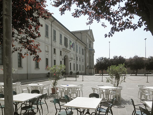
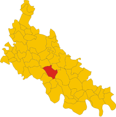
Borghetto Lodigiano (Borghetto Lodigiano)
.svg)
- Italian comune
 Hiking in Borghetto Lodigiano
Borghetto Lodigiano, located in the Lombardy region of Italy, is a charming small town that offers a unique blend of rural landscapes and historical sights, making it a pleasant destination for hiking enthusiasts.
Hiking Opportunities:
-
Surrounding Countryside: The area around Borghetto Lodigiano features beautiful countryside trails that wind through fields, vineyards, and along the banks of the River Adda. These paths often offer serene views and a chance to experience the local flora and fauna.
-
Parco Adda Sud: Located not too far from Borghetto, this park has several trails for hiking and nature walks. The park is home to diverse wildlife and offers scenic views of the Adda River, making it a great spot for both casual hikes and more structured outings.
-
Cultural Hikes: Combine your hiking experience with cultural exploration. Many trails pass near historical sites, allowing hikers to enjoy Italy's rich history. For example, you might encounter ancient churches and charming village architecture along your route.
Tips for Hiking in Borghetto Lodigiano:
- Season: The best times to hike are during the spring and fall when the weather is mild, and the landscape is vibrant with blooming flowers or rich autumn colors.
- Trail Maps: It’s advisable to carry a local trail map or use a reliable hiking app to navigate the trails, as signage can vary.
- Footwear: Wear sturdy hiking shoes, as some paths may be uneven or muddy, especially after rain.
- Hydration and Snacks: Carry enough water and snacks to keep your energy up while enjoying the beautiful scenery.
Local Attractions:
After a day of hiking, you might want to explore the local cuisine and enjoy traditional Lombard dishes in Borghetto Lodigiano or nearby towns. The area is known for its agricultural produce, and sampling local cheeses and wines could be a delightful end to your hiking adventure.
Overall, Borghetto Lodigiano may not be the most famous hiking destination in Italy, but it offers a charming and peaceful setting for those who appreciate nature and history.
- Country:

- Postal Code: 26812
- Local Dialing Code: 0371
- Licence Plate Code: LO
- Coordinates: 45° 12' 57" N, 9° 30' 1" E


- GPS tracks (wikiloc): [Link]
- AboveSeaLevel: 68 м m
- Area: 23.64 sq km
- Population: 4302
- Web site: http://www.comune.borghettodarroscia.im.it
- Wikipedia en: wiki(en)
- Wikipedia: wiki(it)
- Wikidata storage: Wikidata: Q42376
- Wikipedia Commons Category: [Link]
- Freebase ID: [/m/0gr525]
- GeoNames ID: Alt: [6539413]
- VIAF ID: Alt: [243904856]
- OSM relation ID: [44442]
- WOEID: [711166]
- UN/LOCODE: [ITBLO]
- ISTAT ID: 098004
- Italian cadastre code: A995
Shares border with regions:


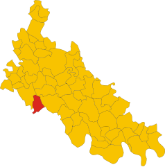
Villanova del Sillaro
- Italian comune
Hiking in Villanova del Sillaro
Villanova del Sillaro is a charming small village located in the Emilia-Romagna region of Italy. While it may not be as famed as some larger Italian hiking destinations, it offers an enchanting landscape for those looking to explore the Italian countryside....
- Country:
- Postal Code: 26818
- Local Dialing Code: 0371
- Licence Plate Code: LO
- Coordinates: 45° 14' 20" N, 9° 28' 58" E
- GPS tracks (wikiloc): [Link]
- AboveSeaLevel: 69 м m
- Area: 13.5 sq km
- Population: 1869
- Web site: [Link]


Ossago Lodigiano
- Italian comune
Hiking in Ossago Lodigiano
Ossago Lodigiano is a small town located in the Lombardy region of Italy, not far from the larger city of Lodi. The area is primarily characterized by its flat plains, agricultural landscapes, and the proximity to the Adda River, making it a serene and picturesque setting for hiking....
- Country:
- Postal Code: 26816
- Local Dialing Code: 0371
- Licence Plate Code: LO
- Coordinates: 45° 14' 48" N, 9° 32' 17" E
- GPS tracks (wikiloc): [Link]
- AboveSeaLevel: 71 м m
- Area: 11.53 sq km
- Population: 1416
- Web site: [Link]


Livraga
- Italian comune
Hiking in Livraga
Livraga is a small town located in the Lombardy region of northern Italy. While it may not be well-known for extensive hiking trails, it can serve as a great starting point for exploring the surrounding countryside and nearby natural areas....
- Country:
- Postal Code: 26814
- Local Dialing Code: 0377
- Licence Plate Code: LO
- Coordinates: 45° 11' 36" N, 9° 32' 51" E
- GPS tracks (wikiloc): [Link]
- AboveSeaLevel: 67 м m
- Area: 12.37 sq km
- Population: 2538
- Web site: [Link]
Brembio
- Italian comune
Hiking in Brembio
Brembio is a small town located in the Lombardy region of Italy, not far from the larger cities of Lodi and Milan. While it may not be as renowned for hiking as some of the more mountainous areas in Italy, there are still opportunities for enjoying outdoor activities and exploring the surrounding countryside....
- Country:
- Postal Code: 26822
- Local Dialing Code: 0377
- Licence Plate Code: LO
- Coordinates: 45° 12' 56" N, 9° 34' 21" E
- GPS tracks (wikiloc): [Link]
- AboveSeaLevel: 67 м m
- Area: 17.08 sq km
- Population: 2696
- Web site: [Link]


San Colombano al Lambro
- Italian comune
Hiking in San Colombano al Lambro
San Colombano al Lambro is a charming town located in the Lombardy region of northern Italy, surrounded by beautiful natural landscapes, rolling hills, and vineyards. While it may not be as well-known as some larger national parks or famous hiking areas, it offers a variety of trails that are great for hiking enthusiasts looking to explore the Italian countryside....
- Country:
- Postal Code: 20078
- Local Dialing Code: 0371
- Licence Plate Code: MI
- Coordinates: 45° 11' 0" N, 9° 29' 0" E
- GPS tracks (wikiloc): [Link]
- AboveSeaLevel: 80 м m
- Area: 16.55 sq km
- Population: 7336
- Web site: [Link]

Graffignana
- Italian comune
Hiking in Graffignana
Graffignana is a small town located in the Lombardy region of northern Italy. While it might not be as well-known for hiking as some other areas in Italy, there are still opportunities for outdoor enthusiasts to enjoy nature and engage in hiking activities in and around the town....
- Country:
- Postal Code: 26813
- Local Dialing Code: 0371
- Licence Plate Code: LO
- Coordinates: 45° 12' 27" N, 9° 27' 19" E
- GPS tracks (wikiloc): [Link]
- AboveSeaLevel: 67 м m
- Area: 10.92 sq km
- Population: 2612
- Web site: [Link]