Loreux (Loreux)

- commune in Loir-et-Cher, France
- Country:

- Postal Code: 41200
- Coordinates: 47° 23' 56" N, 1° 49' 51" E


- GPS tracks (wikiloc): [Link]
- Area: 29.95 sq km
- Population: 224
- Wikipedia en: wiki(en)
- Wikipedia: wiki(fr)
- Wikidata storage: Wikidata: Q1382486
- Wikipedia Commons Category: [Link]
- Freebase ID: [/m/03nw0cn]
- GeoNames ID: Alt: [2997588]
- SIREN number: [214101180]
- BnF ID: [15259392q]
- INSEE municipality code: 41118
Shares border with regions:


Selles-Saint-Denis
- commune in Loir-et-Cher, France
- Country:
- Postal Code: 41300
- Coordinates: 47° 23' 9" N, 1° 55' 21" E
- GPS tracks (wikiloc): [Link]
- Area: 50.98 sq km
- Population: 1316
- Web site: [Link]


Marcilly-en-Gault
- commune in Loir-et-Cher, France
- Country:
- Postal Code: 41210
- Coordinates: 47° 27' 55" N, 1° 52' 25" E
- GPS tracks (wikiloc): [Link]
- Area: 50.31 sq km
- Population: 751

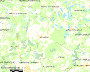
Millançay
- commune in Loir-et-Cher, France
- Country:
- Postal Code: 41200
- Coordinates: 47° 26' 49" N, 1° 46' 22" E
- GPS tracks (wikiloc): [Link]
- Area: 57.94 sq km
- Population: 771

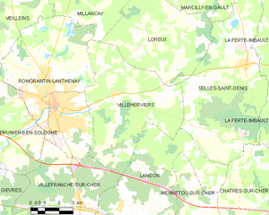
Villeherviers
- commune in Loir-et-Cher, France
- Country:
- Postal Code: 41200
- Coordinates: 47° 21' 58" N, 1° 47' 53" E
- GPS tracks (wikiloc): [Link]
- Area: 38.9 sq km
- Population: 477