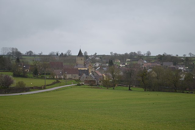
Lurcy-le-Bourg (Lurcy-le-Bourg)

- commune in Nièvre, France
- Country:

- Postal Code: 58700
- Coordinates: 47° 9' 40" N, 3° 23' 12" E


- GPS tracks (wikiloc): [Link]
- Area: 22.58 sq km
- Population: 300
- Wikipedia en: wiki(en)
- Wikipedia: wiki(fr)
- Wikidata storage: Wikidata: Q746615
- Wikipedia Commons Category: [Link]
- Freebase ID: [/m/03qfd8d]
- GeoNames ID: Alt: [6438003]
- SIREN number: [215801473]
- BnF ID: [152664120]
- PACTOLS thesaurus ID: [pcrt7zbSQMXolY]
- INSEE municipality code: 58147
Shares border with regions:
Saint-Franchy
- commune in Nièvre, France
- Country:
- Postal Code: 58330
- Coordinates: 47° 8' 22" N, 3° 27' 40" E
- GPS tracks (wikiloc): [Link]
- Area: 18.63 sq km
- Population: 74


Prémery
- commune in Nièvre, France
- Country:
- Postal Code: 58700
- Coordinates: 47° 10' 28" N, 3° 19' 51" E
- GPS tracks (wikiloc): [Link]
- Area: 45.62 sq km
- Population: 1868


Saint-Benin-des-Bois
- commune in Nièvre, France
- Country:
- Postal Code: 58330
- Coordinates: 47° 7' 21" N, 3° 24' 34" E
- GPS tracks (wikiloc): [Link]
- Area: 19.4 sq km
- Population: 170

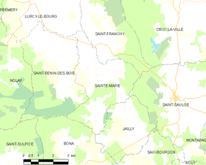
Sainte-Marie
- commune in Nièvre, France
- Country:
- Postal Code: 58330
- Coordinates: 47° 7' 4" N, 3° 26' 15" E
- GPS tracks (wikiloc): [Link]
- Area: 15.64 sq km
- Population: 84

Oulon
- commune in Nièvre, France
- Country:
- Postal Code: 58700
- Coordinates: 47° 11' 57" N, 3° 23' 53" E
- GPS tracks (wikiloc): [Link]
- Area: 10.99 sq km
- Population: 67


Nolay
- commune in Nièvre, France
- Country:
- Postal Code: 58700
- Coordinates: 47° 7' 15" N, 3° 19' 23" E
- GPS tracks (wikiloc): [Link]
- Area: 43.04 sq km
- Population: 366