Luzillé (Luzillé)

- commune in Indre-et-Loire, France
- Country:

- Postal Code: 37150
- Coordinates: 47° 15' 44" N, 1° 3' 37" E


- GPS tracks (wikiloc): [Link]
- Area: 40.68 sq km
- Population: 981
- Web site: http://www.luzille.fr
- Wikipedia en: wiki(en)
- Wikipedia: wiki(fr)
- Wikidata storage: Wikidata: Q1171920
- Wikipedia Commons Category: [Link]
- Freebase ID: [/m/03nvcf6]
- GeoNames ID: Alt: [6433046]
- SIREN number: [213701410]
- BnF ID: [152576922]
- VIAF ID: Alt: [248652486]
- Digital Atlas of the Roman Empire ID: [15848]
- INSEE municipality code: 37141
Shares border with regions:


Civray-de-Touraine
- commune in Indre-et-Loire, France
- Country:
- Postal Code: 37150
- Coordinates: 47° 19' 56" N, 1° 2' 55" E
- GPS tracks (wikiloc): [Link]
- Area: 22.88 sq km
- Population: 1845
- Web site: [Link]


Francueil
- commune in Indre-et-Loire, France
- Country:
- Postal Code: 37150
- Coordinates: 47° 18' 43" N, 1° 4' 58" E
- GPS tracks (wikiloc): [Link]
- Area: 12.91 sq km
- Population: 1363
- Web site: [Link]


Le Liège
- commune in Indre-et-Loire, France
- Country:
- Postal Code: 37460
- Coordinates: 47° 13' 43" N, 1° 6' 13" E
- GPS tracks (wikiloc): [Link]
- Area: 11.15 sq km
- Population: 362
- Web site: [Link]

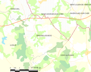
Épeigné-les-Bois
- commune in Indre-et-Loire, France
- Country:
- Postal Code: 37150
- Coordinates: 47° 16' 50" N, 1° 6' 39" E
- GPS tracks (wikiloc): [Link]
- Area: 14.52 sq km
- Population: 449
- Web site: [Link]


Sublaines
- commune in Indre-et-Loire, France
- Country:
- Postal Code: 37310
- Coordinates: 47° 15' 52" N, 0° 59' 28" E
- GPS tracks (wikiloc): [Link]
- Area: 14.44 sq km
- Population: 200


Bléré
- commune in Indre-et-Loire, France
- Country:
- Postal Code: 37150
- Coordinates: 47° 19' 31" N, 0° 59' 23" E
- GPS tracks (wikiloc): [Link]
- Area: 30.8 sq km
- Population: 5312
- Web site: [Link]


Saint-Quentin-sur-Indrois
- commune in Indre-et-Loire, France
- Country:
- Postal Code: 37310
- Coordinates: 47° 12' 13" N, 1° 1' 25" E
- GPS tracks (wikiloc): [Link]
- Area: 27.23 sq km
- Population: 511

Genillé
- commune in Indre-et-Loire, France
- Country:
- Postal Code: 37460
- Coordinates: 47° 11' 8" N, 1° 5' 43" E
- GPS tracks (wikiloc): [Link]
- Area: 63.12 sq km
- Population: 1534
- Web site: [Link]