canton of Bléré (canton de Bléré)

- canton of France
- Country:

- Capital: Bléré
- Coordinates: 47° 18' 29" N, 1° 0' 14" E


- GPS tracks (wikiloc): [Link]
- Population: 26246
- Wikipedia en: wiki(en)
- Wikipedia: wiki(fr)
- Wikidata storage: Wikidata: Q1276864
- VIAF ID: Alt: [143524312]
- Library of Congress authority ID: Alt: [nr97016955]
- INSEE canton code: [3703]
Includes regions:


Azay-sur-Cher
- commune in Indre-et-Loire, France
- Country:
- Postal Code: 37270
- Coordinates: 47° 20' 57" N, 0° 50' 46" E
- GPS tracks (wikiloc): [Link]
- Area: 22.85 sq km
- Population: 3040
- Web site: [Link]


La Croix-en-Touraine
- commune in Indre-et-Loire, France
- Country:
- Postal Code: 37150
- Coordinates: 47° 20' 12" N, 0° 59' 26" E
- GPS tracks (wikiloc): [Link]
- Area: 15.04 sq km
- Population: 2177

Courçay
- commune in Indre-et-Loire, France
- Country:
- Postal Code: 37310
- Coordinates: 47° 15' 2" N, 0° 52' 33" E
- GPS tracks (wikiloc): [Link]
- Area: 24.77 sq km
- Population: 814
- Web site: [Link]


Civray-de-Touraine
- commune in Indre-et-Loire, France
- Country:
- Postal Code: 37150
- Coordinates: 47° 19' 56" N, 1° 2' 55" E
- GPS tracks (wikiloc): [Link]
- Area: 22.88 sq km
- Population: 1845
- Web site: [Link]


Francueil
- commune in Indre-et-Loire, France
- Country:
- Postal Code: 37150
- Coordinates: 47° 18' 43" N, 1° 4' 58" E
- GPS tracks (wikiloc): [Link]
- Area: 12.91 sq km
- Population: 1363
- Web site: [Link]


Dierre
- commune in Indre-et-Loire, France
- Country:
- Postal Code: 37150
- Coordinates: 47° 20' 46" N, 0° 57' 9" E
- GPS tracks (wikiloc): [Link]
- Area: 10.27 sq km
- Population: 595
- Web site: [Link]


Athée-sur-Cher
- commune in Indre-et-Loire, France
- Country:
- Postal Code: 37270
- Coordinates: 47° 19' 15" N, 0° 54' 56" E
- GPS tracks (wikiloc): [Link]
- Area: 34.47 sq km
- Population: 2674
- Web site: [Link]


Céré-la-Ronde
- commune in Indre-et-Loire, France
- Country:
- Postal Code: 37460
- Coordinates: 47° 15' 38" N, 1° 11' 24" E
- GPS tracks (wikiloc): [Link]
- Area: 49.2 sq km
- Population: 450
- Web site: [Link]

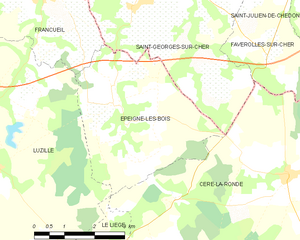
Épeigné-les-Bois
- commune in Indre-et-Loire, France
- Country:
- Postal Code: 37150
- Coordinates: 47° 16' 50" N, 1° 6' 39" E
- GPS tracks (wikiloc): [Link]
- Area: 14.52 sq km
- Population: 449
- Web site: [Link]


Sublaines
- commune in Indre-et-Loire, France
- Country:
- Postal Code: 37310
- Coordinates: 47° 15' 52" N, 0° 59' 28" E
- GPS tracks (wikiloc): [Link]
- Area: 14.44 sq km
- Population: 200


Luzillé
- commune in Indre-et-Loire, France
- Country:
- Postal Code: 37150
- Coordinates: 47° 15' 44" N, 1° 3' 37" E
- GPS tracks (wikiloc): [Link]
- Area: 40.68 sq km
- Population: 981
- Web site: [Link]


Saint-Martin-le-Beau
- commune in Indre-et-Loire, France
- Country:
- Postal Code: 37270
- Coordinates: 47° 21' 21" N, 0° 54' 35" E
- GPS tracks (wikiloc): [Link]
- Area: 18.44 sq km
- Population: 3165
- Web site: [Link]


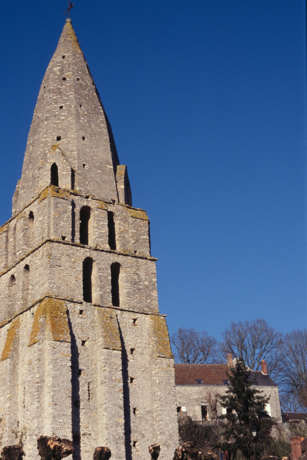
Bléré
- commune in Indre-et-Loire, France
- Country:
- Postal Code: 37150
- Coordinates: 47° 19' 31" N, 0° 59' 23" E
- GPS tracks (wikiloc): [Link]
- Area: 30.8 sq km
- Population: 5312
- Web site: [Link]
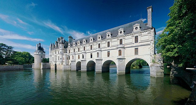

Chenonceaux
- commune in Indre-et-Loire, France
- Country:
- Postal Code: 37150
- Coordinates: 47° 19' 55" N, 1° 4' 6" E
- GPS tracks (wikiloc): [Link]
- Area: 4.33 sq km
- Population: 351


Chisseaux
- commune in Indre-et-Loire, France
- Country:
- Postal Code: 37150
- Coordinates: 47° 19' 52" N, 1° 5' 35" E
- GPS tracks (wikiloc): [Link]
- Area: 11.8 sq km
- Population: 626


Cigogné
- commune in Indre-et-Loire, France
- Country:
- Postal Code: 37310
- Coordinates: 47° 15' 35" N, 0° 55' 50" E
- GPS tracks (wikiloc): [Link]
- Area: 21.79 sq km
- Population: 434
- Web site: [Link]