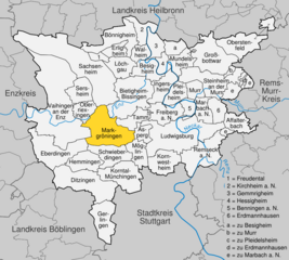
Möglingen (Möglingen)

- municipality in Germany
 Hiking in Möglingen
Möglingen, a small town in Germany, is surrounded by beautiful natural landscapes that provide great opportunities for hiking enthusiasts. While Möglingen itself is not as well-known as other hiking destinations, its proximity to larger natural reserves and connected pathways makes it an attractive spot for local hiking.
Hiking Trails and Nature
-
Surrounding Nature: The area around Möglingen features a mix of dense forests, rolling hills, and agricultural land. This diversity allows for various hiking experiences, from leisurely walks to more challenging hikes.
-
Local Parks and Green Spaces: Within the town, you can find parks and green areas that offer pleasant walking trails. For a more immersive nature experience, exploring nearby forests is recommended.
-
Paths and Connections: The town is connected to regional hiking networks, allowing hikers to access longer trails that can lead to nearby villages or natural reserves. Look for marked pathways that can guide you through scenic routes.
Planning Your Hike
-
Trail Maps: Check for local maps that detail the hiking trails in and around Möglingen. These can often be found at tourist information centers or online resources.
-
Weather Conditions: Always check the weather before heading out. The trails can become muddy or slippery after rain, so appropriate footwear is essential.
-
Hiking Groups: Consider joining local hiking clubs or groups. This can enhance your hiking experience and provide an opportunity to meet other hiking enthusiasts.
-
Safety Measures: Make sure to carry water, snacks, a basic first-aid kit, and a map or GPS device. It's also a good idea to inform someone about your hiking plans.
Additional Tips
-
Wildlife Watching: The region is home to a variety of wildlife, so keep an eye out for local fauna while hiking.
-
Photography: Bring a camera or smartphone to capture the beautiful landscapes, especially during sunrise or sunset.
-
Local Culture: After your hike, consider visiting local cafes or eateries to enjoy some traditional German cuisine and experience the local culture.
Hiking in Möglingen can be a delightful experience, allowing you to reconnect with nature while exploring the scenic beauty of southern Germany.
- Country:

- Postal Code: 71696
- Local Dialing Code: 07141
- Licence Plate Code: LB
- Coordinates: 48° 53' 15" N, 9° 7' 37" E


- GPS tracks (wikiloc): [Link]
- AboveSeaLevel: 297 м m
- Area: 9.93 sq km
- Population: 10983
- Web site: http://www.moeglingen.de
- Wikipedia en: wiki(en)
- Wikipedia: wiki(de)
- Wikidata storage: Wikidata: Q61738
- Wikipedia Commons Category: [Link]
- Freebase ID: [/m/0dz8yz]
- GeoNames ID: Alt: [2870194]
- VIAF ID: Alt: [240524126]
- OSM relation ID: [405810]
- GND ID: Alt: [4443914-3]
- archINFORM location ID: [169]
- Historical Gazetteer (GOV) ID: [MOGGENJN48NV]
- German municipality key: 08118051
Shares border with regions:

Markgröningen
- town in the district (Kreis) of Ludwigsburg, Baden-Württemberg, Germany
Hiking in Markgröningen
Markgröningen is a charming town in the state of Baden-Württemberg, Germany, located near Stuttgart. While it may not be as widely recognized for hiking as some of the larger natural parks in the region, it provides access to scenic trails and the beautiful Swabian countryside....
- Country:
- Postal Code: 71706
- Local Dialing Code: 07147; 07145
- Licence Plate Code: LB
- Coordinates: 48° 54' 17" N, 9° 4' 51" E
- GPS tracks (wikiloc): [Link]
- AboveSeaLevel: 281 м m
- Area: 28.16 sq km
- Population: 14555
- Web site: [Link]


Asperg
- municipality in Germany
Hiking in Asperg
Asperg, a small town located in the state of Baden-Württemberg, Germany, offers some delightful hiking opportunities, particularly due to its proximity to natural landscapes and historical sites. While the town itself may not have extensive hiking trails, it serves as a great starting point for exploring surrounding areas:...
- Country:
- Postal Code: 71679
- Local Dialing Code: 07141
- Licence Plate Code: LB
- Coordinates: 48° 54' 23" N, 9° 8' 29" E
- GPS tracks (wikiloc): [Link]
- AboveSeaLevel: 270 м m
- Area: 5.8 sq km
- Population: 13315
- Web site: [Link]