
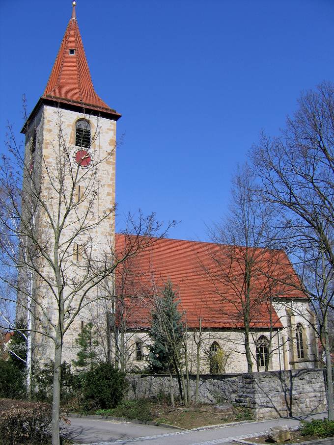
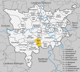
Markgröningen (Markgröningen)

- town in the district (Kreis) of Ludwigsburg, Baden-Württemberg, Germany
 Hiking in Markgröningen
Markgröningen is a charming town in the state of Baden-Württemberg, Germany, located near Stuttgart. While it may not be as widely recognized for hiking as some of the larger natural parks in the region, it provides access to scenic trails and the beautiful Swabian countryside.
Hiking Opportunities
-
Local Trails: Markgröningen has several local trails that wind through the surrounding fields, vineyards, and forests. These routes are typically well-marked and can vary in length, making them suitable for both casual walkers and more experienced hikers.
-
Rems-Murr Circuit: You can connect to the Rems-Murr hiking network, which offers a variety of routes that showcase the natural beauty of the area. This network includes sections along rivers, through forests, and across hills.
-
Vineyard Walks: The region is known for its wine production, and many trails take you through scenic vineyards. These walks provide not only beautiful views but also opportunities to learn about local wine culture.
-
Historical Trails: Some routes include historical elements, allowing hikers to explore sites of interest in and around Markgröningen, such as old churches, ruins, and traditional Swabian architecture.
Best Time to Hike
The best times for hiking in and around Markgröningen are during the spring and fall months (April to June and September to October), when the weather is usually mild and the landscapes are particularly stunning.
Tips for Hiking in Markgröningen
- Maps and Guides: Consider taking a local hiking map or guide, as it can enhance your experience and help you discover hidden gems in the area.
- Footwear: Good hiking shoes are important, especially if you plan to tackle more rugged terrain.
- Water and Snacks: Always carry enough water and some snacks, especially on longer hikes, as facilities may be limited on the trails.
- Weather Check: Keep an eye on the weather forecast before heading out, and be prepared for sudden changes, especially in transitional seasons.
Markgröningen may not be a hiking hotspot like the Black Forest, but it offers a peaceful and picturesque environment for walking enthusiasts. Happy hiking!
- Country:

- Postal Code: 71706
- Local Dialing Code: 07147; 07145
- Licence Plate Code: LB
- Coordinates: 48° 54' 17" N, 9° 4' 51" E


- GPS tracks (wikiloc): [Link]
- AboveSeaLevel: 281 м m
- Area: 28.16 sq km
- Population: 14555
- Web site: http://www.markgroeningen.de
- Wikipedia en: wiki(en)
- Wikipedia: wiki(de)
- Wikidata storage: Wikidata: Q13896
- Wikipedia Commons Gallery: [Link]
- Wikipedia Commons Category: [Link]
- Wikipedia Commons Maps Category: [Link]
- Freebase ID: [/m/0dpfwl]
- GeoNames ID: Alt: [2873369]
- VIAF ID: Alt: [125503832]
- OSM relation ID: [405841]
- GND ID: Alt: [4037601-1]
- archINFORM location ID: [13788]
- Library of Congress authority ID: Alt: [n81133742]
- MusicBrainz area ID: [4fd96ded-dd5b-4c26-a375-ec9ab7f4f1db]
- WOEID: [673991]
- German municipality key: 08118050
Shares border with regions:


Asperg
- municipality in Germany
Hiking in Asperg
Asperg, a small town located in the state of Baden-Württemberg, Germany, offers some delightful hiking opportunities, particularly due to its proximity to natural landscapes and historical sites. While the town itself may not have extensive hiking trails, it serves as a great starting point for exploring surrounding areas:...
- Country:
- Postal Code: 71679
- Local Dialing Code: 07141
- Licence Plate Code: LB
- Coordinates: 48° 54' 23" N, 9° 8' 29" E
- GPS tracks (wikiloc): [Link]
- AboveSeaLevel: 270 м m
- Area: 5.8 sq km
- Population: 13315
- Web site: [Link]


Oberriexingen
- municipality in Germany
Hiking in Oberriexingen
Oberriexingen, a small town in the state of Baden-Württemberg in Germany, offers a variety of hiking opportunities that cater to different skill levels and preferences. Nestled near the scenic landscapes of the Swabian Jura and surrounded by vineyards, forests, and charming countryside, it serves as a great starting point for hikers looking to explore the region....
- Country:
- Postal Code: 71739
- Local Dialing Code: 07042
- Licence Plate Code: LB
- Coordinates: 48° 55' 32" N, 9° 1' 41" E
- GPS tracks (wikiloc): [Link]
- AboveSeaLevel: 203 м m
- Area: 8.16 sq km
- Population: 3251
- Web site: [Link]


Tamm
- municipality in Germany
Hiking in Tamm
Tamm, located in the Baden-Württemberg region of Germany, offers various hiking opportunities that showcase the beautiful landscapes of the area. Here are some key points about hiking in Tamm:...
- Country:
- Postal Code: 71732
- Local Dialing Code: 07141
- Licence Plate Code: LB
- Coordinates: 48° 55' 18" N, 9° 7' 14" E
- GPS tracks (wikiloc): [Link]
- AboveSeaLevel: 259 м m
- Area: 8.78 sq km
- Population: 12605
- Web site: [Link]
Möglingen
- municipality in Germany
Hiking in Möglingen
Möglingen, a small town in Germany, is surrounded by beautiful natural landscapes that provide great opportunities for hiking enthusiasts. While Möglingen itself is not as well-known as other hiking destinations, its proximity to larger natural reserves and connected pathways makes it an attractive spot for local hiking....
- Country:
- Postal Code: 71696
- Local Dialing Code: 07141
- Licence Plate Code: LB
- Coordinates: 48° 53' 15" N, 9° 7' 37" E
- GPS tracks (wikiloc): [Link]
- AboveSeaLevel: 297 м m
- Area: 9.93 sq km
- Population: 10983
- Web site: [Link]

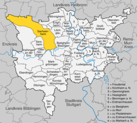
Sachsenheim
- municipality in Germany
Hiking in Sachsenheim
Sachsenheim, located in the state of Baden-Württemberg, Germany, offers some excellent opportunities for hiking enthusiasts. The region is characterized by picturesque landscapes, rolling hills, forests, and vineyards, making it a scenic destination for both casual walkers and serious hikers....
- Country:
- Postal Code: 74343
- Local Dialing Code: 07147; 07046
- Licence Plate Code: LB
- Coordinates: 48° 57' 36" N, 9° 3' 53" E
- GPS tracks (wikiloc): [Link]
- AboveSeaLevel: 246 м m
- Area: 57.92 sq km
- Population: 17861
- Web site: [Link]


Vaihingen an der Enz
- municipality in Germany
Hiking in Vaihingen an der Enz
Vaihingen an der Enz, located in the state of Baden-Württemberg, Germany, offers a charming blend of scenic hikes and historical sites. The landscape is characterized by rolling hills, vineyards, and beautiful forests, making it a delightful spot for hiking enthusiasts of all skill levels....
- Country:
- Postal Code: 71665
- Local Dialing Code: 07042
- Coordinates: 48° 55' 58" N, 8° 57' 23" E
- GPS tracks (wikiloc): [Link]
- AboveSeaLevel: 217 м m
- Area: 73.41 sq km
- Population: 29308
- Web site: [Link]


Schwieberdingen
- municipality in Germany
Hiking in Schwieberdingen
Schwieberdingen is a small town located in the Baden-Württemberg region of Germany, near Stuttgart. While it may not be as well-known for hiking as some of the larger national parks or mountainous areas, it offers some lovely options for outdoor enthusiasts....
- Country:
- Postal Code: 71701
- Local Dialing Code: 07150
- Licence Plate Code: LB
- Coordinates: 48° 52' 35" N, 9° 4' 28" E
- GPS tracks (wikiloc): [Link]
- AboveSeaLevel: 256 м m
- Area: 14.87 sq km
- Population: 11406
- Web site: [Link]


Bietigheim-Bissingen
- town in the district of Ludwigsburg, Baden-Württemberg, Germany
Hiking in Bietigheim-Bissingen
Bietigheim-Bissingen is a charming town located in Baden-Württemberg, Germany, offering a pleasant combination of natural beauty and historical significance. The area is surrounded by picturesque landscapes, including forests, vineyards, and rivers, making it a great destination for hiking enthusiasts....
- Country:
- Postal Code: 74321
- Local Dialing Code: 07147; 07142
- Licence Plate Code: LB
- Coordinates: 48° 58' 0" N, 9° 8' 0" E
- GPS tracks (wikiloc): [Link]
- AboveSeaLevel: 246 м m
- Area: 31.29 sq km
- Population: 42968
- Web site: [Link]