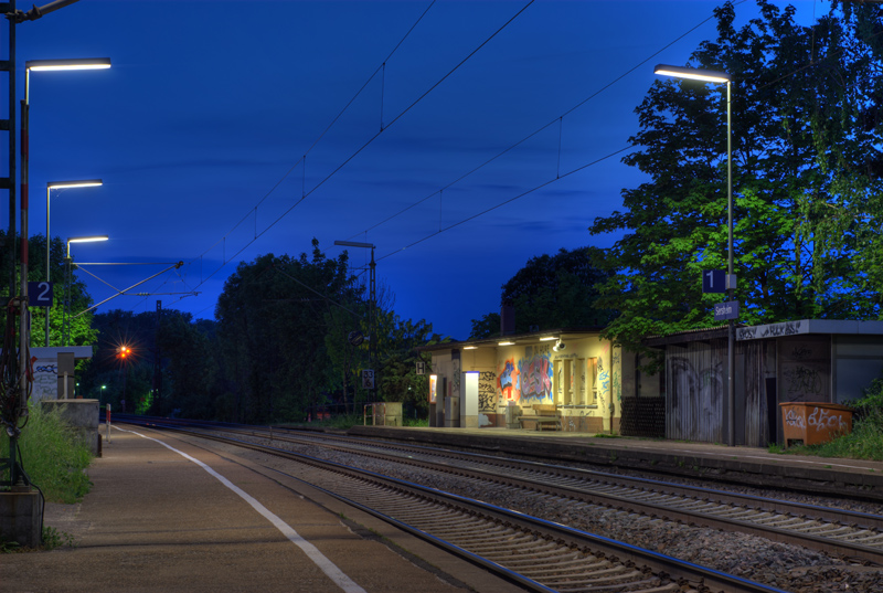
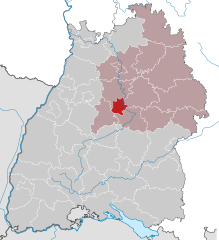
Ludwigsburg (Landkreis Ludwigsburg)

- district in Baden-Württemberg, Germany
 Hiking in Ludwigsburg
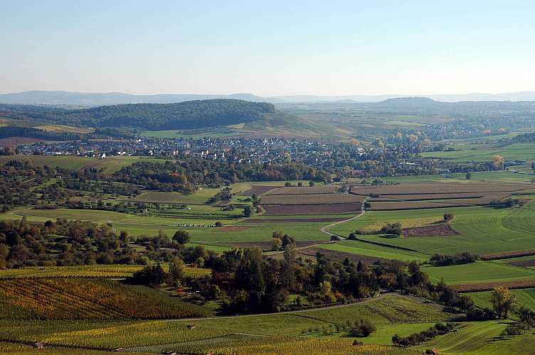
Ludwigsburg is a district located in the state of Baden-Württemberg, Germany, and is known for its picturesque landscapes and rich cultural heritage. While the area itself may not be as prominent as some of the larger mountain ranges in Germany, it offers several beautiful hiking opportunities that cater to different skill levels.
Hiking Opportunities in Ludwigsburg:
-
Favorite Trails:
- Park of Ludwigsburg Palace: A lovely starting point, where you can enjoy the magnificent gardens and then venture into nearby trails.
- The Surrounding Countryside: You can find numerous trails around the surrounding fields, vineyards, and forests, particularly the Elingen and the areas near the Neckar River.
-
Nature Reserves:
- The area is home to several nature reserves where you can explore diverse ecosystems.
-
Nearby Hiking Areas:
- Swabian Jura: Not too far from Ludwigsburg, this mountain range offers more advanced hiking opportunities with trails that provide stunning views and unique geological formations.
- North and South of Ludwigsburg: The regions closer to the local forests and hills provide nice trails for day hikes, ideal for families and beginners.
-
Hiking Clubs:
- Ludwigsburg has several local hiking clubs and organizations that organize group hikes, nature walks, and educational excursions. Engaging with these groups can provide a richer experience and local knowledge.
-
Seasonal Considerations:
- Spring and autumn are particularly beautiful times to hike in the district, with blooming flowers and vibrant foliage. Be mindful of the weather, especially in winter when trails may be icy.
-
Amenities and Accessibility:
- The district is easily accessible via public transport, and you’ll find facilities such as parking areas, restrooms, and sometimes even refreshment stops along popular routes.
Tips for Hiking in Ludwigsburg:
- Preparation: Always check trail conditions and weather forecasts before setting out.
- Gear: Make sure you have appropriate footwear and clothing for hiking.
- Water and Snacks: Carry enough water and some snacks, especially for longer hikes.
- Navigation: While many trails are well-marked, having a map or downloaded trail app can be helpful.
- Respect Nature: Follow Leave No Trace principles to ensure that the trails remain beautiful for everyone.
Whether you're looking for a leisurely stroll or a more challenging hike, Ludwigsburg offers a charming backdrop for outdoor enthusiasts. Enjoy your adventure!
- Country:

- Capital: Ludwigsburg
- Licence Plate Code: LB
- Coordinates: 48° 54' 0" N, 9° 12' 0" E


- GPS tracks (wikiloc): [Link]
- AboveSeaLevel: 266 м m
- Area: 686.83 sq km
- Population: 534074
- Web site: http://www.landkreis-ludwigsburg.de/
- Wikipedia en: wiki(en)
- Wikipedia: wiki(de)
- Wikidata storage: Wikidata: Q8541
- Wikipedia Commons Category: [Link]
- Freebase ID: [/m/01k4gs]
- GeoNames ID: Alt: [3220752]
- VIAF ID: Alt: [157108542]
- OSM relation ID: [62536]
- GND ID: Alt: [4036470-7]
- archINFORM location ID: [2504]
- Library of Congress authority ID: Alt: [n80132194]
- TGN ID: [7077335]
- ISNI: Alt: [0000 0004 0565 5321]
- NUTS code: [DE115]
- Ringgold ID: [40192]
- German district key: 08118
Includes regions:

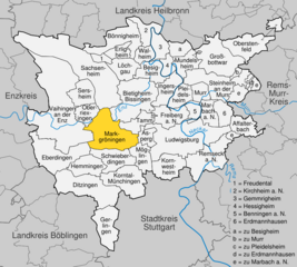
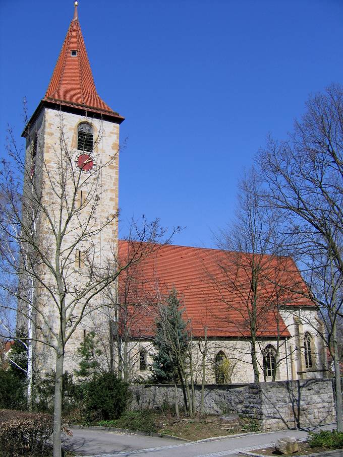
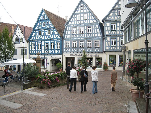
Markgröningen
- town in the district (Kreis) of Ludwigsburg, Baden-Württemberg, Germany
Hiking in Markgröningen
Markgröningen is a charming town in the state of Baden-Württemberg, Germany, located near Stuttgart. While it may not be as widely recognized for hiking as some of the larger natural parks in the region, it provides access to scenic trails and the beautiful Swabian countryside....
- Country:
- Postal Code: 71706
- Local Dialing Code: 07147; 07145
- Licence Plate Code: LB
- Coordinates: 48° 54' 17" N, 9° 4' 51" E
- GPS tracks (wikiloc): [Link]
- AboveSeaLevel: 281 м m
- Area: 28.16 sq km
- Population: 14555
- Web site: [Link]

Kornwestheim
- town in the district of Ludwigsburg, Baden-Württemberg, Germany
Hiking in Kornwestheim
Kornwestheim is a town located in the state of Baden-Württemberg, Germany, near Stuttgart. While it may not be as famous for its hiking opportunities as some other regions, there are still several options for enjoying the outdoors and exploring the scenic beauty of the area. Here’s a guide to hiking near Kornwestheim:...
- Country:
- Postal Code: 70806
- Local Dialing Code: 07154
- Licence Plate Code: LB
- Coordinates: 48° 51' 35" N, 9° 11' 6" E
- GPS tracks (wikiloc): [Link]
- AboveSeaLevel: 297 м m
- Area: 14.65 sq km
- Population: 32680
- Web site: [Link]


Asperg
- municipality in Germany
Hiking in Asperg
Asperg, a small town located in the state of Baden-Württemberg, Germany, offers some delightful hiking opportunities, particularly due to its proximity to natural landscapes and historical sites. While the town itself may not have extensive hiking trails, it serves as a great starting point for exploring surrounding areas:...
- Country:
- Postal Code: 71679
- Local Dialing Code: 07141
- Licence Plate Code: LB
- Coordinates: 48° 54' 23" N, 9° 8' 29" E
- GPS tracks (wikiloc): [Link]
- AboveSeaLevel: 270 м m
- Area: 5.8 sq km
- Population: 13315
- Web site: [Link]

Affalterbach
- municipality in Germany
Hiking in Affalterbach
Affalterbach, located in Baden-Württemberg, Germany, is a scenic area known for its beautiful landscapes and outdoor activities, including hiking. The region is characterized by rolling hills, forests, and picturesque vineyards, making it an ideal spot for both casual hikes and more adventurous excursions....
- Country:
- Postal Code: 71563
- Local Dialing Code: 07144
- Licence Plate Code: LB
- Coordinates: 48° 55' 22" N, 9° 19' 25" E
- GPS tracks (wikiloc): [Link]
- AboveSeaLevel: 312 м m
- Area: 10.15 sq km
- Population: 4456
- Web site: [Link]


Erdmannhausen
- municipality in Germany
Hiking in Erdmannhausen
Erdmannhausen is a quaint municipality located in the state of Baden-Württemberg, Germany. While it may not be as well-known as larger hiking destinations, it provides access to beautiful natural landscapes and picturesque surroundings suitable for outdoor activities, including hiking....
- Country:
- Postal Code: 71729
- Local Dialing Code: 07144
- Licence Plate Code: LB
- Coordinates: 48° 56' 0" N, 9° 18' 0" E
- GPS tracks (wikiloc): [Link]
- AboveSeaLevel: 283 м m
- Area: 8.71 sq km
- Population: 4808
- Web site: [Link]


Benningen am Neckar
- municipality in Germany
Hiking in Benningen am Neckar
Benningen am Neckar is a picturesque village located in the state of Baden-Württemberg, Germany, near the Neckar River. The area offers a charming mix of nature, history, and culture, making it an attractive spot for hiking and outdoor activities....
- Country:
- Postal Code: 71726
- Local Dialing Code: 07144
- Licence Plate Code: LB
- Coordinates: 48° 56' 42" N, 9° 14' 33" E
- GPS tracks (wikiloc): [Link]
- AboveSeaLevel: 210 м m
- Area: 4.87 sq km
- Population: 6030
- Web site: [Link]


Freudental
- town in Ludwigsburg district, Baden-Württemberg, Germany
Hiking in Freudental
Freudental is a small village in the Baden-Württemberg region of Germany, nestled within the scenic landscape of the Stromberg region and close to the Enz Valley. While it may not be as widely recognized as some of Germany's larger hiking destinations, it serves as a lovely base for exploring the surrounding countryside....
- Country:
- Postal Code: 74392
- Local Dialing Code: 07143
- Licence Plate Code: LB
- Coordinates: 49° 0' 35" N, 9° 3' 33" E
- GPS tracks (wikiloc): [Link]
- AboveSeaLevel: 293 м m
- Area: 3.07 sq km
- Population: 2453
- Web site: [Link]


Ditzingen
- municipality in Germany
Hiking in Ditzingen
Ditzingen, a town located in the state of Baden-Württemberg, Germany, offers several hiking opportunities that allow you to explore the beautiful natural surroundings and enjoy outdoor activities. While Ditzingen itself is a relatively small town, it is situated near the foothills of the Swabian Jura and is surrounded by picturesque landscapes, forests, and valleys....
- Country:
- Postal Code: 71254
- Local Dialing Code: 07152; 07156
- Licence Plate Code: LB
- Coordinates: 48° 49' 35" N, 9° 4' 0" E
- GPS tracks (wikiloc): [Link]
- AboveSeaLevel: 303 м m
- Area: 30.39 sq km
- Population: 24633
- Web site: [Link]

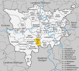
Korntal-Münchingen
- town in the District of Ludwigsburg, Baden-Württemberg, Germany
Hiking in Korntal-Münchingen
Korntal-Münchingen is a small town located in the state of Baden-Württemberg, Germany, near Stuttgart. While it may not be as famous as some of the larger hiking destinations in the region, it offers several opportunities for outdoor enthusiasts to enjoy nature and engage in hiking activities....
- Country:
- Postal Code: 70825
- Local Dialing Code: 07150; 0711
- Licence Plate Code: LB
- Coordinates: 48° 49' 50" N, 9° 7' 17" E
- GPS tracks (wikiloc): [Link]
- AboveSeaLevel: 304 м m
- Area: 20.71 sq km
- Population: 18701
- Web site: [Link]


Remseck am Neckar
- municipality in Germany
Hiking in Remseck am Neckar
Remseck am Neckar is a charming town located in the Baden-Württemberg region of Germany. It's situated along the Neckar River and is surrounded by picturesque landscapes that make it an appealing destination for hiking enthusiasts....
- Country:
- Postal Code: 71686
- Local Dialing Code: 07146
- Licence Plate Code: LB
- Coordinates: 48° 52' 8" N, 9° 16' 35" E
- GPS tracks (wikiloc): [Link]
- AboveSeaLevel: 212 м m
- Area: 22.82 sq km
- Population: 25759
- Web site: [Link]


Erligheim
- municipality in Germany
Hiking in Erligheim
Erligheim is a small town located in Baden-Württemberg, Germany, and while it may not be a prominent hiking destination compared to some more famous trails and national parks, there are still opportunities for hiking in and around the area....
- Country:
- Postal Code: 74391
- Local Dialing Code: 07143
- Licence Plate Code: LB
- Coordinates: 49° 1' 21" N, 9° 5' 50" E
- GPS tracks (wikiloc): [Link]
- AboveSeaLevel: 246 м m
- Area: 6.19 sq km
- Population: 2837
- Web site: [Link]


Oberriexingen
- municipality in Germany
Hiking in Oberriexingen
Oberriexingen, a small town in the state of Baden-Württemberg in Germany, offers a variety of hiking opportunities that cater to different skill levels and preferences. Nestled near the scenic landscapes of the Swabian Jura and surrounded by vineyards, forests, and charming countryside, it serves as a great starting point for hikers looking to explore the region....
- Country:
- Postal Code: 71739
- Local Dialing Code: 07042
- Licence Plate Code: LB
- Coordinates: 48° 55' 32" N, 9° 1' 41" E
- GPS tracks (wikiloc): [Link]
- AboveSeaLevel: 203 м m
- Area: 8.16 sq km
- Population: 3251
- Web site: [Link]


Ingersheim
- municipality in Germany
Hiking in Ingersheim
Ingersheim, located in the Baden-Württemberg region of Germany, offers a charming setting for hiking enthusiasts. While it may not be one of the most famous hiking destinations, its scenic landscape, proximity to vineyards, and natural beauty make it a pleasant spot for outdoor activities....
- Country:
- Postal Code: 74379
- Local Dialing Code: 07142
- Licence Plate Code: LB
- Coordinates: 48° 57' 40" N, 9° 10' 55" E
- GPS tracks (wikiloc): [Link]
- AboveSeaLevel: 210 м m
- Area: 11.55 sq km
- Population: 6193
- Web site: [Link]


Steinheim an der Murr
- municipality in Germany
Hiking in Steinheim an der Murr
Steinheim an der Murr, located in the Baden-Württemberg region of Germany, offers a variety of hiking opportunities that take advantage of its picturesque landscapes and natural beauty. The area is characterized by gentle hills, vineyards, and forests, making it suitable for both novice and experienced hikers....
- Country:
- Postal Code: 71711
- Local Dialing Code: 07144
- Licence Plate Code: LB
- Coordinates: 48° 58' 0" N, 9° 17' 0" E
- GPS tracks (wikiloc): [Link]
- AboveSeaLevel: 200 м m
- Area: 23.18 sq km
- Population: 12086
- Web site: [Link]

Sersheim
- municipality in Germany
Hiking in Sersheim
Sersheim is a small town located in the Baden-Württemberg region of Germany, known for its picturesque landscapes and scenic surroundings. While it may not be a widely known hiking destination, there are several opportunities for hiking nearby that showcase the natural beauty of the area....
- Country:
- Postal Code: 74372
- Local Dialing Code: 07042
- Licence Plate Code: LB
- Coordinates: 48° 58' 0" N, 9° 1' 0" E
- GPS tracks (wikiloc): [Link]
- AboveSeaLevel: 217 м m
- Area: 11.48 sq km
- Population: 5607
- Web site: [Link]


Tamm
- municipality in Germany
Hiking in Tamm
Tamm, located in the Baden-Württemberg region of Germany, offers various hiking opportunities that showcase the beautiful landscapes of the area. Here are some key points about hiking in Tamm:...
- Country:
- Postal Code: 71732
- Local Dialing Code: 07141
- Licence Plate Code: LB
- Coordinates: 48° 55' 18" N, 9° 7' 14" E
- GPS tracks (wikiloc): [Link]
- AboveSeaLevel: 259 м m
- Area: 8.78 sq km
- Population: 12605
- Web site: [Link]


Eberdingen
- municipality in Germany
Hiking in Eberdingen
Eberdingen is a picturesque village located in Baden-Württemberg, Germany, and is surrounded by beautiful countryside, making it an excellent destination for hiking enthusiasts. Here are some key points about hiking in Eberdingen:...
- Country:
- Postal Code: 71735
- Local Dialing Code: 07042
- Licence Plate Code: LB
- Coordinates: 48° 53' 0" N, 8° 58' 0" E
- GPS tracks (wikiloc): [Link]
- AboveSeaLevel: 305 м m
- Area: 26.21 sq km
- Population: 6667
- Web site: [Link]
Möglingen
- municipality in Germany
Hiking in Möglingen
Möglingen, a small town in Germany, is surrounded by beautiful natural landscapes that provide great opportunities for hiking enthusiasts. While Möglingen itself is not as well-known as other hiking destinations, its proximity to larger natural reserves and connected pathways makes it an attractive spot for local hiking....
- Country:
- Postal Code: 71696
- Local Dialing Code: 07141
- Licence Plate Code: LB
- Coordinates: 48° 53' 15" N, 9° 7' 37" E
- GPS tracks (wikiloc): [Link]
- AboveSeaLevel: 297 м m
- Area: 9.93 sq km
- Population: 10983
- Web site: [Link]


Oberstenfeld
- municipality in Germany
Hiking in Oberstenfeld
Oberstenfeld is a charming village located in the Rems-Murr district of Baden-Württemberg, Germany. It's surrounded by picturesque landscapes, making it an excellent destination for hiking enthusiasts. Here are some highlights to consider when hiking in Oberstenfeld:...
- Country:
- Postal Code: 71720
- Local Dialing Code: 07062
- Licence Plate Code: LB
- Coordinates: 49° 1' 26" N, 9° 19' 10" E
- GPS tracks (wikiloc): [Link]
- AboveSeaLevel: 246 м m
- Area: 21.1 sq km
- Population: 7877
- Web site: [Link]

Besigheim
- municipality in Germany
Hiking in Besigheim
Besigheim is a charming town located in the Baden-Württemberg region of Germany, known for its picturesque vineyards, beautiful landscapes, and scenic routes along the Neckar River. Hiking in and around Besigheim offers a variety of trails that cater to different skill levels, making it a great destination for both casual walkers and experienced hikers....
- Country:
- Postal Code: 74354
- Local Dialing Code: 07143
- Licence Plate Code: LB
- Coordinates: 48° 59' 56" N, 9° 8' 29" E
- GPS tracks (wikiloc): [Link]
- AboveSeaLevel: 202 м m
- Area: 16.83 sq km
- Population: 11951
- Web site: [Link]

Großbottwar
- municipality in Germany
Hiking in Großbottwar
Großbottwar is a charming town located in the Rems-Murr district of Baden-Württemberg, Germany. It's nestled in a picturesque landscape surrounded by vineyards, forests, and rolling hills, making it an excellent destination for hiking enthusiasts....
- Country:
- Postal Code: 71723
- Local Dialing Code: 07148
- Licence Plate Code: LB
- Coordinates: 49° 0' 5" N, 9° 17' 35" E
- GPS tracks (wikiloc): [Link]
- AboveSeaLevel: 215 м m
- Area: 25.51 sq km
- Population: 8253
- Web site: [Link]


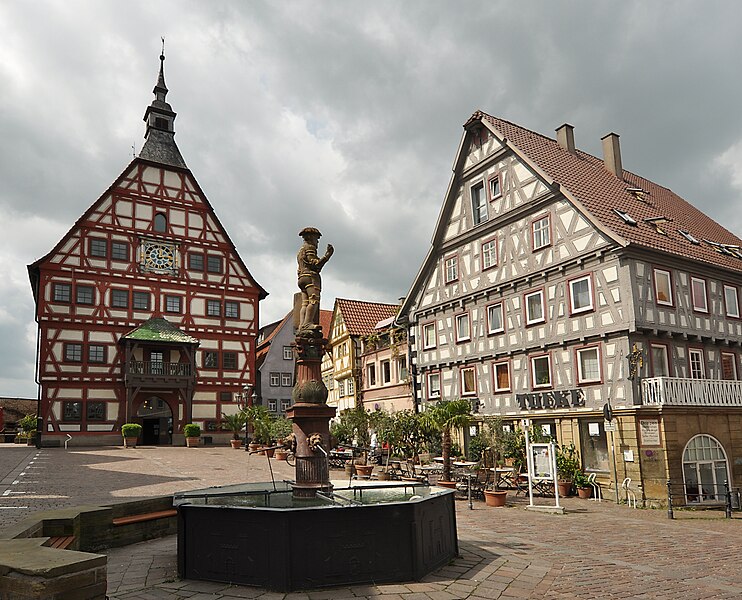
Bönnigheim
- municipality in Germany
Hiking in Bönnigheim
Bönnigheim is a charming town located in Baden-Württemberg, Germany, surrounded by picturesque landscapes that make it a wonderful destination for hiking enthusiasts. Here are some key aspects you might find interesting about hiking in Bönnigheim:...
- Country:
- Postal Code: 74357
- Local Dialing Code: 07143
- Licence Plate Code: LB
- Coordinates: 49° 2' 27" N, 9° 5' 42" E
- GPS tracks (wikiloc): [Link]
- AboveSeaLevel: 221 м m
- Area: 20.14 sq km
- Population: 7593
- Web site: [Link]


Freiberg am Neckar
- municipality in Germany
Hiking in Freiberg am Neckar
Freiberg am Neckar is a charming town located in the Baden-Württemberg region of Germany, not far from Stuttgart. It's surrounded by picturesque landscapes, making it an excellent destination for hiking enthusiasts. Here are some highlights of hiking in Freiberg am Neckar:...
- Country:
- Postal Code: 71691
- Local Dialing Code: 07141
- Licence Plate Code: LB
- Coordinates: 48° 56' 5" N, 9° 11' 30" E
- GPS tracks (wikiloc): [Link]
- AboveSeaLevel: 240 м m
- Area: 13.14 sq km
- Population: 15717
- Web site: [Link]


Gerlingen
- municipality in Germany
Hiking in Gerlingen
Gerlingen is a charming town located near Stuttgart, Germany, surrounded by beautiful natural landscapes. It offers several hiking opportunities that cater to different skill levels and preferences. Here are some highlights you can consider when hiking in and around Gerlingen:...
- Country:
- Postal Code: 70839
- Local Dialing Code: 07156
- Licence Plate Code: LB
- Coordinates: 48° 48' 0" N, 9° 3' 55" E
- GPS tracks (wikiloc): [Link]
- AboveSeaLevel: 336 м m
- Area: 17.01 sq km
- Population: 19151
- Web site: [Link]


Marbach am Neckar
- municipality in Germany
Hiking in Marbach am Neckar
Marbach am Neckar, located in the state of Baden-Württemberg in Germany, is a picturesque town known for its rich literary history as the birthplace of the playwright Friedrich Schiller. The area is surrounded by beautiful landscapes, making it a great destination for hiking enthusiasts....
- Country:
- Postal Code: 71672
- Local Dialing Code: 07144
- Licence Plate Code: LB
- Coordinates: 48° 56' 26" N, 9° 15' 27" E
- GPS tracks (wikiloc): [Link]
- AboveSeaLevel: 229 м m
- Area: 18.06 sq km
- Population: 15382
- Web site: [Link]

Sachsenheim
- municipality in Germany
Hiking in Sachsenheim
Sachsenheim, located in the state of Baden-Württemberg, Germany, offers some excellent opportunities for hiking enthusiasts. The region is characterized by picturesque landscapes, rolling hills, forests, and vineyards, making it a scenic destination for both casual walkers and serious hikers....
- Country:
- Postal Code: 74343
- Local Dialing Code: 07147; 07046
- Licence Plate Code: LB
- Coordinates: 48° 57' 36" N, 9° 3' 53" E
- GPS tracks (wikiloc): [Link]
- AboveSeaLevel: 246 м m
- Area: 57.92 sq km
- Population: 17861
- Web site: [Link]


Vaihingen an der Enz
- municipality in Germany
Hiking in Vaihingen an der Enz
Vaihingen an der Enz, located in the state of Baden-Württemberg, Germany, offers a charming blend of scenic hikes and historical sites. The landscape is characterized by rolling hills, vineyards, and beautiful forests, making it a delightful spot for hiking enthusiasts of all skill levels....
- Country:
- Postal Code: 71665
- Local Dialing Code: 07042
- Coordinates: 48° 55' 58" N, 8° 57' 23" E
- GPS tracks (wikiloc): [Link]
- AboveSeaLevel: 217 м m
- Area: 73.41 sq km
- Population: 29308
- Web site: [Link]


Schwieberdingen
- municipality in Germany
Hiking in Schwieberdingen
Schwieberdingen is a small town located in the Baden-Württemberg region of Germany, near Stuttgart. While it may not be as well-known for hiking as some of the larger national parks or mountainous areas, it offers some lovely options for outdoor enthusiasts....
- Country:
- Postal Code: 71701
- Local Dialing Code: 07150
- Licence Plate Code: LB
- Coordinates: 48° 52' 35" N, 9° 4' 28" E
- GPS tracks (wikiloc): [Link]
- AboveSeaLevel: 256 м m
- Area: 14.87 sq km
- Population: 11406
- Web site: [Link]


Hessigheim
- municipality in Germany
Hiking in Hessigheim
Hessigheim, located in the Baden-Württemberg region of Germany, is renowned for its scenic beauty and hiking opportunities. It's nestled along the Neckar River and is well known for its vineyards, rock formations, and beautiful landscapes. Here are some highlights and tips for hiking in Hessigheim:...
- Country:
- Postal Code: 74394
- Local Dialing Code: 07143
- Licence Plate Code: LB
- Coordinates: 48° 59' 39" N, 9° 11' 11" E
- GPS tracks (wikiloc): [Link]
- AboveSeaLevel: 204 м m
- Area: 5.03 sq km
- Population: 2347
- Web site: [Link]


Walheim
- municipality in Germany
Hiking in Walheim
Walheim is a picturesque area that offers some lovely hiking opportunities, particularly for those who enjoy the combination of nature and local culture. While specifics may vary depending on when you're planning to go, here are some general insights into hiking in and around Walheim:...
- Country:
- Postal Code: 74399
- Local Dialing Code: 07143
- Licence Plate Code: LB
- Coordinates: 49° 0' 42" N, 9° 9' 10" E
- GPS tracks (wikiloc): [Link]
- AboveSeaLevel: 192 м m
- Area: 6.14 sq km
- Population: 3264
- Web site: [Link]


Kirchheim am Neckar
- municipality in Germany
Hiking in Kirchheim am Neckar
Kirchheim am Neckar, located in Baden-Württemberg, Germany, offers a charming backdrop for hiking enthusiasts. The region is characterized by its picturesque landscapes, vineyards, and scenic views of the Neckar River, making it an attractive destination for outdoor activities....
- Country:
- Postal Code: 74366
- Local Dialing Code: 07143
- Licence Plate Code: LB
- Coordinates: 49° 2' 38" N, 9° 8' 47" E
- GPS tracks (wikiloc): [Link]
- AboveSeaLevel: 178 м m
- Area: 8.53 sq km
- Population: 5436
- Web site: [Link]


Gemmrigheim
- municipality in Germany
Hiking in Gemmrigheim
Gemmrigheim, located in the German state of Baden-Württemberg, is surrounded by picturesque landscapes, making it a charming destination for hiking enthusiasts. The area is characterized by its vineyards, rolling hills, and the scenic views of the Neckar River valley....
- Country:
- Postal Code: 74376
- Local Dialing Code: 07143
- Licence Plate Code: LB
- Coordinates: 49° 1' 42" N, 9° 9' 20" E
- GPS tracks (wikiloc): [Link]
- AboveSeaLevel: 190 м m
- Area: 8.23 sq km
- Population: 4124
- Web site: [Link]


Löchgau
- municipality in Germany
Hiking in Löchgau
Löchgau is a picturesque village located in the Baden-Württemberg region of Germany, not far from the cities of Heilbronn and Ludwigsburg. While it may not be as well-known for hiking as some of its more mountainous counterparts, Löchgau and its surrounding areas offer some lovely trails and scenic routes for those looking to enjoy nature....
- Country:
- Postal Code: 74369
- Local Dialing Code: 07143
- Licence Plate Code: LB
- Coordinates: 49° 0' 13" N, 9° 6' 23" E
- GPS tracks (wikiloc): [Link]
- AboveSeaLevel: 260 м m
- Area: 10.95 sq km
- Population: 5520
- Web site: [Link]

Hemmingen
- town in Baden-Württemberg, Germany
Hiking in Hemmingen
Hemmingen, located in the state of Baden-Württemberg in Germany, is a charming small town with a variety of hiking opportunities in the surrounding area. The region is characterized by picturesque landscapes, including lush forests, rolling hills, and scenic views....
- Country:
- Postal Code: 71282
- Local Dialing Code: 07150
- Licence Plate Code: LB
- Coordinates: 48° 51' 58" N, 9° 1' 55" E
- GPS tracks (wikiloc): [Link]
- AboveSeaLevel: 327 м m
- Area: 12.34 sq km
- Population: 7416
- Web site: [Link]

Mundelsheim
- municipality in Germany
Hiking in Mundelsheim
Mundelsheim, located in the picturesque Baden-Württemberg region of Germany, is known for its charming landscapes, vineyards, and the serene atmosphere of the surrounding countryside. The area offers a variety of hiking opportunities suitable for different skill levels. Here are some highlights:...
- Country:
- Postal Code: 74395
- Local Dialing Code: 07143
- Coordinates: 49° 0' 3" N, 9° 12' 28" E
- GPS tracks (wikiloc): [Link]
- AboveSeaLevel: 198 м m
- Area: 10.2 sq km
- Population: 3247
- Web site: [Link]


Pleidelsheim
- municipality in Germany
Hiking in Pleidelsheim
Pleidelsheim is a small town located in the Baden-Württemberg region of Germany. While it may not be as well-known as some larger hiking destinations, its picturesque surroundings and proximity to various trails make it a pleasant place for hiking enthusiasts. Here are some points to consider when planning a hiking trip in and around Pleidelsheim:...
- Country:
- Postal Code: 74385
- Local Dialing Code: 07144
- Licence Plate Code: LB
- Coordinates: 48° 57' 33" N, 9° 12' 11" E
- GPS tracks (wikiloc): [Link]
- AboveSeaLevel: 199 м m
- Area: 10.18 sq km
- Population: 6284
- Web site: [Link]


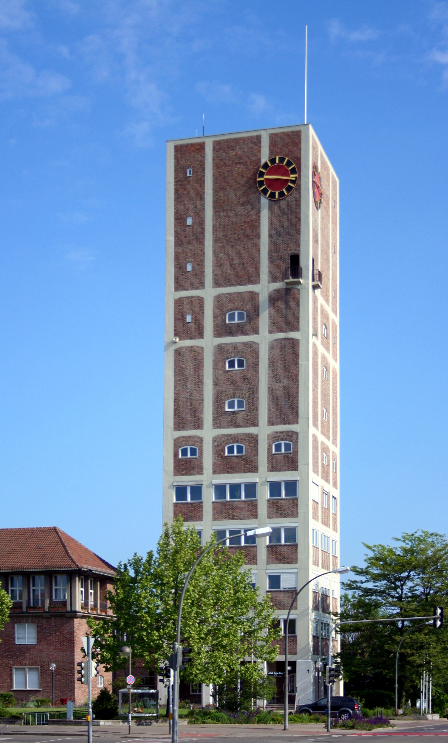
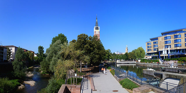
Ludwigsburg
- city in Baden-Württemberg, Germany
Hiking in Ludwigsburg
Ludwigsburg, located in the state of Baden-Wurttemberg, Germany, is primarily known for its historic Baroque architecture and beautiful gardens, notably the Ludwigsburg Palace and its surrounding parks. While it may not be the first place that comes to mind for hiking, there are several options in and around the city for those looking to enjoy the outdoors....
- Country:
- Postal Code: 71634–71642
- Local Dialing Code: 07141
- Licence Plate Code: LB
- Coordinates: 48° 53' 51" N, 9° 11' 31" E
- GPS tracks (wikiloc): [Link]
- AboveSeaLevel: 293 м m
- Area: 43.35 sq km
- Population: 91116
- Web site: [Link]


Murr
- municipality in Germany
Hiking in Murr
Murr, a charming village in the district of Ludwigsburg in Baden-Württemberg, Germany, offers a lovely backdrop for hiking enthusiasts. Nestled between lush vineyards and forested areas, Murr's surrounding nature offers a variety of trails suitable for different skill levels....
- Country:
- Postal Code: 71711
- Local Dialing Code: 07144
- Licence Plate Code: LB
- Coordinates: 48° 57' 49" N, 9° 15' 32" E
- GPS tracks (wikiloc): [Link]
- AboveSeaLevel: 203 м m
- Area: 7.79 sq km
- Population: 6413
- Web site: [Link]


Bietigheim-Bissingen
- town in the district of Ludwigsburg, Baden-Württemberg, Germany
Hiking in Bietigheim-Bissingen
Bietigheim-Bissingen is a charming town located in Baden-Württemberg, Germany, offering a pleasant combination of natural beauty and historical significance. The area is surrounded by picturesque landscapes, including forests, vineyards, and rivers, making it a great destination for hiking enthusiasts....
- Country:
- Postal Code: 74321
- Local Dialing Code: 07147; 07142
- Licence Plate Code: LB
- Coordinates: 48° 58' 0" N, 9° 8' 0" E
- GPS tracks (wikiloc): [Link]
- AboveSeaLevel: 246 м m
- Area: 31.29 sq km
- Population: 42968
- Web site: [Link]
Shares border with regions:

Stuttgart
- capital city of German federated state Baden-Württemberg
Hiking in Stuttgart
Hiking in Stuttgart offers a fantastic blend of urban and natural experiences. The city is surrounded by beautiful landscapes, vineyards, and wooded hills, making it an excellent base for outdoor enthusiasts. Here are some highlights and popular hiking areas around Stuttgart:...
- Country:
- Postal Code: 70619; 70599; 70597; 70569; 70567; 70565; 70563; 70499; 70469; 70376; 70439; 70437; 70435; 70378; 70374; 70372; 70329; 70327; 70199; 70197; 70195; 70193; 70192; 70191; 70190; 70188; 70186; 70184; 70182; 70180; 70178; 70176; 70174; 70173
- Local Dialing Code: 711
- Licence Plate Code: S
- Coordinates: 48° 46' 34" N, 9° 10' 39" E
- GPS tracks (wikiloc): [Link]
- AboveSeaLevel: 247 м m
- Area: 207.33 sq km
- Population: 632743
- Web site: [Link]


Heilbronn
- district in Germany
Hiking in Heilbronn
Heilbronn is a district located in the state of Baden-Württemberg, Germany, characterized by its diverse landscapes, rolling vineyards, and a mix of cultural and historical attractions. Here are some highlights of hiking in the Heilbronn district:...
- Country:
- Capital: Heilbronn
- Licence Plate Code: HN
- Coordinates: 49° 9' 36" N, 9° 15' 0" E
- GPS tracks (wikiloc): [Link]
- AboveSeaLevel: 166 м m
- Area: 1099.93 sq km
- Population: 334388
- Web site: [Link]

Enz
- district of Baden-Württemberg, Germany
Hiking in Enz
Enzkreis, located in Baden-Württemberg, Germany, is a wonderful area for hiking enthusiasts, offering a mix of picturesque landscapes, historic towns, and diverse trail options. Here’s an overview of some aspects to consider when hiking in this region:...
- Country:
- Capital: Pforzheim
- Licence Plate Code: PF
- Coordinates: 48° 54' 0" N, 8° 45' 0" E
- GPS tracks (wikiloc): [Link]
- AboveSeaLevel: 298 м m
- Area: 573.69 sq km
- Web site: [Link]

Rems-Murr
- district in Baden-Wurttemberg, Germany
Hiking in Rems-Murr
Rems-Murr-Kreis, located in the Baden-Württemberg region of Germany, offers a diverse landscape for hiking enthusiasts. The area is characterized by rolling hills, vineyards, forests, and picturesque villages, making it an attractive destination for hikers of all skill levels. Here are some highlights and tips for hiking in Rems-Murr-Kreis:...
- Country:
- Capital: Waiblingen
- Licence Plate Code: WN
- Coordinates: 48° 55' 0" N, 9° 32' 0" E
- GPS tracks (wikiloc): [Link]
- AboveSeaLevel: 481 м m
- Area: 858.14 sq km
- Population: 419456
- Web site: [Link]


Böblingen
- district of Baden-Württemberg, Germany
Hiking in Böblingen
Böblingen, located in Baden-Württemberg, Germany, is surrounded by beautiful landscapes, making it an excellent area for hiking enthusiasts. The district features various trails that cater to different skill levels, from casual walks to more challenging hikes....
- Country:
- Capital: Böblingen
- Licence Plate Code: LEO; BB
- Coordinates: 48° 42' 0" N, 9° 0' 36" E
- GPS tracks (wikiloc): [Link]
- AboveSeaLevel: 444 м m
- Area: 617.82 sq km
- Population: 381281
- Web site: [Link]