Mandres-sur-Vair (Mandres-sur-Vair)

- commune in Vosges, France
- Country:

- Postal Code: 88800
- Coordinates: 48° 13' 26" N, 5° 53' 33" E


- GPS tracks (wikiloc): [Link]
- Area: 11.93 sq km
- Population: 461
- Wikipedia en: wiki(en)
- Wikipedia: wiki(fr)
- Wikidata storage: Wikidata: Q1157633
- Wikipedia Commons Category: [Link]
- Freebase ID: [/m/03qgvc6]
- Freebase ID: [/m/03qgvc6]
- GeoNames ID: Alt: [6445634]
- GeoNames ID: Alt: [6445634]
- SIREN number: [218802858]
- SIREN number: [218802858]
- BnF ID: [152792111]
- BnF ID: [152792111]
- INSEE municipality code: 88285
- INSEE municipality code: 88285
Shares border with regions:

Belmont-sur-Vair
- commune in Vosges, France
- Country:
- Postal Code: 88800
- Coordinates: 48° 15' 17" N, 5° 54' 26" E
- GPS tracks (wikiloc): [Link]
- Area: 6.17 sq km
- Population: 116


Auzainvilliers
- commune in Vosges, France
- Country:
- Postal Code: 88140
- Coordinates: 48° 14' 14" N, 5° 50' 27" E
- GPS tracks (wikiloc): [Link]
- Area: 8.25 sq km
- Population: 220


Norroy
- commune in Vosges, France
- Country:
- Postal Code: 88800
- Coordinates: 48° 12' 56" N, 5° 55' 12" E
- GPS tracks (wikiloc): [Link]
- Area: 7.22 sq km
- Population: 228


Contrexéville
- commune in Vosges, France
- Country:
- Postal Code: 88140
- Coordinates: 48° 11' 4" N, 5° 53' 44" E
- GPS tracks (wikiloc): [Link]
- AboveSeaLevel: 344 м m
- Area: 14.96 sq km
- Population: 3259
- Web site: [Link]
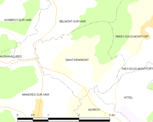
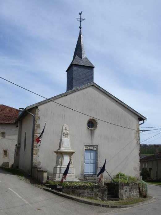
Saint-Remimont
- commune in Vosges, France
- Country:
- Postal Code: 88800
- Coordinates: 48° 14' 41" N, 5° 53' 56" E
- GPS tracks (wikiloc): [Link]
- Area: 4.6 sq km
- Population: 235


Bulgnéville
- commune in Vosges, France
- Country:
- Postal Code: 88140
- Coordinates: 48° 12' 26" N, 5° 50' 5" E
- GPS tracks (wikiloc): [Link]
- Area: 13.33 sq km
- Population: 1517
- Web site: [Link]