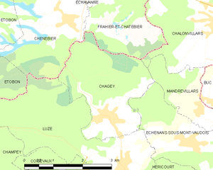
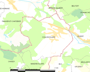
Mandrevillars (Mandrevillars)
- commune in Haute-Saône, France
Mandrevillars is a charming location in France, nestled in the Franche-Comté region. While not as widely recognized as some major hiking destinations, it offers beautiful landscapes, picturesque views, and opportunities for outdoor activities. Here’s what you can expect when hiking in and around Mandrevillars:
Trail Options:
-
Local Trails: There are various local trails suitable for hikers of different skill levels. Make sure to explore the scenic routes that wind through forests and meadows, offering a peaceful escape into nature.
-
Nearby Regional Parks: Consider exploring nearby natural parks, such as the Parc naturel régional du Haut-Jura. This area provides a range of trails with varying difficulty levels, as well as opportunities for wildlife spotting and enjoying diverse ecosystems.
-
Lakeside Walks: The region has beautiful lakes, such as Lake Saint-Point, where you can find leisurely hiking routes and stunning views, especially during sunrise or sunset.
Tips for Hiking in Mandrevillars:
- Check the Weather: The weather can change quickly in mountainous areas, so check local forecasts before heading out.
- Bring Proper Gear: Footwear is crucial—wear sturdy hiking boots. Dress in layers to accommodate changes in temperature.
- Stay Hydrated: Carry enough water, especially on warmer days, and consider packing some snacks for energy.
- Leave No Trace: Always follow Leave No Trace principles to preserve the natural beauty of the area.
Conclusion:
Mandrevillars can be a hidden gem for hikers seeking to experience the tranquility of nature away from the busier trails. Whether you’re a beginner looking for a leisurely walk or an experienced hiker seeking a challenge, the landscapes around Mandrevillars have something to offer. Happy hiking!
- Country:

- Postal Code: 70400
- Coordinates: 47° 36' 47" N, 6° 46' 40" E


- GPS tracks (wikiloc): [Link]
- Area: 3.03 sq km
- Population: 234
- Wikipedia en: wiki(en)
- Wikipedia: wiki(fr)
- Wikidata storage: Wikidata: Q681653
- Wikipedia Commons Category: [Link]
- Freebase ID: [/m/03ntg46]
- GeoNames ID: Alt: [6442002]
- SIREN number: [217003300]
- BnF ID: [15272722c]
- INSEE municipality code: 70330
Shares border with regions:


Échenans-sous-Mont-Vaudois
- commune in Haute-Saône, France
 Hiking in Échenans-sous-Mont-Vaudois
Échenans-sous-Mont-Vaudois, located in the Bourgogne-Franche-Comté region of France, offers a serene and scenic environment for hiking enthusiasts. While it may not be one of the most prominent hiking destinations, it provides a peaceful escape into nature, particularly for those who enjoy exploring less crowded trails....
- Country:

- Postal Code: 70400
- Coordinates: 47° 36' 10" N, 6° 46' 18" E


- GPS tracks (wikiloc): [Link]
- AboveSeaLevel: 381 м m
- Area: 5.44 sq km
- Population: 499


Chagey
- commune in Haute-Saône, France
Chagey, located in the Haute-Saône department of France, offers a unique hiking experience characterized by its picturesque landscapes and natural beauty. While it is a small village, the surrounding area provides various trails that showcase the region's charming countryside, including rolling hills, forests, and rivers....
- Country:

- Postal Code: 70400
- Coordinates: 47° 36' 43" N, 6° 44' 6" E


- GPS tracks (wikiloc): [Link]
- Area: 6.99 sq km
- Population: 651

Buc
- commune in Territoire de Belfort, France
Buc, located in the Territoire de Belfort department in the Bourgogne-Franche-Comté region of France, offers varying hiking opportunities that showcase the beautiful natural landscapes of the area. While Buc itself may not be a well-known hiking destination, its proximity to the Vosges Mountains and the Ballons des Vosges Regional Natural Park provides many trails ideal for hiking enthusiasts....
- Country:

- Postal Code: 90800
- Coordinates: 47° 36' 53" N, 6° 47' 7" E


- GPS tracks (wikiloc): [Link]
- Area: 2.44 sq km
- Population: 294


Châlonvillars
- commune in Haute-Saône, France
- Country:

- Postal Code: 70400
- Coordinates: 47° 38' 22" N, 6° 47' 11" E


- GPS tracks (wikiloc): [Link]
- Area: 7.6 sq km
- Population: 1256
- Web site: [Link]
