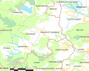
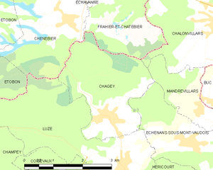
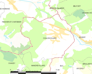
Châlonvillars (Châlonvillars)
- commune in Haute-Saône, France
- Country:

- Postal Code: 70400
- Coordinates: 47° 38' 22" N, 6° 47' 11" E


- GPS tracks (wikiloc): [Link]
- Area: 7.6 sq km
- Population: 1256
- Web site: http://mairie-chalonvillars.e-monsite.com/
- Wikipedia en: wiki(en)
- Wikipedia: wiki(fr)
- Wikidata storage: Wikidata: Q835232
- Wikipedia Commons Category: [Link]
- Freebase ID: [/m/03ntkxn]
- GeoNames ID: Alt: [6441855]
- SIREN number: [217001171]
- INSEE municipality code: 70117
Shares border with regions:

Évette-Salbert
- commune in Territoire de Belfort, France
- Country:

- Postal Code: 90350
- Coordinates: 47° 40' 30" N, 6° 47' 54" E


- GPS tracks (wikiloc): [Link]
- AboveSeaLevel: 391 м m
- Area: 9.16 sq km
- Population: 2073
- Web site: [Link]


Frahier-et-Chatebier
- commune in Haute-Saône, France
- Country:

- Postal Code: 70400
- Coordinates: 47° 39' 37" N, 6° 44' 51" E


- GPS tracks (wikiloc): [Link]
- Area: 17.39 sq km
- Population: 1360
- Web site: [Link]


Chagey
- commune in Haute-Saône, France
Chagey, located in the Haute-Saône department of France, offers a unique hiking experience characterized by its picturesque landscapes and natural beauty. While it is a small village, the surrounding area provides various trails that showcase the region's charming countryside, including rolling hills, forests, and rivers....
- Country:

- Postal Code: 70400
- Coordinates: 47° 36' 43" N, 6° 44' 6" E


- GPS tracks (wikiloc): [Link]
- Area: 6.99 sq km
- Population: 651


Mandrevillars
- commune in Haute-Saône, France
Mandrevillars is a charming location in France, nestled in the Franche-Comté region. While not as widely recognized as some major hiking destinations, it offers beautiful landscapes, picturesque views, and opportunities for outdoor activities. Here’s what you can expect when hiking in and around Mandrevillars:...
- Country:

- Postal Code: 70400
- Coordinates: 47° 36' 47" N, 6° 46' 40" E


- GPS tracks (wikiloc): [Link]
- Area: 3.03 sq km
- Population: 234

Buc
- commune in Territoire de Belfort, France
Buc, located in the Territoire de Belfort department in the Bourgogne-Franche-Comté region of France, offers varying hiking opportunities that showcase the beautiful natural landscapes of the area. While Buc itself may not be a well-known hiking destination, its proximity to the Vosges Mountains and the Ballons des Vosges Regional Natural Park provides many trails ideal for hiking enthusiasts....
- Country:

- Postal Code: 90800
- Coordinates: 47° 36' 53" N, 6° 47' 7" E


- GPS tracks (wikiloc): [Link]
- Area: 2.44 sq km
- Population: 294


Essert
- commune in Territoire de Belfort, France
Hiking in Essert, located in the Territoire de Belfort region of France, offers a delightful combination of natural beauty, picturesque landscapes, and accessibility for outdoor enthusiasts. Here are some highlights and tips for hiking in this area:...
- Country:

- Postal Code: 90850
- Coordinates: 47° 37' 55" N, 6° 48' 59" E


- GPS tracks (wikiloc): [Link]
- Area: 7.01 sq km
- Population: 3268
- Web site: [Link]

