Marçais (Marçais)

- commune in Cher, France
- Country:

- Postal Code: 18170
- Coordinates: 46° 41' 49" N, 2° 22' 14" E


- GPS tracks (wikiloc): [Link]
- Area: 29.03 sq km
- Population: 288
- Wikipedia en: wiki(en)
- Wikipedia: wiki(fr)
- Wikidata storage: Wikidata: Q1423797
- Wikipedia Commons Category: [Link]
- Freebase ID: [/m/03mfd63]
- GeoNames ID: Alt: [6428212]
- SIREN number: [211801360]
- INSEE municipality code: 18136
Shares border with regions:


Ardenais
- commune in Cher, France
- Country:
- Postal Code: 18170
- Coordinates: 46° 38' 50" N, 2° 21' 33" E
- GPS tracks (wikiloc): [Link]
- Area: 17.55 sq km
- Population: 207


Saint-Pierre-les-Bois
- commune in Cher, France
- Country:
- Postal Code: 18170
- Coordinates: 46° 39' 52" N, 2° 16' 44" E
- GPS tracks (wikiloc): [Link]
- Area: 20.38 sq km
- Population: 296


Orcenais
- commune in Cher, France
- Country:
- Postal Code: 18200
- Coordinates: 46° 43' 6" N, 2° 25' 32" E
- GPS tracks (wikiloc): [Link]
- Area: 18.93 sq km
- Population: 252


Morlac
- commune in Cher, France
- Country:
- Postal Code: 18170
- Coordinates: 46° 43' 9" N, 2° 18' 30" E
- GPS tracks (wikiloc): [Link]
- Area: 32.38 sq km
- Population: 328


Loye-sur-Arnon
- commune in Cher, France
- Country:
- Postal Code: 18170
- Coordinates: 46° 39' 10" N, 2° 23' 11" E
- GPS tracks (wikiloc): [Link]
- Area: 34.15 sq km
- Population: 312

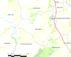
Arcomps
- commune in Cher, France
- Country:
- Postal Code: 18200
- Coordinates: 46° 40' 32" N, 2° 25' 58" E
- GPS tracks (wikiloc): [Link]
- Area: 20.14 sq km
- Population: 312


Vallenay
- commune in Cher, France
- Country:
- Postal Code: 18190
- Coordinates: 46° 48' 5" N, 2° 22' 16" E
- GPS tracks (wikiloc): [Link]
- Area: 25.66 sq km
- Population: 736