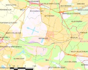
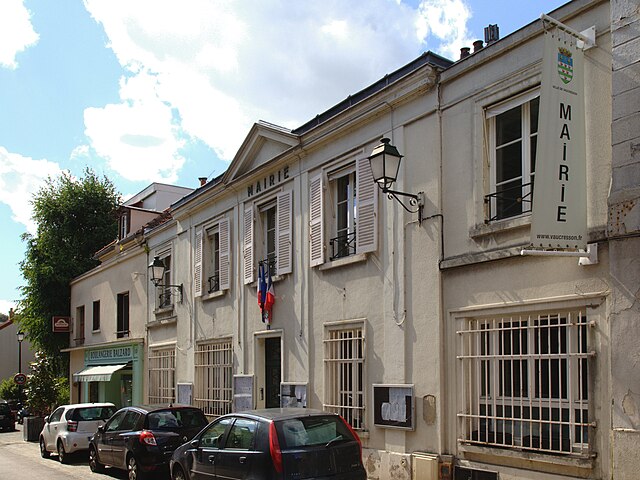
Marnes-la-Coquette (Marnes-la-Coquette)
- commune in Hauts-de-Seine, France
- Country:

- Postal Code: 92430
- Coordinates: 48° 49' 49" N, 2° 10' 38" E


- GPS tracks (wikiloc): [Link]
- Area: 3.48 sq km
- Population: 1751
- Web site: http://www.marnes-la-coquette.fr
- Wikipedia en: wiki(en)
- Wikipedia: wiki(fr)
- Wikidata storage: Wikidata: Q636993
- Wikipedia Commons Category: [Link]
- Freebase ID: [/m/08zyyf]
- Freebase ID: [/m/08zyyf]
- Freebase ID: [/m/08zyyf]
- GeoNames ID: Alt: [2995597]
- GeoNames ID: Alt: [2995597]
- GeoNames ID: Alt: [2995597]
- SIREN number: [219200474]
- SIREN number: [219200474]
- SIREN number: [219200474]
- BnF ID: [152802650]
- BnF ID: [152802650]
- BnF ID: [152802650]
- VIAF ID: Alt: [237439709]
- VIAF ID: Alt: [237439709]
- VIAF ID: Alt: [237439709]
- GND ID: Alt: [4471836-6]
- GND ID: Alt: [4471836-6]
- GND ID: Alt: [4471836-6]
- Library of Congress authority ID: Alt: [n82116992]
- Library of Congress authority ID: Alt: [n82116992]
- Library of Congress authority ID: Alt: [n82116992]
- MusicBrainz area ID: [6d3e3541-b725-4d0b-9613-213bd8e6807f]
- MusicBrainz area ID: [6d3e3541-b725-4d0b-9613-213bd8e6807f]
- MusicBrainz area ID: [6d3e3541-b725-4d0b-9613-213bd8e6807f]
- data.gouv.fr org ID: [ville-de-marnes-la-coquette]
- data.gouv.fr org ID: [ville-de-marnes-la-coquette]
- data.gouv.fr org ID: [ville-de-marnes-la-coquette]
- INSEE municipality code: 92047
- INSEE municipality code: 92047
- INSEE municipality code: 92047
Shares border with regions:


Saint-Cloud
- commune in Hauts-de-Seine, France
- Country:

- Postal Code: 92210
- Coordinates: 48° 50' 47" N, 2° 12' 55" E


- GPS tracks (wikiloc): [Link]
- AboveSeaLevel: 136 м m
- Area: 7.56 sq km
- Population: 29362
- Web site: [Link]


Garches
- commune in Hauts-de-Seine, France
- Country:

- Postal Code: 92380
- Coordinates: 48° 50' 44" N, 2° 11' 13" E


- GPS tracks (wikiloc): [Link]
- Area: 2.69 sq km
- Population: 17762
- Web site: [Link]


Ville-d'Avray
- commune in Hauts-de-Seine, France
- Country:

- Postal Code: 92410
- Coordinates: 48° 49' 34" N, 2° 11' 36" E


- GPS tracks (wikiloc): [Link]
- AboveSeaLevel: 125 м m
- Area: 3.67 sq km
- Population: 11422
- Web site: [Link]


Versailles
- commune in Yvelines, France
- Country:

- Postal Code: 78000
- Coordinates: 48° 48' 17" N, 2° 8' 3" E


- GPS tracks (wikiloc): [Link]
- AboveSeaLevel: 180 м m
- Area: 26.18 sq km
- Population: 85771
- Web site: [Link]


Vaucresson
- commune in Hauts-de-Seine, France
- Country:

- Postal Code: 92420
- Coordinates: 48° 50' 33" N, 2° 9' 10" E


- GPS tracks (wikiloc): [Link]
- Area: 3.08 sq km
- Population: 8688
- Web site: [Link]
