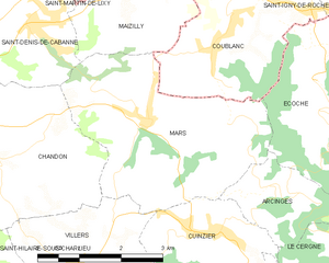
Mars (Mars)
- commune in Loire, France
- Country:

- Postal Code: 42750
- Coordinates: 46° 9' 11" N, 4° 14' 47" E


- GPS tracks (wikiloc): [Link]
- AboveSeaLevel: 390 м m
- Area: 12.03 sq km
- Population: 557
- Wikipedia en: wiki(en)
- Wikipedia: wiki(fr)
- Wikidata storage: Wikidata: Q1116491
- Wikipedia Commons Category: [Link]
- Freebase ID: [/m/03nwbh4]
- Freebase ID: [/m/03nwbh4]
- GeoNames ID: Alt: [6616767]
- GeoNames ID: Alt: [6616767]
- SIREN number: [214201410]
- SIREN number: [214201410]
- BnF ID: [15259709f]
- BnF ID: [15259709f]
- INSEE municipality code: 42141
- INSEE municipality code: 42141
Shares border with regions:
Cuinzier
- commune in Loire, France
- Country:

- Postal Code: 42460
- Coordinates: 46° 7' 39" N, 4° 16' 1" E


- GPS tracks (wikiloc): [Link]
- Area: 5.62 sq km
- Population: 731


Arcinges
- commune in Loire, France
- Country:

- Postal Code: 42460
- Coordinates: 46° 8' 15" N, 4° 16' 51" E


- GPS tracks (wikiloc): [Link]
- Area: 3.44 sq km
- Population: 208
Villers
- commune in Loire, France
- Country:

- Postal Code: 42460
- Coordinates: 46° 7' 17" N, 4° 13' 21" E


- GPS tracks (wikiloc): [Link]
- Area: 5.73 sq km
- Population: 576
Écoche
- commune in Loire, France
- Country:

- Postal Code: 42670
- Coordinates: 46° 9' 39" N, 4° 17' 51" E


- GPS tracks (wikiloc): [Link]
- AboveSeaLevel: 430 м m
- Area: 11.7 sq km
- Population: 558
Chandon
- commune in Loire, France
- Country:

- Postal Code: 42190
- Coordinates: 46° 8' 59" N, 4° 12' 50" E


- GPS tracks (wikiloc): [Link]
- Area: 12.38 sq km
- Population: 1438


Coublanc
- commune in Saône-et-Loire, France
- Country:

- Postal Code: 71170
- Coordinates: 46° 10' 26" N, 4° 16' 23" E


- GPS tracks (wikiloc): [Link]
- Area: 8.76 sq km
- Population: 851
- Web site: [Link]


Maizilly
- commune in Loire, France
- Country:

- Postal Code: 42750
- Coordinates: 46° 10' 43" N, 4° 14' 41" E


- GPS tracks (wikiloc): [Link]
- Area: 5.12 sq km
- Population: 335
- Web site: [Link]


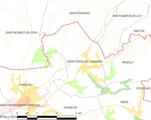
Saint-Denis-de-Cabanne
- commune in Loire, France
- Country:

- Postal Code: 42750
- Coordinates: 46° 10' 27" N, 4° 12' 43" E


- GPS tracks (wikiloc): [Link]
- Area: 7.65 sq km
- Population: 1271
- Web site: [Link]
