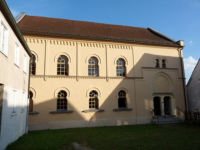
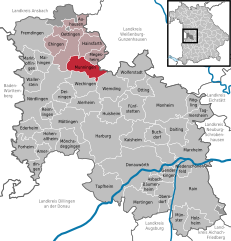
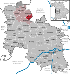
Megesheim (Megesheim)
- municipality of Germany
Megesheim, located in Bavaria, Germany, is a charming village surrounded by beautiful natural landscapes, making it an ideal destination for hiking enthusiasts. The area offers a variety of trails that showcase the region's rolling hills, lush fields, and picturesque views.
Hiking Trails:
-
Local Nature Trails: The surrounding countryside features numerous local trails that are often well-marked and can cater to various skill levels. You can find routes that range from easy strolls to more challenging hikes.
-
Long-Distance Trails: Nearby, you may also find long-distance hiking paths like the Frankenweg, which runs through the region and offers an opportunity to explore more of the Franconian area.
-
Scenic Vistas: Along many of the hiking routes, you can enjoy panoramic views of the countryside, quaint villages, and historical landmarks. Keep your camera ready!
Tips for Hiking in Megesheim:
- Research Trails: Before heading out, consider picking up a hiking map or checking online resources for trail information and difficulty levels.
- Weather Conditions: Be mindful of the weather, as it can change rapidly. Dress in layers and be prepared for rain.
- Appropriate Gear: Wear sturdy hiking shoes and comfortable clothing. Don't forget essentials like water, snacks, and a first-aid kit.
- Wildlife Awareness: The area is home to various flora and fauna, so be respectful of the environment and keep an eye out for wildlife.
- Local Culture: Take time to enjoy the local culture and cuisine in Megesheim after your hike. The village may have charming cafes and restaurants where you can unwind.
Safety:
- Always inform someone of your hiking plans and estimated return time.
- Stay on marked trails to help preserve the natural landscape and for your safety.
Hiking in Megesheim can be a peaceful and rewarding experience, allowing you to enjoy the stunning nature of Bavaria while getting some exercise. Happy hiking!
- Country:

- Postal Code: 86750
- Local Dialing Code: 09082
- Licence Plate Code: DON
- Coordinates: 48° 56' 0" N, 10° 39' 0" E


- GPS tracks (wikiloc): [Link]
- AboveSeaLevel: 422 м m
- Area: 12.53 sq km
- Population: 753
- Web site: http://www.megesheim.de
- Wikipedia en: wiki(en)
- Wikipedia: wiki(de)
- Wikidata storage: Wikidata: Q426741
- Wikipedia Commons Category: [Link]
- Freebase ID: [/m/02q10vm]
- GeoNames ID: Alt: [6557288]
- VIAF ID: Alt: [245824106]
- OSM relation ID: [962605]
- GND ID: Alt: [4476335-9]
- TGN ID: [7131016]
- Historical Gazetteer (GOV) ID: [MEGEIMJN58HW]
- Bavarikon ID: [ODB_A00000846]
- German municipality key: 09779180
Shares border with regions:


Hainsfarth
- municipality of Germany
Hainsfarth, located in Bavaria, Germany, offers a charming setting for hiking enthusiasts. The region features picturesque landscapes, lush forests, and rolling hills that make for a great hiking experience. Here are some highlights and tips for hiking in Hainsfarth:...
- Country:

- Postal Code: 86744
- Local Dialing Code: 09082
- Licence Plate Code: DON
- Coordinates: 48° 58' 0" N, 10° 37' 0" E


- GPS tracks (wikiloc): [Link]
- AboveSeaLevel: 445 м m
- Area: 17.54 sq km
- Population: 1443
- Web site: [Link]


Munningen
- municipality of Germany
Munningen is a small area located in the Bavarian region of Germany, near the Danube River. While it may not be as widely known as some larger hiking destinations, it offers beautiful landscapes and opportunities for outdoor activities, particularly for those who enjoy tranquility away from more crowded trails....
- Country:

- Postal Code: 86754
- Local Dialing Code: 0 90 82
- Licence Plate Code: DON
- Coordinates: 48° 55' 0" N, 10° 35' 0" E


- GPS tracks (wikiloc): [Link]
- AboveSeaLevel: 415 м m
- Area: 22.78 sq km
- Population: 1659
- Web site: [Link]

