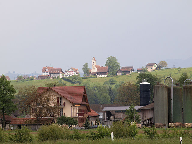
Merenschwand (Merenschwand)

- municipality in Switzerland
 Hiking in Merenschwand
Merenschwand, a picturesque municipality located in the Canton of Aargau in Switzerland, offers a variety of hiking opportunities that cater to different skill levels. Nestled in a beautiful landscape characterized by rolling hills, forests, and stunning views of the surrounding countryside, it's an excellent destination for both casual walkers and more experienced hikers.
Popular Hiking Trails
-
Merenschwand to Muri:
- This trail offers a moderate hike that connects Merenschwand to the nearby town of Muri. The route typically runs through forests and opens up to scenic views of the landscape. It's about 10 km one way and can take around 3-4 hours depending on your pace.
-
Zofingen Ridge:
- This hike provides a bit more of a challenge and includes some elevation gain, rewarding hikers with magnificent panoramic views of the surrounding Swiss Alps and the Aargau region. The trail is well marked and suitable for intermediate hikers.
-
Nature Trails:
- For a more leisurely experience, several nature trails wind through the area, allowing hikers to enjoy the flora and fauna unique to this part of Switzerland. These trails are generally flat and good for families or those looking for a gentle outing.
Tips for Hiking in Merenschwand
-
Best Time to Visit: The best seasons for hiking in Merenschwand are late spring through early autumn. The weather is typically mild, and the trails are well-maintained.
-
Gear Recommendations: While basic hiking shoes and weather-appropriate clothing suffice for most trails, consider trekking poles for steeper sections and pack sufficient water and snacks.
-
Navigation: Many trails are signposted, but it's a good idea to carry a map or use a GPS app to stay on track, especially on lesser-known routes.
-
Wildlife: Keep an eye out for local wildlife. The region is home to a variety of animals, and sighting them can be a delightful part of your hike.
-
Respect Nature: As with any outdoor activity, practice Leave No Trace principles to keep the environment pristine for future visitors.
Whether you're planning a peaceful day hike or a more strenuous trek, Merenschwand provides a scenic backdrop that showcases the natural beauty of Switzerland. Enjoy your hiking adventure!
- Country:

- Postal Code: 5634
- Local Dialing Code: 056
- Licence Plate Code: AG
- Coordinates: 47° 15' 44" N, 8° 22' 39" E


- GPS tracks (wikiloc): [Link]
- AboveSeaLevel: 381 м m
- Area: 13.51 sq km
- Population: 3393
- Web site: http://www.merenschwand.ch
- Wikipedia en: wiki(en)
- Wikipedia: wiki(de)
- Wikidata storage: Wikidata: Q64755
- Wikipedia Commons Category: [Link]
- Freebase ID: [/m/0flrz8]
- GeoNames ID: Alt: [7286488]
- VIAF ID: Alt: [236554905]
- OSM relation ID: [1684365]
- GND ID: Alt: [4530181-5]
- HDS ID: [1789]
- Swiss municipality code: [4234]
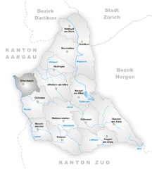
Shares border with regions:


Mühlau
- municipality in the canton Aargau, Switzerland
Hiking in Mühlau
Mühlau is a picturesque area located in Austria, near Innsbruck, that offers several hiking opportunities for outdoor enthusiasts. Nestled among the Alps, it provides stunning views, diverse flora and fauna, and various trails suitable for hikers of all skill levels....
- Country:
- Postal Code: 5642
- Local Dialing Code: 056
- Licence Plate Code: AG
- Coordinates: 47° 13' 49" N, 8° 23' 30" E
- GPS tracks (wikiloc): [Link]
- AboveSeaLevel: 397 м m
- Area: 5.52 sq km
- Population: 1172
- Web site: [Link]


Aristau
- municipality in Switzerland
Hiking in Aristau
Aristau is a beautiful and less-traveled destination perfect for hiking enthusiasts. Located in the Swiss region, it offers scenic views, lush landscapes, and a variety of trails suitable for different skill levels. Here’s an overview of what you can expect when hiking in Aristau:...
- Country:
- Postal Code: 5628
- Local Dialing Code: 056
- Licence Plate Code: AG
- Coordinates: 47° 17' 29" N, 8° 21' 50" E
- GPS tracks (wikiloc): [Link]
- AboveSeaLevel: 387 м m
- Area: 8.64 sq km
- Population: 1436
- Web site: [Link]


Obfelden
- municipality in Switzerland
Hiking in Obfelden
Obfelden, located in the Canton of Zurich, Switzerland, offers beautiful hiking opportunities amidst stunning natural landscapes. The region is characterized by rolling hills, lush forests, and picturesque views of the surrounding Alps, making it a great destination for hikers of all skill levels....
- Country:
- Postal Code: 8912
- Local Dialing Code: 044
- Licence Plate Code: ZH
- Coordinates: 47° 15' 42" N, 8° 25' 19" E
- GPS tracks (wikiloc): [Link]
- AboveSeaLevel: 435 м m
- Area: 7.54 sq km
- Population: 5340
- Web site: [Link]
Hünenberg
- municipality in Switzerland
Hiking in Hünenberg
Hünenberg, located in the Canton of Zug in Switzerland, offers a blend of beautiful landscapes, scenic views, and various hiking opportunities. Here are some key points to consider if you’re planning a hike in this area:...
- Country:
- Postal Code: 6331
- Local Dialing Code: 041
- Licence Plate Code: ZG
- Coordinates: 47° 11' 29" N, 8° 25' 11" E
- GPS tracks (wikiloc): [Link]
- AboveSeaLevel: 403 м m
- Area: 18.7 sq km
- Population: 8824
- Web site: [Link]

Ottenbach
- municipality in Switzerland
Hiking in Ottenbach
Ottenbach, a picturesque village located in the Canton of Aargau in Switzerland, offers a great setting for hiking enthusiasts. The surrounding landscapes provide a delightful mix of rolling hills, forested areas, and charming valleys, making it an excellent spot for both beginners and experienced hikers....
- Country:
- Postal Code: 8913
- Local Dialing Code: 044
- Licence Plate Code: ZH
- Coordinates: 47° 16' 53" N, 8° 24' 14" E
- GPS tracks (wikiloc): [Link]
- AboveSeaLevel: 409 м m
- Area: 4.98 sq km
- Population: 2556
- Web site: [Link]

Muri
- municipality in the canton Aargau, Switzerland
Hiking in Muri
Muri, located in the Aargau region of Switzerland, is surrounded by beautiful landscapes that offer great opportunities for hiking enthusiasts. The area features a combination of rolling hills, forests, and scenic views that are characteristic of the Swiss countryside....
- Country:
- Postal Code: 5630
- Local Dialing Code: 056
- Licence Plate Code: AG
- Coordinates: 47° 16' 29" N, 8° 20' 30" E
- GPS tracks (wikiloc): [Link]
- AboveSeaLevel: 478 м m
- Area: 12.34 sq km
- Population: 7769
- Web site: [Link]