Miribel-Lanchâtre (Miribel-Lanchâtre)

- commune in Isère, France
 Hiking in Miribel-Lanchâtre
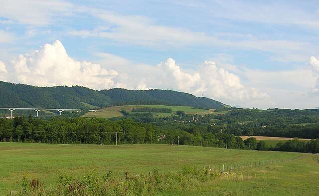
Miribel-Lanchâtre is a charming destination in the department of Isère, in the Auvergne-Rhône-Alpes region of France. It offers beautiful landscapes, rich biodiversity, and various hiking opportunities that cater to different skill levels, making it an excellent spot for hiking enthusiasts.
Hiking Highlights in Miribel-Lanchâtre:
-
Scenic Trails: The area has numerous well-marked trails that take you through stunning natural settings, including forests, meadows, and viewpoints overlooking the surrounding valleys and mountains.
-
Varied Terrain: Hikers can experience a range of terrains, from gentle slopes suitable for families and beginners to more challenging paths for experienced hikers.
-
Nature and Wildlife: The region is rich in flora and fauna, providing opportunities for wildlife watching. Keep an eye out for local species and unique plants along the trails.
-
Historical and Cultural Sites: Some hiking routes may lead you to historical landmarks or offer insights into the area's cultural heritage, making your hike both physically rewarding and intellectually stimulating.
-
Accessibility: The trails vary in length and difficulty, making it easy to find a route that fits your skill level and schedule. Whether you're looking for a short day hike or a longer trek, there are options available.
-
Local Advice: Local tourist offices often provide maps and details about current trail conditions, so it’s a good idea to stop by and gather information before you set out.
-
Seasonal Considerations: The best times for hiking in Miribel-Lanchâtre are typically during spring and early autumn when the weather is mild and the scenery is lush. However, snow in the winter may restrict access to some trails, so it's essential to check trail conditions beforehand.
Safety Tips:
- Always be mindful of weather conditions and dress appropriately.
- Carry plenty of water, snacks, and a first aid kit.
- Inform someone about your hiking plan and expected return time.
- Stay on marked trails to protect the environment and for your safety.
Miribel-Lanchâtre promises a rewarding hiking experience with its natural beauty and diverse trails, making it a wonderful destination for both casual walkers and seasoned hikers. Whether you prefer peaceful walks through nature or challenging hikes, you can find what you’re looking for in this picturesque area.
- Country:

- Postal Code: 38450
- Coordinates: 44° 58' 28" N, 5° 37' 13" E


- GPS tracks (wikiloc): [Link]
- Area: 9.65 sq km
- Population: 415
- Web site: http://miribel.lanchatre.free.fr
- Wikipedia en: wiki(en)
- Wikipedia: wiki(fr)
- Wikidata storage: Wikidata: Q1151464
- Wikipedia Commons Category: [Link]
- Freebase ID: [/m/0ftymq]
- GeoNames ID: Alt: [6433242]
- SIREN number: [213802358]
- BnF ID: [15258047t]
- INSEE municipality code: 38235
Shares border with regions:


Le Gua
- commune in Isère, France
Hiking in Le Gua
Le Gua, located in the Isère department of the Auvergne-Rhône-Alpes region in France, offers a blend of picturesque landscapes and accessible hiking trails, making it a great destination for outdoor enthusiasts. Here are some highlights and tips for hiking in Le Gua:...
- Country:
- Postal Code: 38450
- Coordinates: 45° 1' 31" N, 5° 38' 52" E
- GPS tracks (wikiloc): [Link]
- Area: 28.48 sq km
- Population: 1812
- Web site: [Link]

Saint-Paul-lès-Monestier
- commune in Isère, France
Hiking in Saint-Paul-lès-Monestier
Saint-Paul-lès-Monestier is a picturesque village located in the Isère department in the Auvergne-Rhône-Alpes region of southeastern France. It serves as an excellent base for hiking enthusiasts who want to explore the beautiful landscapes of the Vercors Massif....
- Country:
- Postal Code: 38650
- Coordinates: 44° 55' 46" N, 5° 37' 40" E
- GPS tracks (wikiloc): [Link]
- Area: 13.88 sq km
- Population: 257


Saint-Guillaume
- commune in Isère, France
Hiking in Saint-Guillaume
Saint-Guillaume, located in Quebec, Canada, offers a variety of hiking opportunities amidst beautiful natural landscapes. The area is characterized by its lush forests, rolling hills, and scenic views, making it an appealing destination for both novice and experienced hikers....
- Country:
- Postal Code: 38650
- Coordinates: 44° 57' 18" N, 5° 35' 21" E
- GPS tracks (wikiloc): [Link]
- Area: 13.33 sq km
- Population: 265


Château-Bernard
- commune in Isère, France
Hiking in Château-Bernard
Hiking in Château-Bernard offers a delightful opportunity to explore the natural beauty of the area, characterized by picturesque landscapes, diverse flora and fauna, and a rich cultural history. While Château-Bernard itself is a small commune in the Auvergne region of France, there are several hikes and trails in the surrounding areas that cater to various skill levels....
- Country:
- Postal Code: 38650
- Coordinates: 44° 58' 30" N, 5° 34' 35" E
- GPS tracks (wikiloc): [Link]
- Area: 18.27 sq km
- Population: 276
- Web site: [Link]


Saint-Martin-de-la-Cluze
- commune in Isère, France
Hiking in Saint-Martin-de-la-Cluze
Saint-Martin-de-la-Cluze is a picturesque village located in the French Alps, specifically in the Isère department. Its stunning natural scenery and diverse topography make it a fantastic destination for hiking enthusiasts....
- Country:
- Postal Code: 38650
- Coordinates: 44° 58' 58" N, 5° 39' 31" E
- GPS tracks (wikiloc): [Link]
- AboveSeaLevel: 760 м m
- Area: 16.26 sq km
- Population: 705
- Web site: [Link]


Sinard
- commune in Isère, France
Hiking in Sinard
Sinard is a beautiful area that offers various hiking opportunities, though it’s less widely known compared to some other hiking destinations. The region is characterized by stunning landscapes, including mountains, forests, and possibly bodies of water, making it an excellent choice for nature enthusiasts....
- Country:
- Postal Code: 38650
- Coordinates: 44° 56' 44" N, 5° 39' 25" E
- GPS tracks (wikiloc): [Link]
- Area: 10.44 sq km
- Population: 662