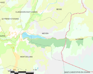
Mizoën (Mizoën)
- commune in Isère, France
Mizoën is a charming village located in the Écrins National Park in the French Alps. This picturesque region is known for its stunning landscapes, pristine wilderness, and variety of hiking trails suitable for all levels of experience. Here’s some information to help you plan your hiking adventure in Mizoën:
Trails and Hiking Routes:
-
L'Alpe du Villar d'Arène: This trail leads you through beautiful alpine meadows and offers breathtaking views of the surrounding peaks, including the famous Meije. The hike can take several hours, making it perfect for a day trip.
-
Refuge de l'Aigle: A popular trek that provides access to higher altitudes and stunning vistas. This trail can be challenging, but for those looking for an adventure, the panoramic views from the refuge are well worth the effort.
-
Les Ecrins Circuit: This longer circuit encompasses multiple days of hiking and takes you through some of the most spectacular scenery in the Écrins National Park. You’ll traverse varied landscapes, including glaciers, high mountain ridges, and turquoise lakes.
Best Time to Hike:
- Summer (June to September) is the prime season for hiking in Mizoën, as the weather is generally mild, and trails are accessible. Early summer can still have some snow in the higher altitudes, while by late summer, the wildflowers are in full bloom.
Preparation and Tips:
- Trail Conditions: Always check local trail conditions before heading out, as snow and weather can impact trail accessibility.
- Gear: Wear sturdy hiking boots and bring appropriate clothing, including layers to accommodate changing weather. A good backpack, water, snacks, and a first aid kit are also essential.
- Maps and Navigation: It’s helpful to carry a map or download GPS files for the trails. Mobile connectivity may be limited in the mountainous areas.
Local Regulations:
- Respect the natural environment; stick to marked trails and pack out what you bring in.
- Be conscious of wildlife and local flora, avoiding any disruption to their habitats.
Additional Activities:
- In addition to hiking, Mizoën offers opportunities for mountain biking, climbing, and enjoying the local gastronomy in village restaurants.
Access:
- Mizoën is accessible by car, typically a drive from nearby larger towns like Briançon or Grenoble. There are parking areas in and around the village.
With its stunning scenery and varied trails, Mizoën is a fantastic destination for hikers looking to explore the beauty of the French Alps. Be sure to plan ahead to maximize your experience!
- Country:

- Postal Code: 38142
- Coordinates: 45° 3' 0" N, 6° 8' 33" E


- GPS tracks (wikiloc): [Link]
- Area: 14.6 sq km
- Population: 195
- Web site: http://www.mizoen.fr
- Wikipedia en: wiki(en)
- Wikipedia: wiki(fr)
- Wikidata storage: Wikidata: Q1088355
- Wikipedia Commons Category: [Link]
- Freebase ID: [/m/03g_1j3]
- GeoNames ID: Alt: [6433244]
- SIREN number: [213802374]
- archINFORM location ID: [4297]
- INSEE municipality code: 38237
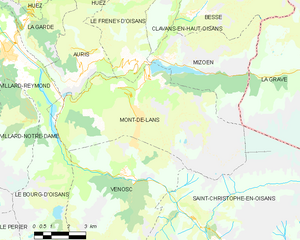
Shares border with regions:


Clavans-en-Haut-Oisans
- commune in Isère, France
 Hiking in Clavans-en-Haut-Oisans
Clavans-en-Haut-Oisans is a picturesque village located in the French Alps, specifically in the Isère department. It's a fantastic base for hiking enthusiasts due to its stunning natural surroundings and proximity to the Écrins National Park, one of France's largest and most beautiful national parks....
- Country:

- Postal Code: 38142
- Coordinates: 45° 5' 1" N, 6° 9' 46" E


- GPS tracks (wikiloc): [Link]
- Area: 15.58 sq km
- Population: 108
- Web site: [Link]


Besse
- commune in Isère, France
Besse, located in the Isère department of the Auvergne-Rhône-Alpes region in southeastern France, is a fantastic destination for hiking enthusiasts. Nestled in the spectacular landscapes of the French Alps, Besse offers a range of hiking trails that cater to various levels of experience, from beginner to expert....
- Country:

- Postal Code: 38142
- Coordinates: 45° 4' 18" N, 6° 10' 12" E


- GPS tracks (wikiloc): [Link]
- Area: 25.46 sq km
- Population: 133
- Web site: [Link]


Mont-de-Lans
- former commune in Isère, France
Mont-de-Lans, located in the French Alps, is a scenic area that offers a variety of hiking opportunities for all levels of hikers. Situated near the famous ski resort of Les Deux Alpes, it transforms into a hiker’s paradise during the warmer months, showcasing stunning alpine landscapes, breathtaking views, and diverse flora and fauna....
- Country:

- Postal Code: 38860
- Coordinates: 45° 2' 9" N, 6° 7' 44" E


- GPS tracks (wikiloc): [Link]
- Area: 31.66 sq km
- Population: 1129
- Web site: [Link]


Le Freney-d'Oisans
- commune in Isère, France
Le Freney-d'Oisans is a charming village located in the Auvergne-Rhône-Alpes region of France, nestled in the French Alps. It's a fantastic location for hiking enthusiasts due to its stunning natural scenery, diverse trails, and proximity to other outdoor activities....
- Country:

- Postal Code: 38142
- Coordinates: 45° 2' 41" N, 6° 7' 32" E


- GPS tracks (wikiloc): [Link]
- Area: 14.54 sq km
- Population: 252
- Web site: [Link]

La Grave
- commune in Hautes-Alpes, France
La Grave is a stunning area located in the French Alps, known for its breathtaking mountain scenery and varied hiking opportunities. Here are some key points to consider if you're planning a hiking trip in La Grave:...
- Country:

- Postal Code: 05320
- Coordinates: 45° 2' 46" N, 6° 18' 21" E


- GPS tracks (wikiloc): [Link]
- Area: 126.91 sq km
- Population: 487
- Web site: [Link]
