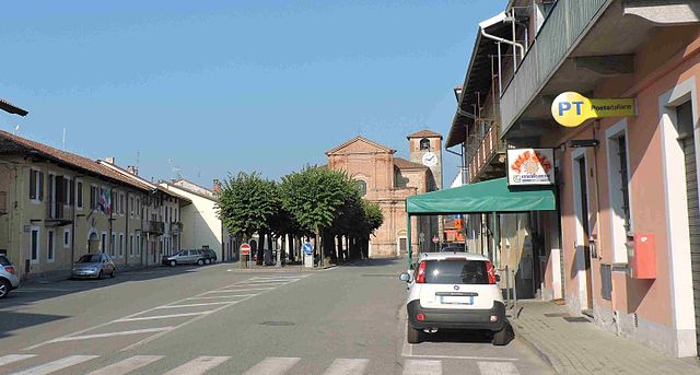
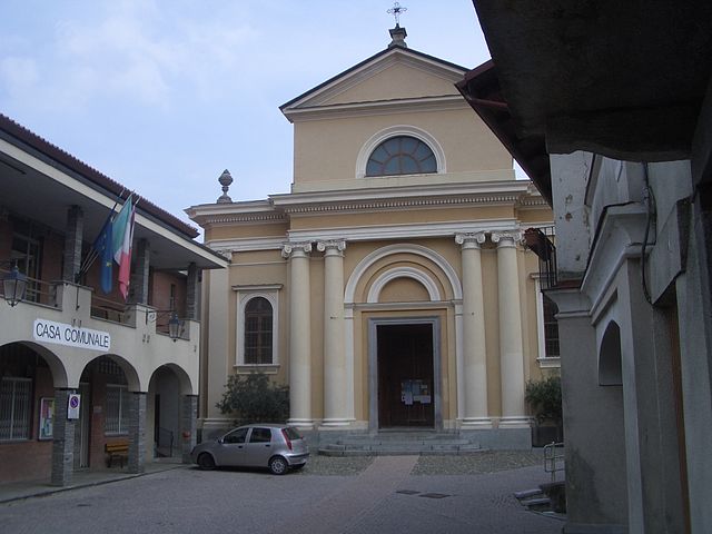
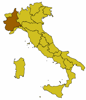
Mongrando (Mongrando)
- Italian comune
 Hiking in Mongrando
Mongrando is a small town in the Piedmont region of Italy, situated near the foothills of the Alps. While it may not be as widely known as some other hiking destinations, it offers beautiful landscapes and opportunities for outdoor activities, including hiking. Here are some details about hiking in and around Mongrando:
Trails and Natural Features
-
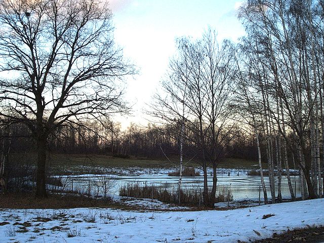
Surrounding Nature: The area near Mongrando is characterized by rolling hills, forests, and proximity to the Biellese Alps. Hikers can enjoy a variety of terrain, from gentle slopes to more challenging routes.
-
Local Trails: While there are not extensive guidebooks specifically for Mongrando, many local trails connect to the greater network of paths in the Biella province. These trails often have well-marked signs and offer varying levels of difficulty.
-
Scenic Views: The hikes in this area can provide stunning views of the Alps, picturesque valleys, and countryside. You may also encounter local wildlife and beautiful flora along the way.
Recommended Routes
-
Trail to Monte Mucrone: A popular hike is to the summit of Monte Mucrone. This trek typically starts from a nearby village and can be a challenging but rewarding experience, offering panoramic views of the surrounding mountains.
-
Path of the Biella Natural Park: Explore trails within the Parco Regionale della Baraggia, which is slightly to the south. This park offers various trails well-suited for hiking, with information points about local flora and fauna.
Tips for Hiking in Mongrando
-
Preparation: Always check the weather before heading out, and dress appropriately for changing conditions. Wear sturdy hiking shoes, and consider carrying trekking poles for added stability.
-
Local Knowledge: Engage with local guides or resident hikers for tips and insights about hidden gems or less-traveled paths.
-
Hydration and Nutrition: Bring enough water and snacks, as facilities may be limited on the trails.
-
Leave No Trace: Respect the natural environment. Follow hiking etiquette by staying on marked trails and taking all your litter with you.
Additional Attractions
- After your hike, consider exploring the town itself. Mongrando features charming architecture, local eateries where you can sample Piedmontese cuisine, and access to nearby cultural attractions in the Biella area.
Hiking in and around Mongrando can be a delightful experience for those looking to explore the natural beauty of Northern Italy. Whether you are an experienced hiker or a beginner, there are options available to match your interests and abilities.
- Country:

- Postal Code: 13888
- Local Dialing Code: 015
- Licence Plate Code: BI
- Coordinates: 45° 31' 0" N, 8° 0' 0" E


- GPS tracks (wikiloc): [Link]
- AboveSeaLevel: 355 м m
- Area: 16.5 sq km
- Population: 3800
- Web site: http://mongrando.ariadne.it/on-line/Home.html
- Wikipedia en: wiki(en)
- Wikipedia: wiki(it)
- Wikidata storage: Wikidata: Q18086
- Wikipedia Commons Category: [Link]
- Freebase ID: [/m/0gr27r]
- GeoNames ID: Alt: [6540300]
- OSM relation ID: [45185]
- MusicBrainz area ID: [7589fecd-35e4-4f95-874d-16f3506d17c8]
- UN/LOCODE: [ITMGD]
- ISTAT ID: 096035
- Italian cadastre code: F369
Shares border with regions:
Borriana
- Italian comune
Hiking in Borriana
Borriana is a charming town in the province of Biella, located in the Piedmont region of Northern Italy. The area around Borriana offers a variety of hiking opportunities that cater to different skill levels and interests, making it a wonderful destination for outdoor enthusiasts....
- Country:
- Postal Code: 13872
- Local Dialing Code: 015
- Licence Plate Code: BI
- Coordinates: 45° 30' 0" N, 8° 2' 0" E
- GPS tracks (wikiloc): [Link]
- AboveSeaLevel: 350 м m
- Area: 5.35 sq km
- Population: 889
- Web site: [Link]

Camburzano
- Italian comune
Hiking in Camburzano
Camburzano is a small commune located in the Piedmont region of northern Italy, known for its scenic landscapes and natural beauty. While it may not be as famous as some larger destinations, it offers opportunities for hiking and exploring the surrounding countryside....
- Country:
- Postal Code: 13891
- Local Dialing Code: 015
- Licence Plate Code: BI
- Coordinates: 45° 33' 0" N, 7° 59' 0" E
- GPS tracks (wikiloc): [Link]
- AboveSeaLevel: 420 м m
- Area: 3.8 sq km
- Population: 1178
- Web site: [Link]
Donato, Piedmont
- Italian comune
Hiking in Donato, Piedmont
Donato, located in the Piedmont region of Italy, is a charming destination for hiking enthusiasts. Here are some key points about hiking in the area:...
- Country:
- Postal Code: 13893
- Local Dialing Code: 015
- Licence Plate Code: BI
- Coordinates: 45° 32' 0" N, 7° 52' 0" E
- GPS tracks (wikiloc): [Link]
- AboveSeaLevel: 711 м m
- Area: 12.07 sq km
- Population: 707
- Web site: [Link]

Graglia
- Italian comune
Hiking in Graglia
Graglia is a charming town located in the province of Biella in northern Italy, surrounded by beautiful natural landscapes. It offers a multitude of hiking trails that suit various levels of experience, from casual walks to more challenging treks. Here are some highlights about hiking in the Graglia area:...
- Country:
- Postal Code: 13895
- Local Dialing Code: 015
- Licence Plate Code: BI
- Coordinates: 45° 33' 29" N, 7° 58' 44" E
- GPS tracks (wikiloc): [Link]
- AboveSeaLevel: 596 м m
- Area: 20.14 sq km
- Population: 1511
- Web site: [Link]
Netro, Piedmont
- Italian comune
Hiking in Netro, Piedmont
Netro, located in the Piedmont region of Italy, is a beautiful destination for hiking enthusiasts. This area is characterized by its stunning natural landscapes, rolling hills, lush forests, and picturesque views of the surrounding mountains. Here are some highlights of hiking in Netro and the Piedmont region:...
- Country:
- Postal Code: 13896
- Local Dialing Code: 015
- Licence Plate Code: BI
- Coordinates: 45° 32' 15" N, 7° 56' 50" E
- GPS tracks (wikiloc): [Link]
- AboveSeaLevel: 606 м m
- Area: 12.57 sq km
- Population: 982
- Web site: [Link]

Occhieppo Inferiore
- Italian comune
Hiking in Occhieppo Inferiore
Occhieppo Inferiore is a charming area located in the Piedmont region of northwestern Italy, close to the town of Biella. The surrounding landscape is characterized by beautiful hills, lush forests, and scenic views of the surrounding mountains, making it an excellent destination for hiking enthusiasts....
- Country:
- Postal Code: 13897
- Local Dialing Code: 015
- Licence Plate Code: BI
- Coordinates: 45° 31' 0" N, 8° 0' 0" E
- GPS tracks (wikiloc): [Link]
- AboveSeaLevel: 416 м m
- Area: 4.06 sq km
- Population: 3965
- Web site: [Link]

Ponderano
- Italian comune
Hiking in Ponderano
Ponderano, located in the Piedmont region of Italy, is a charming area surrounded by beautiful landscapes and offers a variety of hiking opportunities. While it may not be as widely known as some larger national parks, it provides a fantastic experience for both seasoned hikers and those new to outdoor adventures....
- Country:
- Postal Code: 13875
- Local Dialing Code: 015
- Licence Plate Code: BI
- Coordinates: 45° 30' 0" N, 8° 2' 0" E
- GPS tracks (wikiloc): [Link]
- AboveSeaLevel: 357 м m
- Area: 7.05 sq km
- Population: 3783
- Web site: [Link]
Sala Biellese
- Italian comune
Hiking in Sala Biellese
Sala Biellese is a charming village located in the Piedmont region of Italy, surrounded by beautiful landscapes that make it an attractive destination for hikers. The area offers various trails that cater to different skill levels, allowing both experienced hikers and novices to enjoy the natural beauty of the region....
- Country:
- Postal Code: 13884
- Local Dialing Code: 015
- Licence Plate Code: BI
- Coordinates: 45° 30' 0" N, 7° 57' 0" E
- GPS tracks (wikiloc): [Link]
- AboveSeaLevel: 626 м m
- Area: 8.03 sq km
- Population: 577
- Web site: [Link]

Zubiena
- Italian comune
Hiking in Zubiena
Zubiena, located in the province of Biella in the Piedmont region of northern Italy, offers beautiful hiking opportunities amidst scenic landscapes. The area is characterized by its rolling hills, lush forests, and picturesque views of the surrounding mountains, making it an ideal destination for nature enthusiasts and outdoor adventurers....
- Country:
- Postal Code: 13888
- Local Dialing Code: 015
- Licence Plate Code: BI
- Coordinates: 45° 29' 0" N, 7° 57' 0" E
- GPS tracks (wikiloc): [Link]
- AboveSeaLevel: 429 м m
- Area: 12.47 sq km
- Population: 1180
- Web site: [Link]