Occhieppo Inferiore (Occhieppo Inferiore)
- Italian comune
 Hiking in Occhieppo Inferiore
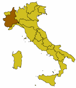
Occhieppo Inferiore is a charming area located in the Piedmont region of northwestern Italy, close to the town of Biella. The surrounding landscape is characterized by beautiful hills, lush forests, and scenic views of the surrounding mountains, making it an excellent destination for hiking enthusiasts.
Hiking Trails
In and around Occhieppo Inferiore, you'll find a variety of hiking trails suitable for different skill levels. Most trails typically offer a blend of:
- Easy Walks: These trails are great for families and beginners, providing accessible paths through scenic forests and gentle hills.
- Moderate Hikes: For those looking for a bit more challenge, there are trails that lead to higher elevations, offering panoramic views of the Biella area and the surrounding Alps.
- Challenging Routes: Experienced hikers can explore more demanding trails that may involve steeper ascents and rocky terrains.
Natural Attractions
Hikers can enjoy beautiful landscapes, including:
- Forests: The area is rich in biodiversity, with various plant and animal species.
- Rivers and Streams: Many trails follow watercourses, adding to the scenic beauty of the hikes.
- Mountains: The nearby mountains offer stunning views, especially from higher vantage points.
Local Tips
- Best Time to Hike: Spring and early autumn are ideal for hiking in this region, as the weather is usually mild and the trails are less crowded.
- Preparation: Ensure you have proper hiking gear, including sturdy footwear, water, snacks, and a map or GPS device. Familiarize yourself with local regulations and trail markers.
- Guided Tours: If you're unfamiliar with the area, consider joining a guided hike to learn more about the local environment and history.
Nearby Attractions
After a day of hiking, you might want to explore the charming villages, local cuisine, and cultural landmarks in the Biella area. The region is known for its rich textiles and history, which can provide a lovely ending to your hiking adventure.
Overall, hiking in Occhieppo Inferiore and the surrounding area can be a rewarding experience for outdoor enthusiasts and nature lovers alike.
- Country:

- Postal Code: 13897
- Local Dialing Code: 015
- Licence Plate Code: BI
- Coordinates: 45° 31' 0" N, 8° 0' 0" E


- GPS tracks (wikiloc): [Link]
- AboveSeaLevel: 416 м m
- Area: 4.06 sq km
- Population: 3965
- Web site: http://www.comune.occhieppo-inferiore.bi.it
- Wikipedia en: wiki(en)
- Wikipedia: wiki(it)
- Wikidata storage: Wikidata: Q18092
- Wikipedia Commons Category: [Link]
- Freebase ID: [/m/0gr29l]
- GeoNames ID: Alt: [6537991]
- VIAF ID: Alt: [245452344]
- OSM relation ID: [45268]
- UN/LOCODE: [ITOCI]
- ISTAT ID: 096040
- Italian cadastre code: F992
Shares border with regions:

Biella
- Italian comune
Hiking in Biella
Biella, located in the Piedmont region of northern Italy, is a fantastic destination for hiking enthusiasts. The area is characterized by its stunning landscapes, rolling hills, and the backdrop of the surrounding Alps. Here are some highlights and key information regarding hiking in Biella:...
- Country:
- Postal Code: 13900
- Local Dialing Code: 015
- Licence Plate Code: BI
- Coordinates: 45° 33' 59" N, 8° 3' 12" E
- GPS tracks (wikiloc): [Link]
- AboveSeaLevel: 420 м m
- Area: 46.69 sq km
- Population: 44616
- Web site: [Link]

Camburzano
- Italian comune
Hiking in Camburzano
Camburzano is a small commune located in the Piedmont region of northern Italy, known for its scenic landscapes and natural beauty. While it may not be as famous as some larger destinations, it offers opportunities for hiking and exploring the surrounding countryside....
- Country:
- Postal Code: 13891
- Local Dialing Code: 015
- Licence Plate Code: BI
- Coordinates: 45° 33' 0" N, 7° 59' 0" E
- GPS tracks (wikiloc): [Link]
- AboveSeaLevel: 420 м m
- Area: 3.8 sq km
- Population: 1178
- Web site: [Link]

Mongrando
- Italian comune
Hiking in Mongrando
Mongrando is a small town in the Piedmont region of Italy, situated near the foothills of the Alps. While it may not be as widely known as some other hiking destinations, it offers beautiful landscapes and opportunities for outdoor activities, including hiking. Here are some details about hiking in and around Mongrando:...
- Country:
- Postal Code: 13888
- Local Dialing Code: 015
- Licence Plate Code: BI
- Coordinates: 45° 31' 0" N, 8° 0' 0" E
- GPS tracks (wikiloc): [Link]
- AboveSeaLevel: 355 м m
- Area: 16.5 sq km
- Population: 3800
- Web site: [Link]

Occhieppo Superiore
- Italian comune
Hiking in Occhieppo Superiore
Occhieppo Superiore is a charming municipality located in the province of Biella in northern Italy. It is surrounded by the beautiful Alpine landscape, which offers a range of hiking opportunities for both beginners and experienced hikers....
- Country:
- Postal Code: 13898
- Local Dialing Code: 015
- Licence Plate Code: BI
- Coordinates: 45° 30' 0" N, 8° 0' 0" E
- GPS tracks (wikiloc): [Link]
- AboveSeaLevel: 465 м m
- Area: 5.15 sq km
- Population: 2728
- Web site: [Link]

Ponderano
- Italian comune
Hiking in Ponderano
Ponderano, located in the Piedmont region of Italy, is a charming area surrounded by beautiful landscapes and offers a variety of hiking opportunities. While it may not be as widely known as some larger national parks, it provides a fantastic experience for both seasoned hikers and those new to outdoor adventures....
- Country:
- Postal Code: 13875
- Local Dialing Code: 015
- Licence Plate Code: BI
- Coordinates: 45° 30' 0" N, 8° 2' 0" E
- GPS tracks (wikiloc): [Link]
- AboveSeaLevel: 357 м m
- Area: 7.05 sq km
- Population: 3783
- Web site: [Link]