Ponderano (Ponderano)

- Italian comune
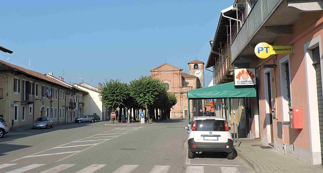
 Hiking in Ponderano
Ponderano, located in the Piedmont region of Italy, is a charming area surrounded by beautiful landscapes and offers a variety of hiking opportunities. While it may not be as widely known as some larger national parks, it provides a fantastic experience for both seasoned hikers and those new to outdoor adventures.
Key Hiking Features in Ponderano:
-
Scenic Trails: The area around Ponderano is characterized by rolling hills, lush forests, and stunning views of the surrounding mountains. Trails range from easy walks suitable for families to more challenging hikes for experienced adventurers.
-
Nature & Wildlife: As you hike, take the time to appreciate the rich biodiversity of the region. You may encounter various flora and fauna, including unique plant species and potential wildlife sightings.
-
Cultural Sites: Some trails may lead you to interesting cultural or historical sites, such as old churches, ruins, or viewpoints that provide insight into the local heritage.
-
Accessibility: Ponderano has various access points to hiking trails, making it convenient for day hikes or longer excursions. It is also a great area for maintaining proximity to local amenities.
-
Seasonal Hiking: The best hiking months are typically from late spring to early autumn, when the weather is mild, and the trails are dry. Each season offers a different perspective on the landscape, with vibrant autumn foliage or the fresh greens of spring.
Hiking Tips for Ponderano:
- Stay Hydrated: Always carry enough water, especially during warmer months.
- Wear Appropriate Gear: Comfortable, durable footwear and weather-appropriate clothing are essential.
- Trail Maps: Bring a map or use a hiking app to navigate the trails.
- Leave No Trace: Respect the natural environment by following Leave No Trace principles.
- Local Guidance: Consider reaching out to local hiking groups or guides for tips and advice on the best trails.
Conclusion:
Whether you're looking for a leisurely stroll through nature or an invigorating hike with challenging terrain, Ponderano has something to offer every hiking enthusiast. Enjoy your exploration of this beautiful region!
- Country:

- Postal Code: 13875
- Local Dialing Code: 015
- Licence Plate Code: BI
- Coordinates: 45° 30' 0" N, 8° 2' 0" E


- GPS tracks (wikiloc): [Link]
- AboveSeaLevel: 357 м m
- Area: 7.05 sq km
- Population: 3783
- Web site: http://www.comune.ponderano.bi.it/on-line/Home.html
- Wikipedia en: wiki(en)
- Wikipedia: wiki(it)
- Wikidata storage: Wikidata: Q18147
- Wikipedia Commons Category: [Link]
- Freebase ID: [/m/0c4j6t]
- GeoNames ID: Alt: [6543658]
- VIAF ID: Alt: [239239256]
- OSM relation ID: [45220]
- UN/LOCODE: [ITIPE]
- ISTAT ID: 096047
- Italian cadastre code: G820
Shares border with regions:

Biella
- Italian comune
Hiking in Biella
Biella, located in the Piedmont region of northern Italy, is a fantastic destination for hiking enthusiasts. The area is characterized by its stunning landscapes, rolling hills, and the backdrop of the surrounding Alps. Here are some highlights and key information regarding hiking in Biella:...
- Country:
- Postal Code: 13900
- Local Dialing Code: 015
- Licence Plate Code: BI
- Coordinates: 45° 33' 59" N, 8° 3' 12" E
- GPS tracks (wikiloc): [Link]
- AboveSeaLevel: 420 м m
- Area: 46.69 sq km
- Population: 44616
- Web site: [Link]
Borriana
- Italian comune
Hiking in Borriana
Borriana is a charming town in the province of Biella, located in the Piedmont region of Northern Italy. The area around Borriana offers a variety of hiking opportunities that cater to different skill levels and interests, making it a wonderful destination for outdoor enthusiasts....
- Country:
- Postal Code: 13872
- Local Dialing Code: 015
- Licence Plate Code: BI
- Coordinates: 45° 30' 0" N, 8° 2' 0" E
- GPS tracks (wikiloc): [Link]
- AboveSeaLevel: 350 м m
- Area: 5.35 sq km
- Population: 889
- Web site: [Link]

Gaglianico
- Italian comune
Hiking in Gaglianico
Gaglianico is a charming municipality located in the province of Biella in the Piedmont region of Italy. While it may not be a well-known hiking destination compared to larger national parks or mountain ranges, Gaglianico and its surrounding areas offer some lovely trails and natural beauty suitable for hiking enthusiasts....
- Country:
- Postal Code: 13894
- Local Dialing Code: 015
- Licence Plate Code: BI
- Coordinates: 45° 33' 0" N, 8° 7' 0" E
- GPS tracks (wikiloc): [Link]
- AboveSeaLevel: 353 м m
- Area: 4.5 sq km
- Population: 3775
- Web site: [Link]

Mongrando
- Italian comune
Hiking in Mongrando
Mongrando is a small town in the Piedmont region of Italy, situated near the foothills of the Alps. While it may not be as widely known as some other hiking destinations, it offers beautiful landscapes and opportunities for outdoor activities, including hiking. Here are some details about hiking in and around Mongrando:...
- Country:
- Postal Code: 13888
- Local Dialing Code: 015
- Licence Plate Code: BI
- Coordinates: 45° 31' 0" N, 8° 0' 0" E
- GPS tracks (wikiloc): [Link]
- AboveSeaLevel: 355 м m
- Area: 16.5 sq km
- Population: 3800
- Web site: [Link]

Occhieppo Inferiore
- Italian comune
Hiking in Occhieppo Inferiore
Occhieppo Inferiore is a charming area located in the Piedmont region of northwestern Italy, close to the town of Biella. The surrounding landscape is characterized by beautiful hills, lush forests, and scenic views of the surrounding mountains, making it an excellent destination for hiking enthusiasts....
- Country:
- Postal Code: 13897
- Local Dialing Code: 015
- Licence Plate Code: BI
- Coordinates: 45° 31' 0" N, 8° 0' 0" E
- GPS tracks (wikiloc): [Link]
- AboveSeaLevel: 416 м m
- Area: 4.06 sq km
- Population: 3965
- Web site: [Link]

Sandigliano
- Italian comune
Hiking in Sandigliano
Sandigliano, a charming municipality located in the Piedmont region of Italy, offers a variety of hiking opportunities, particularly for those looking to explore the scenic landscapes of the surrounding area. While Sandigliano itself may not have extensive trail systems, it is close to other natural attractions and hiking routes in the region....
- Country:
- Postal Code: 13876
- Local Dialing Code: 015
- Licence Plate Code: BI
- Coordinates: 45° 30' 0" N, 8° 2' 0" E
- GPS tracks (wikiloc): [Link]
- AboveSeaLevel: 323 м m
- Area: 10.22 sq km
- Population: 2665
- Web site: [Link]