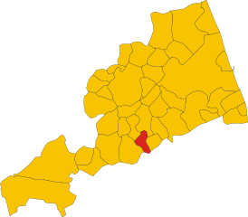
Monsampietro Morico (Monsampietro Morico)
.svg)
- Italian comune
 Hiking in Monsampietro Morico
Monsampietro Morico is a small, picturesque village located in the Marche region of Italy, known for its beautiful landscapes and hiking opportunities. The surrounding area is characterized by rolling hills, lush forests, and stunning views of the Apennine mountains, making it a great destination for hiking enthusiasts.
Hiking Opportunities:
-
Trails: There are various marked hiking trails in and around Monsampietro Morico, suitable for various skill levels. You can find routes that range from easy walks to more challenging hikes.
-
Natural Parks: The nearby Monti Sibillini National Park offers a plethora of hiking options. This park is known for its diverse flora and fauna, as well as its breathtaking scenery.
-
Historic Paths: Some trails may follow paths that have historical significance or lead to ancient ruins, providing not only a physical challenge but also a journey through the region's rich history.
-
Views: Many trails offer panoramic views of the surrounding countryside, with opportunities for photography, birdwatching, and just enjoying the tranquility of nature.
Practical Tips:
-
Best Time to Hike: The best hiking season in this region is generally from spring (April to June) to early fall (September to October), when the weather is mild, and the scenery is at its best.
-
Preparation: Make sure to wear sturdy hiking shoes and bring sufficient water, snacks, and a map or GPS device, as some trails may not be well-marked.
-
Local Guides: Consider joining a guided hiking tour to learn more about the geological and cultural aspects of the area. Local guides can provide valuable insights and enhance your hiking experience.
-
Respect the Environment: Always follow the Leave No Trace principles. Stay on marked trails and carry out any waste to help preserve the natural beauty of the region.
Hiking in Monsampietro Morico can be a peaceful and rewarding experience, offering a unique blend of nature, culture, and stunning scenery.
- Country:

- Postal Code: 63842
- Local Dialing Code: 0734
- Licence Plate Code: FM
- Coordinates: 43° 4' 3" N, 13° 33' 22" E


- GPS tracks (wikiloc): [Link]
- AboveSeaLevel: 289 м m
- Area: 9.76 sq km
- Population: 637
- Web site: http://www.provincia.ap.it/Monsampietro_Morico/
- Wikipedia en: wiki(en)
- Wikipedia: wiki(it)
- Wikidata storage: Wikidata: Q59236
- Wikipedia Commons Category: [Link]
- Freebase ID: [/m/0gl82x]
- GeoNames ID: Alt: [6538536]
- OSM relation ID: [42299]
- TGN ID: [7054437]
- Google Maps Customer ID: [290531176775783616]
- ISTAT ID: 109012
- Italian cadastre code: F379
Shares border with regions:
Belmonte Piceno
- Italian comune
Hiking in Belmonte Piceno
Belmonte Piceno is a charming village located in the Marche region of Italy, known for its beautiful landscapes and rich history. Hiking in and around Belmonte Piceno offers a wonderful way to explore the natural beauty and cultural heritage of the area. Here are some highlights of hiking in this region:...
- Country:
- Postal Code: 63838
- Local Dialing Code: 0734
- Licence Plate Code: FM
- Coordinates: 43° 5' 29" N, 13° 32' 20" E
- GPS tracks (wikiloc): [Link]
- AboveSeaLevel: 312 м m
- Area: 10.53 sq km
- Population: 624
- Web site: [Link]

Monte Rinaldo
- Italian comune
Hiking in Monte Rinaldo
Monte Rinaldo is part of the Monti Sibillini National Park, located in central Italy, specifically in the Marche region. This area is loved for its stunning landscapes, diverse flora and fauna, and a variety of hiking trails suitable for different levels of experience....
- Country:
- Postal Code: 63852
- Local Dialing Code: 0734
- Licence Plate Code: FM
- Coordinates: 43° 1' 42" N, 13° 34' 51" E
- GPS tracks (wikiloc): [Link]
- AboveSeaLevel: 485 м m
- Area: 8 sq km
- Population: 359
- Web site: [Link]
Monteleone di Fermo
- Italian comune
Hiking in Monteleone di Fermo
Monteleone di Fermo is a charming village located in the Marche region of Italy, surrounded by beautiful landscapes ideal for hiking enthusiasts. Here’s an overview of what you can expect when hiking in this area:...
- Country:
- Postal Code: 63841
- Local Dialing Code: 0734
- Licence Plate Code: FM
- Coordinates: 43° 2' 51" N, 13° 31' 43" E
- GPS tracks (wikiloc): [Link]
- AboveSeaLevel: 427 м m
- Area: 8.21 sq km
- Population: 381
- Web site: [Link]


Montelparo
- Italian comune
Hiking in Montelparo
Montelparo is a charming hilltop village located in the Marche region of Italy, surrounded by beautiful landscapes, rolling hills, and rich natural beauty. Hiking in and around Montelparo offers a variety of trails suitable for different experience levels, providing stunning views of the surrounding countryside, vineyards, and distant mountains....
- Country:
- Postal Code: 63853
- Local Dialing Code: 0734
- Licence Plate Code: FM
- Coordinates: 43° 1' 5" N, 13° 32' 7" E
- GPS tracks (wikiloc): [Link]
- AboveSeaLevel: 588 м m
- Area: 21.63 sq km
- Population: 758
- Web site: [Link]


Montottone
- Italian comune
Hiking in Montottone
Montottone is a charming hilltop village located in the Marche region of Italy. Known for its picturesque landscapes, rich history, and beautiful architecture, it offers a variety of hiking opportunities for outdoor enthusiasts. Here are some aspects to consider if you're planning to hike in and around Montottone:...
- Country:
- Postal Code: 63843
- Local Dialing Code: 0734
- Licence Plate Code: FM
- Coordinates: 43° 3' 43" N, 13° 35' 5" E
- GPS tracks (wikiloc): [Link]
- AboveSeaLevel: 277 м m
- Area: 16.38 sq km
- Population: 978
- Web site: [Link]