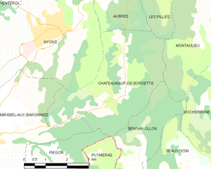
Montaulieu (Montaulieu)

- commune in Drôme, France
 Hiking in Montaulieu
Montaulieu, located in the Vaucluse region of France, offers a variety of hiking opportunities that cater to different skill levels. The area is known for its beautiful landscapes, including hills, forests, and panoramic views of the surrounding countryside. Here are some key points about hiking in Montaulieu:
- Difficulty Levels: Hiking trails range from easy walks suitable for families to more challenging routes for experienced hikers.
- Typical Routes: Popular paths often lead to scenic viewpoints, historical sites, and natural landmarks. Look for paths that follow the contours of the hills or through local vineyards.
- Montaulieu offers stunning vistas of the nearby Luberon Mountains and the expansive Provencal landscape. Make sure to bring a camera to capture the breathtaking views.
- The region has diverse flora, including lavender fields, olive groves, and Mediterranean vegetation. Keep an eye out for local wildlife, such as birds and small mammals.
- Spring (April to June) and Fall (September to October) are the best times to hike, as the weather is usually mild and the landscapes are vibrant with blooming flowers or autumn colors.
- Summer can be quite hot, so it’s advisable to hike early in the morning or later in the evening.
- Footwear: Wear sturdy hiking boots for comfort and support on varying terrain.
- Essentials: Bring plenty of water, snacks, a map or GPS device, and a first-aid kit. Sunscreen and hats are also recommended during sunny days.
- Stay on marked trails to preserve the local ecosystem and avoid getting lost. Check local regulations regarding camping or any potential fees.
- Montaulieu is accessible by car, and many trailheads are within a short drive. Public transport options may be limited, so plan accordingly.
- Besides hiking, you can explore the local culture, visit nearby historical towns, or enjoy local cuisine in nearby villages.
It’s always good to check local resources or hiking guides for the latest trail conditions and recommendations before heading out. Enjoy your hikes in Montaulieu!
- Country:

- Postal Code: 26110
- Coordinates: 44° 21' 28" N, 5° 13' 26" E


- GPS tracks (wikiloc): [Link]
- Area: 13.05 sq km
- Population: 82
- Web site: http://www.montaulieu.eu
- Wikipedia en: wiki(en)
- Wikipedia: wiki(fr)
- Wikidata storage: Wikidata: Q1014966
- Wikipedia Commons Category: [Link]
- Freebase ID: [/m/03mhj5l]
- GeoNames ID: Alt: [6430132]
- SIREN number: [212601900]
- BnF ID: [15253051v]
- VIAF ID: Alt: [242804126]
- INSEE municipality code: 26190
Shares border with regions:


Rochebrune
- commune in Drôme, France
Hiking in Rochebrune
Rochebrune is a picturesque region located in the Drôme department of southeastern France, known for its stunning natural landscapes and diverse hiking opportunities. If you're planning to hike in Rochebrune, here are some key points to consider:...
- Country:
- Postal Code: 26110
- Coordinates: 44° 20' 13" N, 5° 14' 44" E
- GPS tracks (wikiloc): [Link]
- Area: 16.15 sq km
- Population: 61


Curnier
- commune in Drôme, France
Hiking in Curnier
Curnier is a picturesque village located in the Jura Mountains of Switzerland. This region is known for its stunning landscapes, rich biodiversity, and well-marked hiking trails that cater to various skill levels. Here’s what you can expect when hiking in and around Curnier:...
- Country:
- Postal Code: 26110
- Coordinates: 44° 23' 6" N, 5° 14' 4" E
- GPS tracks (wikiloc): [Link]
- Area: 8 sq km
- Population: 177

Châteauneuf-de-Bordette
- commune in Drôme, France
Hiking in Châteauneuf-de-Bordette
Châteauneuf-de-Bordette is a small commune located in the Drôme department of southeastern France. The area is known for its picturesque landscapes, rolling hills, and access to the beautiful natural scenery of the Vercors Regional Natural Park, which offers numerous opportunities for hiking and outdoor activities....
- Country:
- Postal Code: 26110
- Coordinates: 44° 20' 8" N, 5° 10' 41" E
- GPS tracks (wikiloc): [Link]
- Area: 15.33 sq km
- Population: 93


Arpavon
- commune in Drôme, France
Hiking in Arpavon
Arpavon, located in the scenic region of the Drôme Provençale in southeastern France, offers a delightful experience for hikers. The area is characterized by its diverse landscapes, including hills, vineyards, and picturesque villages, making it an ideal destination for nature lovers....
- Country:
- Postal Code: 26110
- Coordinates: 44° 22' 12" N, 5° 16' 4" E
- GPS tracks (wikiloc): [Link]
- Area: 13.45 sq km
- Population: 81


Les Pilles
- commune in Drôme, France
Hiking in Les Pilles
Les Pilles is a beautiful area located in the Vaucluse region of France, known for its stunning natural landscapes and varied hiking opportunities. Here are some key points to consider when planning a hiking trip in Les Pilles:...
- Country:
- Postal Code: 26110
- Coordinates: 44° 22' 46" N, 5° 11' 26" E
- GPS tracks (wikiloc): [Link]
- Area: 5.84 sq km
- Population: 246


Bénivay-Ollon
- commune in Drôme, France
Hiking in Bénivay-Ollon
Bénivay-Ollon, located in the beautiful French Alps, offers a variety of hiking opportunities for outdoor enthusiasts. The region is characterized by stunning mountain landscapes, lush forests, and a rich array of wildlife. Here are some key points to consider if you're planning a hike in this area:...
- Country:
- Postal Code: 26170
- Coordinates: 44° 17' 52" N, 5° 11' 25" E
- GPS tracks (wikiloc): [Link]
- Area: 9.03 sq km
- Population: 58