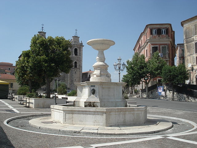
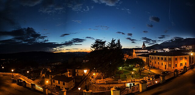
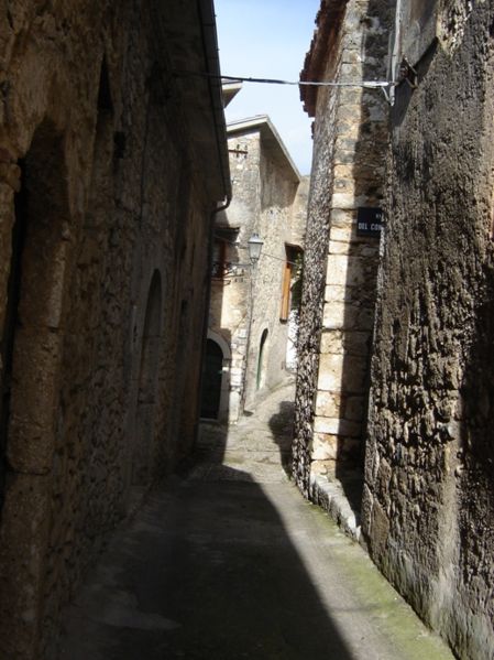
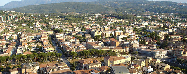
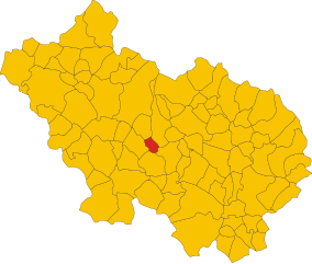
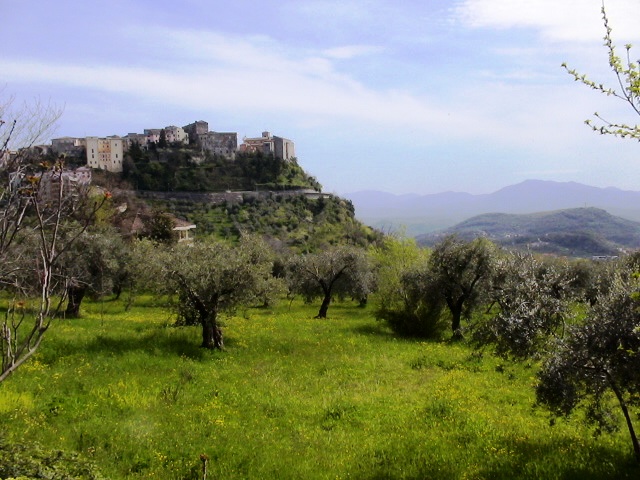
Monte San Giovanni Campano (Monte San Giovanni Campano)
.svg)
- Italian comune
 Hiking in Monte San Giovanni Campano
Monte San Giovanni Campano is a charming town located in the province of Frosinone, in the Lazio region of Italy. It is set in a picturesque landscape characterized by rolling hills, lush vegetation, and historical sites. Hiking in and around Monte San Giovanni Campano can provide an excellent opportunity for both nature lovers and those interested in exploring the historical backdrop of the region.
Hiking Trails
-
Local Paths: There are several well-marked local trails around Monte San Giovanni Campano that cater to various skill levels. These paths often wind through forests, open fields, and olive groves, offering scenic views of the surrounding countryside.
-
Monte Cavo: A popular hiking destination nearby is Monte Cavo, which offers a more challenging hike and panoramic views of the area. It’s a great spot for those looking to enjoy a more strenuous trek.
-
Nature Reserves: The nearby Monti Ernici and other natural parks and reserves provide additional hiking opportunities, with trails that vary significantly in difficulty and length. Exploring these areas can lead you to discover diverse flora and fauna.
What to Expect
-
Natural Beauty: As you hike, you will encounter stunning landscapes, ranging from wooded areas to sweeping hilltops, where you can take in breathtaking views of the Valle di Comino and the surrounding towns.
-
Wildlife: The region is home to various species of birds and other wildlife, making it a delightful experience for nature enthusiasts.
-
Historical Sites: While hiking, you may come across ancient ruins, churches, and other historical landmarks that reflect the rich history of the area.
Tips for Hiking in Monte San Giovanni Campano
-
Prepare: Always check the weather before heading out and dress accordingly. Good hiking shoes are essential due to some trails being rocky or uneven.
-
Stay Hydrated: Carry enough water, especially during the warmer months, to keep yourself hydrated.
-
Local Guidance: Consider hiring a local guide if you want to explore less-known trails or if you're unfamiliar with the area. They can provide insightful information about the landscape and history.
-
Respect Nature: Follow the Leave No Trace principles by not littering and staying on marked paths to preserve the area's beauty.
-
Timing: Early mornings or late afternoons are often the best times to hike, as you can enjoy cooler temperatures and stunning sunrise or sunset views.
Monte San Giovanni Campano is an excellent choice for anyone looking to enjoy hiking surrounded by nature and culture. Whether you are a seasoned hiker or a casual walker, there’s something for everyone in this beautiful part of Italy.
- Country:

- Postal Code: 03025
- Local Dialing Code: 0775
- Licence Plate Code: FR
- Coordinates: 41° 38' 0" N, 13° 31' 0" E


- GPS tracks (wikiloc): [Link]
- AboveSeaLevel: 420 м m
- Area: 48.71 sq km
- Population: 12706
- Web site: http://www.comune.montesangiovannicampano.fr.it/
- Wikipedia en: wiki(en)
- Wikipedia: wiki(it)
- Wikidata storage: Wikidata: Q116952
- Wikipedia Commons Category: [Link]
- Freebase ID: [/m/0gmx4b]
- GeoNames ID: Alt: [6536986]
- VIAF ID: Alt: [266023881]
- OSM relation ID: [41415]
- MusicBrainz area ID: [d7ce5b7e-2739-4e27-8a62-ec6457e73770]
- ISTAT ID: 060044
- Italian cadastre code: F620
Shares border with regions:

Arce
- Italian comune
Hiking in Arce
Hiking in Arce, a charming town in the Lazio region of Italy, offers a blend of stunning natural landscapes, historical sites, and local culture. Situated in the province of Frosinone, Arce is surrounded by the picturesque Aurunci Mountains and is not far from the beautiful landscapes of the Ciociaria area....
- Country:
- Postal Code: 03032
- Local Dialing Code: 0776
- Licence Plate Code: FR
- Coordinates: 41° 35' 0" N, 13° 35' 0" E
- GPS tracks (wikiloc): [Link]
- AboveSeaLevel: 247 м m
- Area: 39.52 sq km
- Population: 5670
- Web site: [Link]


Arpino
- Italian comune
Hiking in Arpino
Arpino is a picturesque town located in the province of Frosinone, in the Lazio region of Italy. Surrounded by the breathtaking landscapes of the Italian countryside, it offers various hiking opportunities for outdoor enthusiasts. Here are some highlights of hiking in and around Arpino:...
- Country:
- Postal Code: 03033
- Local Dialing Code: 0776
- Licence Plate Code: FR
- Coordinates: 41° 38' 49" N, 13° 36' 42" E
- GPS tracks (wikiloc): [Link]
- AboveSeaLevel: 450 м m
- Area: 56.24 sq km
- Population: 7150
- Web site: [Link]


Boville Ernica
- Italian comune
Hiking in Boville Ernica
Boville Ernica is a charming town located in the province of Frosinone in the Lazio region of Italy. Nestled in the foothills of the Abruzzo Apennines, it offers not only historical sites but also a variety of outdoor activities, including hiking. Here are some highlights you might consider when hiking in and around Boville Ernica:...
- Country:
- Postal Code: 03022
- Local Dialing Code: 0775
- Licence Plate Code: FR
- Coordinates: 41° 38' 33" N, 13° 28' 26" E
- GPS tracks (wikiloc): [Link]
- AboveSeaLevel: 450 м m
- Area: 28.19 sq km
- Population: 8525
- Web site: [Link]

Castelliri
- Italian comune
Hiking in Castelliri
Castelliri is a small town located in the province of Frosinone in the Lazio region of Italy. Nestled in the picturesque Apennine Mountains, the area offers a variety of hiking opportunities, ranging from easy walks to more challenging trails, with stunning views of the surrounding countryside....
- Country:
- Postal Code: 03030
- Local Dialing Code: 0776
- Licence Plate Code: FR
- Coordinates: 41° 41' 0" N, 13° 33' 0" E
- GPS tracks (wikiloc): [Link]
- AboveSeaLevel: 261 м m
- Area: 15.32 sq km
- Population: 3411
- Web site: [Link]

Fontana Liri
- Italian comune
Hiking in Fontana Liri
Fontana Liri, located in the Province of Frosinone in Italy, is a beautiful destination for hiking enthusiasts. Nestled in the scenic Apennine mountains, it offers a mix of rural landscapes, lush forests, and stunning mountain views. Here are some highlights and tips for hiking in the Fontana Liri area:...
- Country:
- Postal Code: 03035
- Local Dialing Code: 0776
- Licence Plate Code: FR
- Coordinates: 41° 37' 1" N, 13° 34' 16" E
- GPS tracks (wikiloc): [Link]
- AboveSeaLevel: 150 м m
- Area: 16.11 sq km
- Population: 2906
- Web site: [Link]

Sora, Lazio
- Italian comune
Hiking in Sora, Lazio
Sora, located in the Lazio region of Italy, is a wonderful destination for hikers and nature enthusiasts. Nestled in the Valle di Comino and surrounded by the Apennine Mountains, Sora offers various trails that cater to different skill levels, all set against stunning landscapes featuring lush forests, rivers, and picturesque views....
- Country:
- Postal Code: 03039
- Local Dialing Code: 0776
- Licence Plate Code: FR
- Coordinates: 41° 43' 0" N, 13° 37' 0" E
- GPS tracks (wikiloc): [Link]
- AboveSeaLevel: 300 м m
- Area: 72.13 sq km
- Population: 25972
- Web site: [Link]

Strangolagalli
- Italian comune
Hiking in Strangolagalli
Strangolagalli is a charming locality nestled in the province of Frosinone in the Lazio region of Italy. While it may not be as well-known as some of Italy's larger hiking destinations, it offers serene landscapes and opportunities to explore the natural beauty of the area....
- Country:
- Postal Code: 03020
- Local Dialing Code: 0775
- Licence Plate Code: FR
- Coordinates: 41° 36' 0" N, 13° 29' 32" E
- GPS tracks (wikiloc): [Link]
- AboveSeaLevel: 232 м m
- Area: 10.57 sq km
- Population: 2414
- Web site: [Link]

Veroli
- Italian comune
Hiking in Veroli
Veroli, a charming town situated in the province of Frosinone in the Lazio region of Italy, offers excellent opportunities for hiking enthusiasts. Nestled in the beautiful hills of the Ciociaria area, Veroli boasts stunning landscapes, rich history, and a variety of trails suitable for different experience levels....
- Country:
- Postal Code: 03029
- Local Dialing Code: 0775
- Licence Plate Code: FR
- Coordinates: 41° 41' 0" N, 13° 25' 0" E
- GPS tracks (wikiloc): [Link]
- AboveSeaLevel: 594 м m
- Area: 119.65 sq km
- Population: 20414
- Web site: [Link]