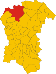
Montebello di Bertona (Montebello di Bertona)
.svg)
- Italian comune
 Hiking in Montebello di Bertona
Montebello di Bertona is a beautiful destination for hikers, located in the Abruzzo region of Italy. Nestled in the Gran Sasso e Monti della Laga National Park, it offers a range of trails that showcase stunning landscapes, diverse flora and fauna, and breathtaking views of the surrounding mountains and valleys.
Key Features of Hiking in Montebello di Bertona:
-
Scenic Trails: The area has various hiking trails suitable for different skill levels. Some trails are easy and family-friendly, while others may require more experience and physical fitness. The routes often lead through woodland areas, meadows, and rocky paths, providing a chance to enjoy nature's beauty.
-
Wildlife: The region is home to a variety of wildlife, including deer, foxes, and numerous bird species. Hikers may have the opportunity to observe these animals in their natural habitat, particularly during quieter times of the day.
-
Flora: The biodiversity in Montebello di Bertona includes many native plant species, making it a great area for botany enthusiasts. Wildflowers bloom in the spring and summer, creating vibrant displays of color throughout the landscape.
-
Cultural Heritage: Along the trails, you can often find historical and cultural references, including old stone structures, churches, and remnants of ancient settlements. This adds an interesting aspect to the hike as you can learn about the region’s history.
-
Panoramic Views: Many trails lead to viewpoints that offer stunning panoramas of the surrounding mountains, valleys, and, depending on the altitude, even distant coastal areas. The views are particularly breathtaking during sunrise or sunset.
-
Access and Facilities: Montebello di Bertona can be accessed by car, and there are parking facilities available near popular trailheads. While there are some local amenities, it’s advisable to bring plenty of water, snacks, and possibly a lunch if you plan to hike for an extended period.
-
Best Times to Hike: The best times to hike in this area are generally in the spring and fall, when the weather is mild and the landscapes are particularly beautiful. Summer can be hot, while winter may bring snow and cold temperatures, which can make trekking more challenging.
Safety Tips:
- Always check the weather forecast before heading out.
- Bring appropriate footwear and clothing for hiking.
- Carry enough water and food for your hike, especially on longer routes.
- Inform someone about your hiking plans and expected return time.
Exploring Montebello di Bertona provides a rewarding experience, perfect for nature lovers and adventure seekers alike. Whether you're looking for a leisurely walk or a more challenging hike, the area has something to offer.
- Country:

- Postal Code: 65010
- Local Dialing Code: 085
- Licence Plate Code: PE
- Coordinates: 42° 25' 0" N, 13° 52' 0" E


- GPS tracks (wikiloc): [Link]
- AboveSeaLevel: 615 м m
- Area: 21.5 sq km
- Population: 945
- Web site: http://www.comune.montebello.pe.it/
- Wikipedia en: wiki(en)
- Wikipedia: wiki(it)
- Wikidata storage: Wikidata: Q51371
- Wikipedia Commons Category: [Link]
- Freebase ID: [/m/0fg8qk]
- GeoNames ID: Alt: [6537470]
- OSM relation ID: [42005]
- ISTAT ID: 068023
- Italian cadastre code: F441
Shares border with regions:


Civitella Casanova
- Italian comune
Hiking in Civitella Casanova
Civitella Casanova is a picturesque village in the Abruzzo region of Italy, known for its natural beauty, historical architecture, and stunning landscapes. Hiking in this area offers an opportunity to explore the scenic countryside, enjoy panoramic views, and experience the rich flora and fauna of the region....
- Country:
- Postal Code: 65010
- Local Dialing Code: 085
- Licence Plate Code: PE
- Coordinates: 42° 22' 0" N, 13° 53' 0" E
- GPS tracks (wikiloc): [Link]
- AboveSeaLevel: 400 м m
- Area: 31.1 sq km
- Population: 1759
- Web site: [Link]


Farindola
- Italian comune
Hiking in Farindola
Farindola is a charming village located in the Gran Sasso e Monti della Laga National Park in Italy, offering a variety of hiking opportunities that cater to different skill levels and preferences. The surrounding landscape is characterized by stunning mountain scenery, rich biodiversity, and numerous trails that explore both natural and cultural sites. Here are some aspects to consider when hiking in and around Farindola:...
- Country:
- Postal Code: 65010
- Local Dialing Code: 085
- Licence Plate Code: PE
- Coordinates: 42° 26' 30" N, 13° 49' 21" E
- GPS tracks (wikiloc): [Link]
- AboveSeaLevel: 530 м m
- Area: 45.47 sq km
- Population: 1456
- Web site: [Link]

Penne, Abruzzo
- Italian comune
Hiking in Penne, Abruzzo
Hiking in Penne, a charming town in the Abruzzo region of Italy, offers you a rich blend of natural beauty, historical significance, and cultural experiences. Here are some highlights and tips for hiking in this picturesque area:...
- Country:
- Postal Code: 65017
- Local Dialing Code: 085
- Licence Plate Code: PE
- Coordinates: 42° 27' 0" N, 13° 55' 0" E
- GPS tracks (wikiloc): [Link]
- AboveSeaLevel: 438 м m
- Area: 91.2 sq km
- Population: 12113
- Web site: [Link]


Villa Celiera
- Italian comune
Hiking in Villa Celiera
Villa Celiera, a picturesque town nestled in the Abruzzo region of Italy, offers a fantastic hiking experience for nature enthusiasts. The area is characterized by its stunning landscapes, including rolling hills, dense forests, and panoramic views of the Gran Sasso and Maiella mountain ranges. Here are some key aspects of hiking in and around Villa Celiera:...
- Country:
- Postal Code: 65010
- Local Dialing Code: 085
- Licence Plate Code: PE
- Coordinates: 42° 22' 49" N, 13° 51' 33" E
- GPS tracks (wikiloc): [Link]
- AboveSeaLevel: 714 м m
- Area: 13.18 sq km
- Population: 652
- Web site: [Link]