
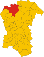
Province of Pescara (provincia di Pescara)

- province of Italy
 Hiking in Province of Pescara
The Province of Pescara, located in the Abruzzo region of Italy, offers a variety of hiking opportunities that allow you to experience picturesque landscapes, diverse ecosystems, and charming villages. Here are some highlights and tips for hiking in this beautiful area:
Highlights of Hiking in the Province of Pescara:
-
Majella National Park: A large protected area with numerous hiking trails ranging from easy walks to challenging treks. The park is known for its rugged mountains, deep valleys, and rich biodiversity. Popular trails include those leading to the famous Hermitage of S.S. Spirito and the beautiful Campo di Giove area.
-
Gran Sasso and Monti della Laga National Park: While it's mainly in the neighboring province, it’s easily accessible from Pescara. The park offers breathtaking views, especially from the summit of Corno Grande, the highest peak in the Apennines. Trails vary in difficulty, catering to both inexperienced walkers and seasoned hikers.
-
Civitella del Tronto: Near Pescara, this historic village provides a great starting point for various hikes in the surrounding hills. The fortress ruins and stunning views add cultural value to your outdoor experience.
-
Coastal Trails: The Adriatic coast offers more relaxed hiking opportunities along picturesque beach paths. You can enjoy the blend of sea and mountain views while walking from Pescara to neighboring coastal towns like Montesilvano or Silvi.
-
Local Flora and Fauna: In addition to stunning landscapes, Pescara's hiking routes often feature diverse wildlife and plant life, making it a suitable area for nature enthusiasts.
Tips for Hiking in Pescara:
-
Best Time to Hike: The ideal seasons for hiking are spring (April to June) and fall (September to October) when temperatures are mild, and the scenery is vibrant with wildflowers or autumn colors.
-
Trail Maps and Guides: It’s advisable to obtain trail maps or hire a local guide, especially for less marked trails. Local tourism offices can provide resources and information on the best routes.
-
Gear: Wear appropriate hiking footwear and pack layers of clothing. Weather conditions can change rapidly in mountainous areas. A backpack with water, snacks, and a first-aid kit is essential.
-
Stay Hydrated and Fuel Up: Bring enough water and energy-rich snacks to keep you energized during your hike.
-
Respect Nature: Follow the principle of "Leave No Trace" to protect the environment, and ensure you stick to marked paths to preserve wildlife habitats.
Overall, hiking in the Province of Pescara can be a rewarding experience that immerses you in Italy's natural beauty while providing opportunities for cultural exploration. Make sure to plan your hikes according to your skill level and enjoy the stunning landscapes that this picturesque region has to offer!
- Country:

- Capital: Pescara
- Postal Code: 65026–65029; 65022–65024; 65019–65020; 65016–65017; 65010–65014; 65121–65129
- Local Dialing Code: 085
- Licence Plate Code: PE
- Coordinates: 42° 27' 50" N, 14° 12' 51" E


- GPS tracks (wikiloc): [Link]
- Area: 1224.67 sq km
- Web site: http://comune.pescara.it
- Wikipedia en: wiki(en)
- Wikipedia: wiki(it)
- Wikidata storage: Wikidata: Q16242
- Wikipedia Commons Gallery: [Link]
- Wikipedia Commons Category: [Link]
- Freebase ID: [/m/041kqz]
- GeoNames ID: Alt: [3171163]
- GND ID: Alt: [4461367-2]
- archINFORM location ID: [2562]
- Library of Congress authority ID: Alt: [n83182360]
- MusicBrainz area ID: [7bb44f6e-cfb7-4224-80e0-4bfb6b71b34f]
- TGN ID: [1003484]
- Gran Enciclopèdia Catalana ID: [0050533]
- NUTS code: [ITF13]
- ISTAT ID: 068
- ISO 3166-2 code: IT-PE
Includes regions:


Pescara
- city in Abruzzo, Central Italy
Hiking in Pescara
Pescara, located on the Adriatic coast of Italy in the Abruzzo region, offers a variety of hiking opportunities, with scenic views of both the coastline and the surrounding mountains. Here are some key points to consider if you're planning a hiking trip in and around Pescara:...
- Country:
- Postal Code: 65121–65129
- Local Dialing Code: 085
- Licence Plate Code: PE
- Coordinates: 42° 27' 51" N, 14° 12' 51" E
- GPS tracks (wikiloc): [Link]
- AboveSeaLevel: 0 м m
- Area: 34.36 sq km
- Population: 120286
- Web site: [Link]

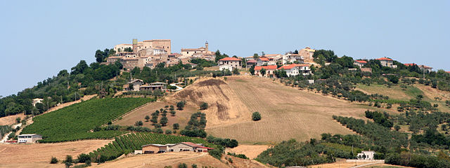
Bolognano
- Italian municipality
Hiking in Bolognano
Bolognano, a charming village in the Abruzzo region of Italy, is an excellent destination for hiking enthusiasts. Nestled in the foothills of the Apennines, it offers stunning landscapes, rich biodiversity, and a variety of trails suitable for different skill levels....
- Country:
- Postal Code: 65020
- Local Dialing Code: 085
- Licence Plate Code: PE
- Coordinates: 42° 13' 0" N, 13° 58' 0" E
- GPS tracks (wikiloc): [Link]
- AboveSeaLevel: 276 м m
- Area: 16.96 sq km
- Population: 1095
- Web site: [Link]


Abbateggio
- Italian comune
Hiking in Abbateggio
Abbateggio, a picturesque village in the Abruzzo region of Italy, offers a fantastic setting for hiking enthusiasts. Nestled in the heart of the Majella National Park, it boasts stunning natural landscapes, rich flora and fauna, and breathtaking views of the surrounding mountains. Here are some key points to consider when hiking in Abbateggio:...
- Country:
- Postal Code: 65020
- Local Dialing Code: 085
- Licence Plate Code: PE
- Coordinates: 42° 14' 0" N, 14° 1' 0" E
- GPS tracks (wikiloc): [Link]
- AboveSeaLevel: 530 м m
- Area: 15.4 sq km
- Population: 371
- Web site: [Link]


Alanno
- Italian comune
Hiking in Alanno
Alanno is a charming town located in the province of Pescara, in the Abruzzo region of Italy. It's surrounded by beautiful landscapes, making it a great destination for hiking enthusiasts. Here are some key points about hiking in and around Alanno:...
- Country:
- Postal Code: 65020
- Local Dialing Code: 085
- Licence Plate Code: PE
- Coordinates: 42° 18' 0" N, 13° 58' 0" E
- GPS tracks (wikiloc): [Link]
- AboveSeaLevel: 307 м m
- Area: 32.53 sq km
- Population: 3466
- Web site: [Link]


Brittoli
- Italian comune
Hiking in Brittoli
Brittoli, a picturesque mountain village in the Abruzzo region of Italy, offers stunning landscapes and a variety of hiking opportunities for outdoor enthusiasts. Nestled amidst the Apennine Mountains, Brittoli provides an excellent base for exploring the natural beauty and cultural heritage of the area....
- Country:
- Postal Code: 65010
- Local Dialing Code: 085
- Licence Plate Code: PE
- Coordinates: 42° 19' 1" N, 13° 51' 41" E
- GPS tracks (wikiloc): [Link]
- AboveSeaLevel: 779 м m
- Area: 15.99 sq km
- Population: 272
- Web site: [Link]


Bussi sul Tirino
- Italian comune
Hiking in Bussi sul Tirino
Bussi sul Tirino is a picturesque town located in the Abruzzo region of Italy, nestled along the Tirino River and surrounded by beautiful mountainous landscapes. This area offers a variety of hiking opportunities, catering to both novice and experienced hikers. Here are some highlights to consider when planning your hiking adventure in Bussi sul Tirino:...
- Country:
- Postal Code: 65022
- Local Dialing Code: 085
- Licence Plate Code: PE
- Coordinates: 42° 13' 0" N, 13° 49' 0" E
- GPS tracks (wikiloc): [Link]
- AboveSeaLevel: 344 м m
- Area: 25.91 sq km
- Population: 2447
- Web site: [Link]

Cappelle sul Tavo
- Italian comune
Hiking in Cappelle sul Tavo
Cappelle sul Tavo is a charming town located in the Abruzzo region of Italy, known for its beautiful landscapes and proximity to the Adriatic coast as well as the Apennine mountains. While Cappelle sul Tavo itself isn't a major hiking destination, it serves as a great base for exploring the surrounding natural areas that offer various hiking opportunities....
- Country:
- Postal Code: 65010
- Local Dialing Code: 085
- Licence Plate Code: PE
- Coordinates: 42° 28' 0" N, 14° 6' 0" E
- GPS tracks (wikiloc): [Link]
- AboveSeaLevel: 122 м m
- Area: 5.41 sq km
- Population: 4016
- Web site: [Link]


Caramanico Terme
- Italian comune
Hiking in Caramanico Terme
Caramanico Terme is a charming village located in the Abruzzo region of Italy, renowned for its thermal springs and stunning natural beauty. It’s nestled in the Majella National Park, making it an excellent destination for hiking enthusiasts. Here are some key points about hiking in the area:...
- Country:
- Postal Code: 65023
- Local Dialing Code: 085
- Licence Plate Code: PE
- Coordinates: 42° 9' 0" N, 14° 1' 0" E
- GPS tracks (wikiloc): [Link]
- AboveSeaLevel: 650 м m
- Area: 84.99 sq km
- Population: 1872
- Web site: [Link]


Carpineto della Nora
- Italian comune
Hiking in Carpineto della Nora
Carpineto della Nora, located in the Abruzzo region of Italy, offers a beautiful and varied terrain for hiking enthusiasts. The area is characterized by its picturesque landscapes, including mountains, forests, and scenic views of the surrounding countryside. Here are some key points about hiking in Carpineto della Nora:...
- Country:
- Postal Code: 65010
- Local Dialing Code: 085
- Licence Plate Code: PE
- Coordinates: 42° 20' 0" N, 13° 52' 0" E
- GPS tracks (wikiloc): [Link]
- AboveSeaLevel: 535 м m
- Area: 24.08 sq km
- Population: 623
- Web site: [Link]


Catignano
- Italian comune
Hiking in Catignano
Catignano is a charming town in the Abruzzo region of Italy, surrounded by beautiful landscapes and offering various hiking opportunities. When hiking in and around Catignano, you're likely to encounter a blend of natural beauty, historical sites, and local culture. Here are some highlights and tips for hiking in the area:...
- Country:
- Postal Code: 65011
- Local Dialing Code: 085
- Licence Plate Code: PE
- Coordinates: 42° 20' 49" N, 13° 57' 7" E
- GPS tracks (wikiloc): [Link]
- AboveSeaLevel: 365 м m
- Area: 17.03 sq km
- Population: 1337
- Web site: [Link]


Castiglione a Casauria
- Italian comune
Hiking in Castiglione a Casauria
Castiglione a Casauria is a picturesque village located in the Abruzzo region of Italy, nestled in the foothills of the Apennines. The area is known for its stunning natural landscapes, historical sites, and outdoor activities, making it a great destination for hiking enthusiasts....
- Country:
- Postal Code: 65020
- Local Dialing Code: 085
- Licence Plate Code: PE
- Coordinates: 42° 14' 13" N, 13° 53' 54" E
- GPS tracks (wikiloc): [Link]
- AboveSeaLevel: 350 м m
- Area: 16.57 sq km
- Population: 802
- Web site: [Link]
Cepagatti
- Italian comune
Hiking in Cepagatti
Cepagatti is a charming town located in the Abruzzo region of Italy, known for its picturesque landscapes and proximity to the Apennine Mountains. While it's not as famous as some other hiking destinations, it does offer opportunities for outdoor enthusiasts to explore the beautiful surrounding countryside. Here are some points to consider for hiking in and around Cepagatti:...
- Country:
- Postal Code: 65012
- Local Dialing Code: 085
- Licence Plate Code: PE
- Coordinates: 42° 21' 57" N, 14° 4' 36" E
- GPS tracks (wikiloc): [Link]
- AboveSeaLevel: 145 м m
- Area: 30.82 sq km
- Population: 11014
- Web site: [Link]


Città Sant'Angelo
- Italian comune
Hiking in Città Sant'Angelo
Città Sant'Angelo is a beautiful town located in the Abruzzo region of Italy, and it offers a variety of hiking opportunities for outdoor enthusiasts. Nestled in the hills of the Pescara province, it's known for its stunning landscapes, historic architecture, and charming medieval town center. Here are some key points about hiking in Città Sant'Angelo:...
- Country:
- Postal Code: 65013
- Local Dialing Code: 085
- Licence Plate Code: PE
- Coordinates: 42° 31' 0" N, 14° 3' 0" E
- GPS tracks (wikiloc): [Link]
- AboveSeaLevel: 322 м m
- Area: 62.02 sq km
- Population: 15034
- Web site: [Link]
Civitaquana
- Italian comune
Hiking in Civitaquana
Civitaquana, located in the Abruzzo region of Italy, offers an array of hiking opportunities for outdoor enthusiasts. Nestled in the Apennine Mountains, this charming village is surrounded by scenic landscapes, making it a fantastic destination for nature lovers. Here are some aspects to consider when hiking in Civitaquana:...
- Country:
- Postal Code: 65010
- Local Dialing Code: 085
- Licence Plate Code: PE
- Coordinates: 42° 20' 0" N, 13° 54' 0" E
- GPS tracks (wikiloc): [Link]
- AboveSeaLevel: 550 м m
- Area: 21.88 sq km
- Population: 1225
- Web site: [Link]


Civitella Casanova
- Italian comune
Hiking in Civitella Casanova
Civitella Casanova is a picturesque village in the Abruzzo region of Italy, known for its natural beauty, historical architecture, and stunning landscapes. Hiking in this area offers an opportunity to explore the scenic countryside, enjoy panoramic views, and experience the rich flora and fauna of the region....
- Country:
- Postal Code: 65010
- Local Dialing Code: 085
- Licence Plate Code: PE
- Coordinates: 42° 22' 0" N, 13° 53' 0" E
- GPS tracks (wikiloc): [Link]
- AboveSeaLevel: 400 м m
- Area: 31.1 sq km
- Population: 1759
- Web site: [Link]
Collecorvino
- Italian comune
Hiking in Collecorvino
Collecorvino is a charming town located in the Abruzzo region of Italy, known for its scenic landscapes and outdoor activities, including hiking. The area surrounding Collecorvino offers beautiful trails that vary in difficulty, making it suitable for both beginner and experienced hikers....
- Country:
- Postal Code: 65010
- Local Dialing Code: 085
- Licence Plate Code: PE
- Coordinates: 42° 28' 0" N, 14° 1' 0" E
- GPS tracks (wikiloc): [Link]
- AboveSeaLevel: 254 м m
- Area: 31.99 sq km
- Population: 6060
- Web site: [Link]
Corvara
- Italian comune
Hiking in Corvara
Corvara, located in the Abruzzo region of Italy, is a fantastic destination for hiking enthusiasts. Nestled in a picturesque valley surrounded by the stunning Gran Sasso and Monti della Laga National Park, the area offers a wide variety of trails that cater to all levels of hikers, from beginners to experienced mountaineers....
- Country:
- Postal Code: 65020
- Local Dialing Code: 085
- Licence Plate Code: PE
- Coordinates: 42° 16' 31" N, 13° 52' 25" E
- GPS tracks (wikiloc): [Link]
- AboveSeaLevel: 625 м m
- Area: 13.73 sq km
- Population: 232


Cugnoli
- Italian comune
Hiking in Cugnoli
Cugnoli is a charming village located in the Abruzzo region of Italy, nestled in the picturesque Gran Sasso e Monti della Laga National Park. The region is known for its stunning landscapes, rich biodiversity, and well-marked hiking trails that cater to various skill levels. Here’s an overview of hiking in and around Cugnoli:...
- Country:
- Postal Code: 65020
- Local Dialing Code: 085
- Licence Plate Code: PE
- Coordinates: 42° 18' 30" N, 13° 55' 59" E
- GPS tracks (wikiloc): [Link]
- AboveSeaLevel: 331 м m
- Area: 15.96 sq km
- Population: 1466
- Web site: [Link]

Elice
- Italian comune
Hiking in Elice
Elice is a charming village located in the province of Pescara, in the Abruzzo region of Italy. It offers a variety of hiking opportunities, particularly for those who enjoy exploring lesser-known trails with scenic views of both the surrounding countryside and the Majella National Park nearby....
- Country:
- Postal Code: 65010
- Local Dialing Code: 085
- Licence Plate Code: PE
- Coordinates: 42° 31' 0" N, 13° 58' 0" E
- GPS tracks (wikiloc): [Link]
- AboveSeaLevel: 259 м m
- Area: 14.31 sq km
- Population: 1693
- Web site: [Link]


Farindola
- Italian comune
Hiking in Farindola
Farindola is a charming village located in the Gran Sasso e Monti della Laga National Park in Italy, offering a variety of hiking opportunities that cater to different skill levels and preferences. The surrounding landscape is characterized by stunning mountain scenery, rich biodiversity, and numerous trails that explore both natural and cultural sites. Here are some aspects to consider when hiking in and around Farindola:...
- Country:
- Postal Code: 65010
- Local Dialing Code: 085
- Licence Plate Code: PE
- Coordinates: 42° 26' 30" N, 13° 49' 21" E
- GPS tracks (wikiloc): [Link]
- AboveSeaLevel: 530 м m
- Area: 45.47 sq km
- Population: 1456
- Web site: [Link]


Lettomanoppello
- Italian comune
Hiking in Lettomanoppello
Lettomanoppello is a charming village located in the Abruzzo region of Italy. The surrounding area is known for its stunning natural landscapes, which provide excellent opportunities for hiking and outdoor activities. Here are some highlights about hiking in Lettomanoppello:...
- Country:
- Postal Code: 65020
- Local Dialing Code: 085
- Licence Plate Code: PE
- Coordinates: 42° 14' 0" N, 14° 2' 0" E
- GPS tracks (wikiloc): [Link]
- AboveSeaLevel: 370 м m
- Area: 15.07 sq km
- Population: 2887
- Web site: [Link]


Loreto Aprutino
- Italian comune
Hiking in Loreto Aprutino
Loreto Aprutino is a charming town located in the Abruzzo region of Italy, known for its stunning landscapes, rolling hills, and proximity to both the mountains and the Adriatic coast. This area offers a variety of hiking opportunities suitable for different skill levels, all set against a backdrop of beautiful natural scenery and historical sites....
- Country:
- Postal Code: 65014
- Local Dialing Code: 085
- Licence Plate Code: PE
- Coordinates: 42° 26' 5" N, 13° 59' 1" E
- GPS tracks (wikiloc): [Link]
- AboveSeaLevel: 307 м m
- Area: 59.5 sq km
- Population: 7369
- Web site: [Link]


Manoppello
- Italian comune
Hiking in Manoppello
Manoppello is a beautiful town in the Abruzzo region of Italy, known for its stunning landscapes and rich history. Hiking in this area provides an opportunity to explore picturesque trails that wind through the surrounding mountains, valleys, and natural parks. Here are some key points to consider for hiking in and around Manoppello:...
- Country:
- Postal Code: 65024
- Local Dialing Code: 085
- Licence Plate Code: PE
- Coordinates: 42° 15' 28" N, 14° 3' 35" E
- GPS tracks (wikiloc): [Link]
- AboveSeaLevel: 217 м m
- Area: 39.26 sq km
- Population: 6920
- Web site: [Link]
Montebello di Bertona
- Italian comune
Hiking in Montebello di Bertona
Montebello di Bertona is a beautiful destination for hikers, located in the Abruzzo region of Italy. Nestled in the Gran Sasso e Monti della Laga National Park, it offers a range of trails that showcase stunning landscapes, diverse flora and fauna, and breathtaking views of the surrounding mountains and valleys....
- Country:
- Postal Code: 65010
- Local Dialing Code: 085
- Licence Plate Code: PE
- Coordinates: 42° 25' 0" N, 13° 52' 0" E
- GPS tracks (wikiloc): [Link]
- AboveSeaLevel: 615 м m
- Area: 21.5 sq km
- Population: 945
- Web site: [Link]


Montesilvano
- Italian comune
Hiking in Montesilvano
Montesilvano is a beautiful coastal town in the Abruzzo region of Italy, located near the Adriatic Sea. While it's primarily known for its beaches and vibrant seaside atmosphere, there are also some lovely hiking opportunities in the surrounding areas, particularly in the nearby mountainous regions....
- Country:
- Postal Code: 65015; 65015–65016
- Local Dialing Code: 085
- Licence Plate Code: PE
- Coordinates: 42° 30' 43" N, 14° 8' 14" E
- GPS tracks (wikiloc): [Link]
- AboveSeaLevel: 5 м m
- Area: 23.57 sq km
- Population: 54152
- Web site: [Link]

Moscufo
- Italian comune
Hiking in Moscufo
Moscufo is a picturesque village located in the Abruzzo region of Italy, near Pescara. While not as well-known for hiking as some other areas in Italy, it is surrounded by scenic landscapes, rolling hills, and natural beauty that can offer some interesting walking and hiking opportunities. Here are some aspects to consider if you’re planning to hike in or near Moscufo:...
- Country:
- Postal Code: 65010
- Local Dialing Code: 085
- Licence Plate Code: PE
- Coordinates: 42° 26' 0" N, 14° 3' 0" E
- GPS tracks (wikiloc): [Link]
- AboveSeaLevel: 246 м m
- Area: 20.26 sq km
- Population: 3168
- Web site: [Link]

Nocciano
- Italian comune
Hiking in Nocciano
Nocciano, a charming town in the Abruzzo region of Italy, offers a variety of opportunities for hiking enthusiasts. The surrounding countryside is characterized by rolling hills, vineyards, and scenic views of the Majella and Gran Sasso mountain ranges, making it an excellent destination for outdoor activities....
- Country:
- Postal Code: 65010
- Local Dialing Code: 085
- Licence Plate Code: PE
- Coordinates: 42° 20' 0" N, 13° 59' 0" E
- GPS tracks (wikiloc): [Link]
- AboveSeaLevel: 301 м m
- Area: 13.76 sq km
- Population: 1796
- Web site: [Link]

Penne, Abruzzo
- Italian comune
Hiking in Penne, Abruzzo
Hiking in Penne, a charming town in the Abruzzo region of Italy, offers you a rich blend of natural beauty, historical significance, and cultural experiences. Here are some highlights and tips for hiking in this picturesque area:...
- Country:
- Postal Code: 65017
- Local Dialing Code: 085
- Licence Plate Code: PE
- Coordinates: 42° 27' 0" N, 13° 55' 0" E
- GPS tracks (wikiloc): [Link]
- AboveSeaLevel: 438 м m
- Area: 91.2 sq km
- Population: 12113
- Web site: [Link]

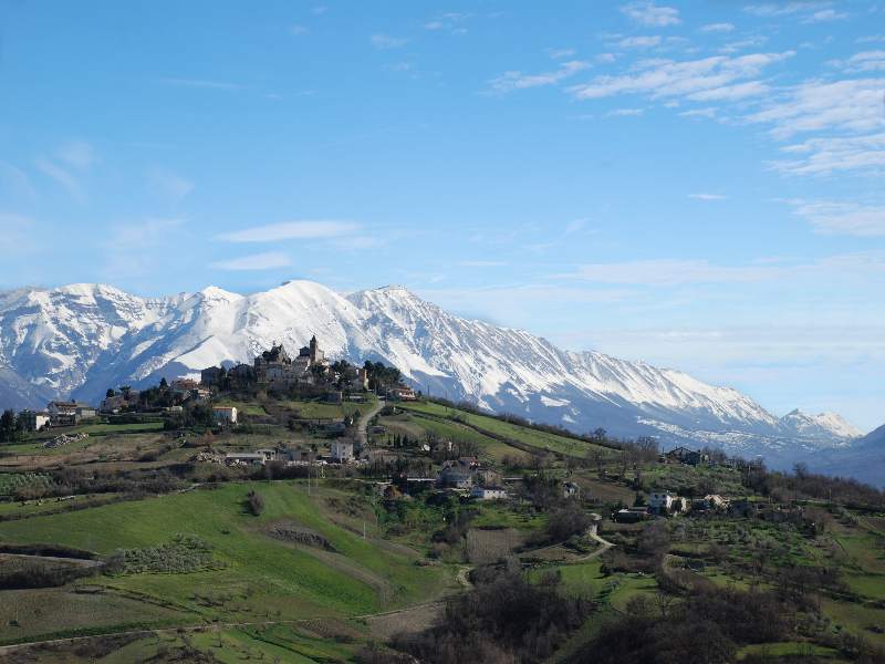
Pescosansonesco
- Italian comune
Hiking in Pescosansonesco
Pescosansonesco is a charming village located in the Abruzzo region of Italy, nestled in the mountains of the Gran Sasso and Monti della Laga National Park. This area is known for its stunning natural landscapes, making it a fantastic destination for hiking enthusiasts....
- Country:
- Postal Code: 65020
- Local Dialing Code: 085
- Licence Plate Code: PE
- Coordinates: 42° 15' 0" N, 13° 53' 0" E
- GPS tracks (wikiloc): [Link]
- AboveSeaLevel: 550 м m
- Area: 18.35 sq km
- Population: 497
- Web site: [Link]


Pianella
- Italian comune
Hiking in Pianella
Pianella, located in the province of Pescara in Italy, is surrounded by beautiful landscapes and offers several hiking opportunities. The region is characterized by its rolling hills, vineyards, and stunning views of the Adriatic Sea and the Apennine Mountains. Here are some considerations and recommendations for hiking in the area:...
- Country:
- Postal Code: 65019
- Local Dialing Code: 085
- Licence Plate Code: PE
- Coordinates: 42° 23' 57" N, 14° 2' 52" E
- GPS tracks (wikiloc): [Link]
- AboveSeaLevel: 236 м m
- Area: 47.05 sq km
- Population: 8652
- Web site: [Link]


Picciano
- Italian comune
Hiking in Picciano
Picciano, a charming village located in the Abruzzo region of Italy, offers a unique hiking experience amidst its stunning landscapes and rich historical context. Here are some key points to consider if you’re planning a hiking trip in Picciano:...
- Country:
- Postal Code: 65010
- Local Dialing Code: 085
- Licence Plate Code: PE
- Coordinates: 42° 28' 31" N, 13° 59' 24" E
- GPS tracks (wikiloc): [Link]
- AboveSeaLevel: 153 м m
- Area: 7.56 sq km
- Population: 1346
- Web site: [Link]

Pietranico
- Italian comune
Hiking in Pietranico
Pietranico is a small village located in the Abruzzo region of Italy, surrounded by stunning natural landscapes that are perfect for hiking enthusiasts. Nestled in the foothills of the Gran Sasso mountain range, Pietranico offers a variety of trails suitable for different skill levels, from leisurely walks to more challenging hikes....
- Country:
- Postal Code: 65020
- Local Dialing Code: 085
- Licence Plate Code: PE
- Coordinates: 42° 17' 0" N, 13° 55' 0" E
- GPS tracks (wikiloc): [Link]
- AboveSeaLevel: 590 м m
- Area: 14.77 sq km
- Population: 477
- Web site: [Link]


Popoli
- Italian comune
Hiking in Popoli
Popoli, located in the Abruzzo region of Italy, is known for its stunning natural landscapes and is an excellent destination for hiking enthusiasts. Nestled in the foothills of the Apennine Mountains, Popoli offers a variety of trails that cater to different skill levels, from leisurely walks to more challenging hikes....
- Country:
- Postal Code: 65026
- Local Dialing Code: 085
- Licence Plate Code: PE
- Coordinates: 42° 10' 7" N, 13° 49' 48" E
- GPS tracks (wikiloc): [Link]
- AboveSeaLevel: 254 м m
- Area: 35.04 sq km
- Population: 5035
- Web site: [Link]


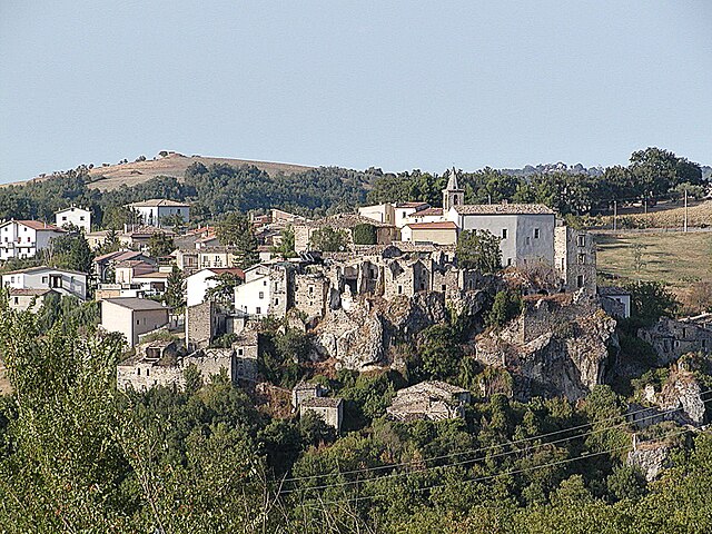
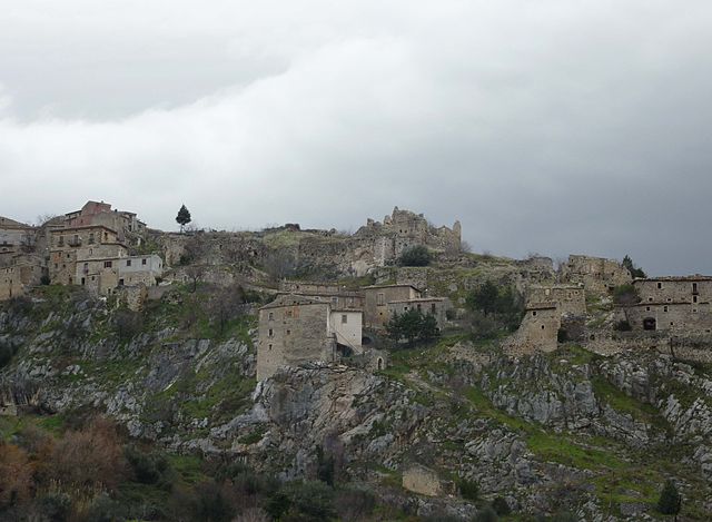
Roccamorice
- Italian comune
Hiking in Roccamorice
Roccamorice is a charming village located in the Abruzzo region of Italy, known for its stunning natural landscapes and proximity to the Majella National Park. Here are some highlights for hiking in and around Roccamorice:...
- Country:
- Postal Code: 65020
- Local Dialing Code: 085
- Licence Plate Code: PE
- Coordinates: 42° 13' 0" N, 14° 2' 0" E
- GPS tracks (wikiloc): [Link]
- AboveSeaLevel: 520 м m
- Area: 25.06 sq km
- Population: 930
- Web site: [Link]


Rosciano
- Italian comune
Hiking in Rosciano
Rosciano, located in the Abruzzo region of Italy, is a fantastic destination for hiking, thanks to its picturesque landscapes, rolling hills, and proximity to both mountains and coastal areas. Here are some highlights and tips for hiking in and around Rosciano:...
- Country:
- Postal Code: 65020
- Local Dialing Code: 085
- Licence Plate Code: PE
- Coordinates: 42° 19' 20" N, 14° 2' 44" E
- GPS tracks (wikiloc): [Link]
- AboveSeaLevel: 253 м m
- Area: 27.79 sq km
- Population: 3949
- Web site: [Link]


Salle, Abruzzo
- Italian comune
Hiking in Salle, Abruzzo
Salle, a charming village in the Abruzzo region of Italy, is surrounded by the stunning natural landscapes of the Majella National Park and the Gran Sasso and Monti della Laga National Park. This area offers a variety of hiking opportunities for all skill levels, featuring breathtaking views, rich biodiversity, and historical sites....
- Country:
- Postal Code: 65020
- Local Dialing Code: 085
- Licence Plate Code: PE
- Coordinates: 42° 10' 37" N, 13° 57' 35" E
- GPS tracks (wikiloc): [Link]
- AboveSeaLevel: 450 м m
- Area: 21.8 sq km
- Population: 291
- Web site: [Link]

Sant'Eufemia a Maiella
- Italian comune
Hiking in Sant'Eufemia a Maiella
Sant'Eufemia a Maiella is a beautiful village located in the Abruzzo region of Italy, surrounded by the stunning landscapes of the Maiella National Park. It's an excellent destination for hiking enthusiasts, offering a variety of trails that cater to different skill levels. Here are some key points to consider when hiking in this area:...
- Country:
- Postal Code: 65020
- Local Dialing Code: 085
- Licence Plate Code: PE
- Coordinates: 42° 7' 0" N, 14° 1' 0" E
- GPS tracks (wikiloc): [Link]
- AboveSeaLevel: 878 м m
- Area: 40.42 sq km
- Population: 263
- Web site: [Link]

San Valentino in Abruzzo Citeriore
- Italian comune
Hiking in San Valentino in Abruzzo Citeriore
San Valentino in Abruzzo Citeriore is a charming village located in the Abruzzo region of Italy, surrounded by picturesque landscapes and a variety of hiking opportunities. The area is known for its natural beauty, characterized by rolling hills, lush forests, and stunning views of the Gran Sasso and Majella mountains....
- Country:
- Postal Code: 65020
- Local Dialing Code: 085
- Licence Plate Code: PE
- Coordinates: 42° 14' 0" N, 13° 59' 0" E
- GPS tracks (wikiloc): [Link]
- AboveSeaLevel: 450 м m
- Area: 16.4 sq km
- Population: 1911
- Web site: [Link]
Scafa
- Italian comune
Hiking in Scafa
Scafa, located in the Abruzzo region of Italy, is a charming destination for hiking enthusiasts. Nestled near the foothills of the Apennine Mountains, it offers access to a variety of natural landscapes, from rolling hills to more rugged terrain....
- Country:
- Postal Code: 65027
- Local Dialing Code: 085
- Licence Plate Code: PE
- Coordinates: 42° 15' 57" N, 13° 59' 48" E
- GPS tracks (wikiloc): [Link]
- AboveSeaLevel: 108 м m
- Area: 10.34 sq km
- Population: 3656
- Web site: [Link]


Serramonacesca
- Italian comune
Hiking in Serramonacesca
Serramonacesca is a picturesque area located in the Abruzzo region of Italy, surrounded by beautiful mountains and lush landscapes, making it an excellent destination for hiking and outdoor activities. Here are some highlights of hiking in Serramonacesca:...
- Country:
- Postal Code: 65025
- Local Dialing Code: 085
- Licence Plate Code: PE
- Coordinates: 42° 14' 55" N, 14° 5' 36" E
- GPS tracks (wikiloc): [Link]
- AboveSeaLevel: 280 м m
- Area: 23.89 sq km
- Population: 552
- Web site: [Link]


Spoltore
- Italian comune
Hiking in Spoltore
Spoltore, located in the Abruzzo region of Italy, is a charming town that offers scenic hiking opportunities thanks to its proximity to both the mountains and the Adriatic coast. While it may not be as widely known as some other hiking destinations, the surrounding area provides a variety of trails suitable for different skill levels. Here are some highlights for hiking around Spoltore:...
- Country:
- Postal Code: 65010
- Local Dialing Code: 085
- Licence Plate Code: PE
- Coordinates: 42° 27' 18" N, 14° 8' 24" E
- GPS tracks (wikiloc): [Link]
- AboveSeaLevel: 185 м m
- Area: 37.01 sq km
- Population: 19378
- Web site: [Link]


Tocco da Casauria
- Italian comune
Hiking in Tocco da Casauria
Tocco da Casauria is a charming village located in the Abruzzo region of Italy, nestled in the foothills of the Majella mountain range. This area is known for its stunning landscapes, rich history, and outdoor activities, including hiking. Here are some details about hiking in and around Tocco da Casauria:...
- Country:
- Postal Code: 65028
- Local Dialing Code: 085
- Licence Plate Code: PE
- Coordinates: 42° 13' 0" N, 13° 55' 0" E
- GPS tracks (wikiloc): [Link]
- AboveSeaLevel: 356 м m
- Area: 29.67 sq km
- Population: 2640
- Web site: [Link]


Torre de' Passeri
- Italian comune
Hiking in Torre de' Passeri
Torre de' Passeri is a picturesque town located in the Abruzzo region of Italy, nestled within the beautiful Apennine Mountains. Hiking in and around Torre de' Passeri offers a mix of scenic landscapes, cultural experiences, and opportunities to explore the natural beauty of the region....
- Country:
- Postal Code: 65029
- Local Dialing Code: 085
- Licence Plate Code: PE
- Coordinates: 42° 14' 0" N, 13° 56' 0" E
- GPS tracks (wikiloc): [Link]
- AboveSeaLevel: 172 м m
- Area: 5.92 sq km
- Population: 3045
- Web site: [Link]
Turrivalignani
- Italian comune
Hiking in Turrivalignani
Turrivalignani is a picturesque village located in the Abruzzo region of Italy, known for its beautiful landscapes and outdoor recreational opportunities, including hiking. Here are some highlights related to hiking in and around Turrivalignani:...
- Country:
- Postal Code: 65020
- Local Dialing Code: 085
- Licence Plate Code: PE
- Coordinates: 42° 16' 0" N, 14° 2' 0" E
- GPS tracks (wikiloc): [Link]
- AboveSeaLevel: 312 м m
- Area: 6.11 sq km
- Population: 887
- Web site: [Link]
Vicoli
- Italian comune
Hiking in Vicoli
Vicoli is a small village located in the Abruzzo region of Italy, known for its beautiful landscapes, historical architecture, and proximity to the Apennine mountains. Hiking in this area can be a delightful experience for nature enthusiasts and adventurers....
- Country:
- Postal Code: 65010
- Local Dialing Code: 085
- Licence Plate Code: PE
- Coordinates: 42° 20' 0" N, 13° 54' 0" E
- GPS tracks (wikiloc): [Link]
- AboveSeaLevel: 445 м m
- Area: 9.33 sq km
- Population: 378
- Web site: [Link]


Villa Celiera
- Italian comune
Hiking in Villa Celiera
Villa Celiera, a picturesque town nestled in the Abruzzo region of Italy, offers a fantastic hiking experience for nature enthusiasts. The area is characterized by its stunning landscapes, including rolling hills, dense forests, and panoramic views of the Gran Sasso and Maiella mountain ranges. Here are some key aspects of hiking in and around Villa Celiera:...
- Country:
- Postal Code: 65010
- Local Dialing Code: 085
- Licence Plate Code: PE
- Coordinates: 42° 22' 49" N, 13° 51' 33" E
- GPS tracks (wikiloc): [Link]
- AboveSeaLevel: 714 м m
- Area: 13.18 sq km
- Population: 652
- Web site: [Link]
Shares border with regions:

Province of Chieti
- province of Italy
Hiking in Province of Chieti
The Province of Chieti, located in the Abruzzo region of Italy, is a fantastic destination for hiking enthusiasts. With its diverse landscapes, ranging from rugged mountains to serene coastal areas, Chieti offers numerous trails suitable for all levels of hikers....
- Country:
- Capital: Chieti
- Postal Code: 66054; 66050–66052; 66045–66047; 66040–66043; 66036–66038; 66030–66034; 66026; 66014–66023; 66010-66100-66012
- Local Dialing Code: 0873; 0872; 0871; 085
- Licence Plate Code: CH
- Coordinates: 42° 21' 0" N, 14° 10' 0" E
- GPS tracks (wikiloc): [Link]
- Area: 2588.35 sq km
- Web site: [Link]
Province of L'Aquila
- province of Italy
Hiking in Province of L'Aquila
The Province of L'Aquila, located in the Abruzzo region of Italy, is a fantastic destination for hiking enthusiasts. Known for its diverse landscapes, it offers a variety of trails that range from easy walks to challenging mountain treks, appealing to hikers of all levels. Here are some highlights:...
- Country:
- Capital: L'Aquila
- Postal Code: 67066–67069; 67019–67041; 67017; 67012–67015; 67010; 67100
- Local Dialing Code: 0863; 0864; 0862
- Licence Plate Code: AQ
- Coordinates: 42° 25' 22" N, 13° 23' 40" E
- GPS tracks (wikiloc): [Link]
- Area: 5034.46 sq km
- Web site: [Link]

Province of Teramo
- province of Italy
Hiking in Province of Teramo
The Province of Teramo, located in the Abruzzo region of Italy, offers stunning landscapes, rich cultural heritage, and a variety of hiking opportunities. Here are some key highlights for hiking in this beautiful province:...
- Country:
- Capital: Teramo
- Postal Code: 64100
- Licence Plate Code: TE
- Coordinates: 42° 39' 31" N, 13° 42' 9" E
- GPS tracks (wikiloc): [Link]
- Area: 1947.64 sq km
- Web site: [Link]