Cervarese Santa Croce (Cervarese Santa Croce)
.svg)
- Italian comune
 Hiking in Cervarese Santa Croce
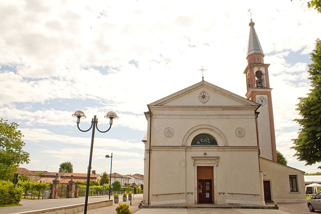
Cervarese Santa Croce is a charming municipality in the province of Padua, Italy, nestled at the foot of the Euganean Hills. This area offers a variety of hiking opportunities, set against a backdrop of beautiful landscapes, rolling hills, and lush greenery.
Hiking Trails
-
Euganean Hills Regional Park: The park encompasses many trails suitable for different experience levels. You can find well-marked paths that lead through vineyards, olive groves, and dense forests. Popular trails include those around Monte Venda and Monte Gemola.
-
Panoramic Trails: Some trails at higher elevations provide stunning views of the surrounding areas, including the Po Valley and the distant Alps on clear days. The trail to the summit of Monte Venda is particularly rewarding.
-
Cultural Hikes: Many hikes can also be combined with visits to historical sites such as the medieval castle of Catajo and various churches scattered throughout the region. This mix of nature and culture can enrich your hiking experience.
Tips for Hiking in Cervarese Santa Croce
- Footwear: Ensure you have sturdy hiking shoes, as some trails may be rocky or uneven.
- Weather: Check the weather forecast before heading out; summer can be hot, while spring and fall are generally mild and pleasant for hiking.
- Water and Snacks: Bring plenty of water and some snacks, especially on longer hikes, as there may be limited services along the trails.
- Trail Maps: It’s advisable to carry a trail map or use a hiking app on your smartphone to stay on track.
Local Highlights
- Nature and Wildlife: The Euganean Hills are home to diverse flora and fauna. Keep your eyes peeled for local wildlife, including various bird species and endemic plants.
- Thermal Springs: After a long hike, you might consider visiting one of the nearby thermal spas in areas like Abano Terme or Montegrotto Terme to relax and unwind.
Cervarese Santa Croce serves as an excellent base for exploring the Euganean Hills, providing both natural beauty and cultural insights. Enjoy your hike!
- Country:

- Postal Code: 35030
- Local Dialing Code: 049
- Licence Plate Code: PD
- Coordinates: 45° 24' 11" N, 11° 41' 32" E


- GPS tracks (wikiloc): [Link]
- AboveSeaLevel: 30 м m
- Area: 17.71 sq km
- Population: 5779
- Web site: http://www.comune.cervarese.pd.it
- Wikipedia en: wiki(en)
- Wikipedia: wiki(it)
- Wikidata storage: Wikidata: Q34435
- Wikipedia Commons Category: [Link]
- Freebase ID: [/m/0gk47k]
- GeoNames ID: Alt: [6543573]
- VIAF ID: Alt: [234794753]
- OSM relation ID: [44910]
- UN/LOCODE: [ITCVE]
- ISTAT ID: 028030
- Italian cadastre code: C544
Shares border with regions:
Saccolongo
- Italian comune
Hiking in Saccolongo
Saccolongo is a small town located in the Veneto region of Italy, known for its picturesque landscapes and proximity to the beautiful Euganean Hills (Colli Euganei). Hiking in and around Saccolongo can be a rewarding experience, offering a mix of gentle slopes, scenic views, and opportunities to explore the local flora and fauna....
- Country:
- Postal Code: 35030
- Local Dialing Code: 049
- Licence Plate Code: PD
- Coordinates: 45° 24' 0" N, 11° 45' 0" E
- GPS tracks (wikiloc): [Link]
- AboveSeaLevel: 19 м m
- Area: 13.8 sq km
- Population: 4945
- Web site: [Link]

Rovolon
- Italian comune
Hiking in Rovolon
Rovolon is a charming town located in the Veneto region of Italy, not far from the city of Vicenza. Surrounded by the beautiful landscapes of the Colli Euganei, Rovolon offers a variety of hiking opportunities for outdoor enthusiasts....
- Country:
- Postal Code: 35030
- Local Dialing Code: 049
- Licence Plate Code: PD
- Coordinates: 45° 21' 0" N, 11° 40' 0" E
- GPS tracks (wikiloc): [Link]
- AboveSeaLevel: 152 м m
- Area: 27.69 sq km
- Population: 4950
- Web site: [Link]

Teolo
- Italian comune
Hiking in Teolo
Teolo is a charming town located in the Veneto region of Italy, situated near the Euganean Hills, which are known for their beautiful landscapes, rich history, and diverse flora and fauna. Hiking in Teolo offers a variety of trails and paths that cater to different skill levels and preferences....
- Country:
- Postal Code: 35037
- Local Dialing Code: 049
- Licence Plate Code: PD
- Coordinates: 45° 21' 0" N, 11° 40' 0" E
- GPS tracks (wikiloc): [Link]
- AboveSeaLevel: 175 м m
- Area: 31.2 sq km
- Population: 9014
- Web site: [Link]
Veggiano
- Italian comune
Hiking in Veggiano
Veggiano is a small town located in the Veneto region of Italy, not far from the city of Padua. While it may not be a famous hiking destination, the surrounding area offers several opportunities for outdoor activities, including hiking....
- Country:
- Postal Code: 35030
- Local Dialing Code: 049
- Licence Plate Code: PD
- Coordinates: 45° 27' 0" N, 11° 43' 0" E
- GPS tracks (wikiloc): [Link]
- AboveSeaLevel: 21 м m
- Area: 16.41 sq km
- Population: 4765
- Web site: [Link]
Montegalda
- Italian comune
Hiking in Montegalda
Montegalda is a picturesque area located in the province of Vicenza, Italy. It's known for its beautiful landscapes, rolling hills, and a mix of natural and cultural attractions. While it's not as widely known as some other hiking destinations in the region, it offers some lovely trails and outdoor experiences for nature lovers....
- Country:
- Postal Code: 36047
- Local Dialing Code: 0444
- Licence Plate Code: VI
- Coordinates: 45° 27' 0" N, 11° 41' 0" E
- GPS tracks (wikiloc): [Link]
- AboveSeaLevel: 28 м m
- Area: 17.41 sq km
- Population: 3431
- Web site: [Link]


Montegaldella
- Italian comune
Hiking in Montegaldella
Montegaldella is a charming area located in the Veneto region of Italy, known for its beautiful natural landscapes and hiking opportunities. The region offers a range of trails that cater to various skill levels, making it a great destination for both beginners and experienced hikers....
- Country:
- Postal Code: 36047
- Local Dialing Code: 0444
- Licence Plate Code: VI
- Coordinates: 45° 26' 0" N, 11° 40' 0" E
- GPS tracks (wikiloc): [Link]
- AboveSeaLevel: 23 м m
- Area: 13.57 sq km
- Population: 1774
- Web site: [Link]