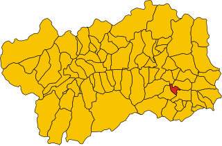
Montjovet (Montjovet)
.svg)
- Italian comune
 Hiking in Montjovet
Montjovet is a picturesque commune located in the Aosta Valley region of Italy, nestled in the foothills of the Alps. This area is known for its stunning landscapes, diverse ecosystems, and a variety of hiking opportunities that cater to different skill levels. Here are some key points to consider when hiking in Montjovet:
Trails and Routes
-
Scenic Trails: Montjovet offers a range of trails that take you through lush forests, rolling hills, and Alpine meadows. Some trails provide breathtaking views of the surrounding mountains, including the iconic peaks of the Aosta Valley.
-
Difficulty Levels: Hikes range from easy, family-friendly walks to more challenging itineraries for seasoned hikers. Always check trail signage and maps at the trailheads to ensure you choose a path that suits your skill level.
-
Popular Hikes:
- Sentiero dei Ghiacciai: This trail provides insights into the glacial landscapes of the region, showcasing unique geological features.
- Mont de la Saxe: A popular viewpoint, often accessed by a moderate hike that rewards hikers with fantastic panoramic views.
Best Time to Hike
- Summer and Early Fall (June to October) are the best times to hike in Montjovet, with mild weather and clear trails. The wildflowers bloom during summer, adding vibrant colors to the landscape.
- Spring can also be pleasant, but some trails may still be snow-covered, so check conditions before heading out.
Preparation and Safety
- Gear: Wear sturdy hiking boots, and bring plenty of water, snacks, a map, and a first aid kit. Depending on the season, layering your clothing will help you adjust to changing weather conditions.
- Guided Tours: If you’re unfamiliar with the area, consider joining a guided hike. Local guides can provide insights into the region's flora, fauna, and history.
Wildlife and Nature
Montjovet is home to diverse wildlife, including deer, chamois, and various bird species. Keep a respectful distance from animals and follow the Leave No Trace principles to protect the natural environment.
Local Culture and Amenities
- Refuges and Accommodations: There are several mountain huts and accommodations throughout the area where you can stop for a meal or spend the night.
- Local Cuisine: Don’t miss the chance to sample local delicacies, such as Fontina cheese and various regional wines, after your hike.
Conclusion
Whether you're an experienced hiker or a beginner looking to enjoy the beauty of nature, Montjovet has something to offer. With its stunning vistas and rich natural heritage, it's a fantastic destination to explore on foot. Always remember to respect the local environment and enjoy your hike!
- Country:

- Postal Code: 11020
- Local Dialing Code: 0166
- Licence Plate Code: AO
- Coordinates: 45° 42' 0" N, 7° 41' 0" E


- GPS tracks (wikiloc): [Link]
- AboveSeaLevel: 406 м m
- Area: 18.76 sq km
- Population: 1774
- Web site: http://www.comune.montjovet.ao.it
- Wikipedia en: wiki(en)
- Wikipedia: wiki(it)
- Wikidata storage: Wikidata: Q35220
- Wikipedia Commons Gallery: [Link]
- Wikipedia Commons Category: [Link]
- Wikipedia Commons Maps Category: [Link]
- Freebase ID: [/m/0fwz21]
- GeoNames ID: Alt: [6540275]
- VIAF ID: Alt: [235699454]
- OSM relation ID: [45763]
- BabelNet ID: [03460572n]
- ISTAT ID: 007043
- Italian cadastre code: F367
Shares border with regions:


Challand-Saint-Victor
- Italian comune
Hiking in Challand-Saint-Victor
Challand-Saint-Victor is a charming village located in the Aosta Valley region of Italy, known for its picturesque mountain scenery and rich natural landscapes. The area offers a variety of hiking opportunities that cater to different skill levels, making it a great destination for both novice and experienced hikers....
- Country:
- Postal Code: 11020
- Local Dialing Code: 0125
- Licence Plate Code: AO
- Coordinates: 45° 41' 0" N, 7° 42' 0" E
- GPS tracks (wikiloc): [Link]
- AboveSeaLevel: 744 м m
- Area: 25 sq km
- Population: 557
- Web site: [Link]


Champdepraz
- Italian comune
Hiking in Champdepraz
Champdepraz is a picturesque commune located in the Aosta Valley region of Italy, surrounded by the stunning Alpine landscape, which makes it a great spot for hiking enthusiasts. The area features a variety of trails suitable for different skill levels, offering breathtaking views of the mountains, lush valleys, and traditional chalets....
- Country:
- Postal Code: 11020
- Local Dialing Code: 0125
- Licence Plate Code: AO
- Coordinates: 45° 41' 0" N, 7° 39' 0" E
- GPS tracks (wikiloc): [Link]
- AboveSeaLevel: 523 м m
- Area: 48.79 sq km
- Population: 714
- Web site: [Link]


Châtillon
- Italian comune
Hiking in Châtillon
Châtillon is a charming town located in the Aosta Valley region of Italy, surrounded by stunning mountainous landscapes that make it a great starting point for hiking enthusiasts. Here’s what you should know about hiking in and around Châtillon:...
- Country:
- Postal Code: 11024
- Local Dialing Code: 0166
- Licence Plate Code: AO
- Coordinates: 45° 45' 0" N, 7° 37' 0" E
- GPS tracks (wikiloc): [Link]
- AboveSeaLevel: 549 м m
- Area: 39.68 sq km
- Population: 4654
- Web site: [Link]


Emarèse
- Italian comune
Hiking in Emarèse
Émarèse is a charming municipality in the Aosta Valley region of northern Italy, known for its stunning natural landscapes, rich history, and outdoor recreational opportunities. Hiking in Émarèse offers a fantastic way to explore the beauty of the Italian Alps and experience the tranquility of nature....
- Country:
- Postal Code: 11020
- Local Dialing Code: 0166
- Licence Plate Code: AO
- Coordinates: 45° 43' 0" N, 7° 42' 0" E
- GPS tracks (wikiloc): [Link]
- AboveSeaLevel: 1170 м m
- Area: 10.23 sq km
- Population: 227
- Web site: [Link]


Saint-Vincent, Aosta Valley
- Italian comune
Hiking in Saint-Vincent, Aosta Valley
Saint-Vincent is a charming town located in the Aosta Valley region of Italy, nestled in the beautiful mountains of the Alps. The area is known not only for its rich history and thermal baths but also for its excellent hiking opportunities. Here are some key points about hiking in and around Saint-Vincent:...
- Country:
- Postal Code: 11027
- Local Dialing Code: 0166
- Licence Plate Code: AO
- Coordinates: 45° 45' 0" N, 7° 39' 0" E
- GPS tracks (wikiloc): [Link]
- AboveSeaLevel: 550 м m
- Area: 20.57 sq km
- Population: 4584
- Web site: [Link]

Verrès
- Italian comune
Hiking in Verrès
Verrès is a charming town located in the Aosta Valley region of Italy, surrounded by beautiful alpine scenery, making it an excellent destination for hiking enthusiasts. The surrounding area offers a variety of trails suitable for different skill levels, from leisurely walks to more challenging alpine hikes....
- Country:
- Postal Code: 11029
- Local Dialing Code: 0125
- Licence Plate Code: AO
- Coordinates: 45° 40' 0" N, 7° 41' 21" E
- GPS tracks (wikiloc): [Link]
- AboveSeaLevel: 391 м m
- Area: 8.36 sq km
- Population: 2642
- Web site: [Link]