Montpeyroux (Montpeyroux)

- commune in Aveyron, France
- Country:

- Postal Code: 12210
- Coordinates: 44° 38' 24" N, 2° 48' 39" E


- GPS tracks (wikiloc): [Link]
- Area: 61.71 sq km
- Population: 547
- Web site: http://www.montpeyroux12.fr
- Wikipedia en: wiki(en)
- Wikipedia: wiki(fr)
- Wikidata storage: Wikidata: Q1379761
- Wikipedia Commons Category: [Link]
- Freebase ID: [/m/03m94m5]
- GeoNames ID: Alt: [6426969]
- SIREN number: [211201561]
- BnF ID: [15247132m]
- INSEE municipality code: 12156
Shares border with regions:


Curières
- commune in Aveyron, France
- Country:
- Postal Code: 12210
- Coordinates: 44° 39' 10" N, 2° 51' 57" E
- GPS tracks (wikiloc): [Link]
- Area: 36.06 sq km
- Population: 223
- Web site: [Link]


Condom-d'Aubrac
- commune in Aveyron, France
- Country:
- Postal Code: 12470
- Coordinates: 44° 36' 14" N, 2° 51' 56" E
- GPS tracks (wikiloc): [Link]
- Area: 46.08 sq km
- Population: 302

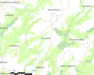
Le Cayrol
- commune in Aveyron, France
- Country:
- Postal Code: 12500
- Coordinates: 44° 35' 14" N, 2° 47' 31" E
- GPS tracks (wikiloc): [Link]
- Area: 22.16 sq km
- Population: 256


Florentin-la-Capelle
- commune in Aveyron, France
- Country:
- Postal Code: 12140
- Coordinates: 44° 37' 49" N, 2° 37' 55" E
- GPS tracks (wikiloc): [Link]
- Area: 36.8 sq km
- Population: 283
- Web site: [Link]

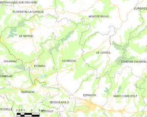
Coubisou
- commune in Aveyron, France
- Country:
- Postal Code: 12190
- Coordinates: 44° 33' 11" N, 2° 43' 54" E
- GPS tracks (wikiloc): [Link]
- Area: 30.95 sq km
- Population: 489


Le Nayrac
- commune in Aveyron, France
- Country:
- Postal Code: 12190
- Coordinates: 44° 36' 47" N, 2° 39' 47" E
- GPS tracks (wikiloc): [Link]
- Area: 36.57 sq km
- Population: 522


Saint-Amans-des-Cots
- commune in Aveyron, France
- Country:
- Postal Code: 12460
- Coordinates: 44° 41' 21" N, 2° 39' 34" E
- GPS tracks (wikiloc): [Link]
- Area: 41.51 sq km
- Population: 763


Soulages-Bonneval
- commune in Aveyron, France
- Country:
- Postal Code: 12210
- Coordinates: 44° 40' 35" N, 2° 47' 21" E
- GPS tracks (wikiloc): [Link]
- Area: 15.16 sq km
- Population: 295
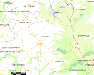
Laguiole
- commune in Aveyron, France
- Country:
- Postal Code: 12210
- Coordinates: 44° 41' 3" N, 2° 50' 50" E
- GPS tracks (wikiloc): [Link]
- Area: 63.06 sq km
- Population: 1236
- Web site: [Link]